Akbarpur, Ambedkar Nagar

Last updated

Akbarpur
City
City view of Akbarpur.jpg
Akbarpur Skyline
India Uttar Pradesh location map.svg
Red pog.svg
Akbarpur
Location in Uttar Pradesh, India
India location map 3.png
Red pog.svg
Akbarpur
Akbarpur (India)
Coordinates: 26°26′00″N82°32′25″E / 26.43333°N 82.54028°E / 26.43333; 82.54028 Coordinates: 26°26′00″N82°32′25″E / 26.43333°N 82.54028°E / 26.43333; 82.54028
CountryFlag of India.svg  India
State Uttar Pradesh
District Ambedkar Nagar
Government
  BodyMunicipal Board
Elevation
133 m (436 ft)
Population
 (2011) [1]
  Total111,594
Language
  Official Hindi [2]
Time zone UTC+5:30 (IST)
PIN
224122
Telephone code+91(5271)
Vehicle registration UP-45
Sex ratio 1000/937 /
Website ambedkarnagar.nic.in

Akbarpur is a city, municipal corporation, tehsil, [3] and the administrative headquarters of Ambedkar Nagar district in the state of Uttar Pradesh, India. [4] It is a part of Ayodhya division.

Contents

Mythology

According to the Ramayana , Akbarpur is where King Dashratha shot Dhanush Shravan Kumar, at the place called Shravan Kshetra. The ashram of the sage Shringi Rishi was situated here. According to the Ramayana, Rama's son Kusha rules Shravasti. The Rajbhar King rules its eastern part. In the Ramayana Rama battled with many Rajbhar kings.

Geography

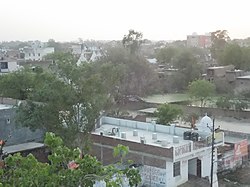
Akbarpur, is situated on the banks of the Tamsa River (also known as the Tons River). The Tamasa River divides the city of Ambedkarnagar into two parts, Akbarpur and Shahzadpur, with the latter being the commercial centre of the city. Lorepur, part of Akbarpur City, is noted as the location of the old palace and imambargah of Lorepur.

Demographics

As of 2011 Indian Census, Akbarpur had a total population of 111,447, of which 57,330 were males and 54,117 were females. Population within the age group of 0 to 6 years was 14,726. The total number of literates in Akbarpur was 72,049, which constituted 64.6% of the population with male literacy of 70.9% and female literacy of 58.1%. The effective literacy rate of 7+ population of Akbarpur was 74.5%, of which male literacy rate was 81.7% and female literacy rate was 66.9%. The Scheduled Castes and Scheduled Tribes population was 15,310 and 50 respectively. Akbarpur had 17720 households in 2011. [1]

Administration

Lohia Bhavan, Akbarpur Lohia bhavan akbarpur.jpg
Lohia Bhavan, Akbarpur
Government airstrip, Akbarpur Akbarpur airstrip.jpg
Government airstrip, Akbarpur
Akbarpur Junction Akbarpur Railway Station..jpg
Akbarpur Junction

Akbarpur city is governed by a municipal corporation.

Economy

Major economic activities in the district are power looms and farming. Agricultural industries include rice milling and power and distribution transformer manufacturing. The district is noted for Tanda Terricot clothes based in nearby Tanda. The district has a sugar factory, the Akbarpur Sugar Mill, which is situated near Mijhaura, about 10 kilometres (6.2 mi) from the city. Many rice mills are present in Akbarpur. There is a cement manufacturing plant, the Jaypee Ayoudha Grinding Unit, which belongs to the Jaypee Group. The district has a thermal power station belonging to NTPC Limited. [5]

Transport

By road

Akbarpur is well connected with the nearby cities of Faizabad, Ayodhya, Lucknow, Sultanpur, Raebareli, Amethi, Azamgarh, Jaunpur, Varanasi, Prayagraj, Pratapgarh; and with the nearby towns of Tanda, Baskhari, Maharua, Dostpur, Bhiti, Hanswar, Haiderganj, Jalalpur, Goshainganj, Tarun, and Bikapur.

The Purvanchal Expressway connects Akbarpur to the capital, New Delhi, via the Agra-Lucknow and Yamuna expressways. [6]

By rail

Akbarpur Junction is the main railway station in Akbarpur city. Goshainganj, Faizabad Junction, Ayodhya Junction, Lucknow Junction, Shahganj Junction and Varanasi Junction are nearby railway stations. [6]

By air

Ayodhya Airport [7] (Ayodhya), Chaudhary Charan Singh International Airport (Lucknow), Gorakhpur Airport (Gorakhpur), and Lal Bahadur Shastri International Airport (Varanasi) are the nearby airports.

Education

The recent establishment of various local colleges has improved the availability of higher education. The Ramabai Government Women Post Graduate College, [8] Akbarpur, was established in 1997 to provide opportunities in various disciplines to rural, as well as urban, students. BNKBPG College is a privately managed and government-aided co-educational degree college that offers several programs. [9] There is one government engineering college, Mahamaya Engineering College, a medical college, and a recently opened agriculture college.

Many government secondary schools (junior high schools and Rajkiya intermediate colleges) have been opened in town to provide educational opportunities. St. Peter's Inter College is an ICSE-accredited English medium inter college founded in 1984, and it celebrated 25 years of existence in 2009. [10] Radiant college is a CBSE-accredited college in Jalalpur. [11] Narendra Dev Intermediate College is accredited to the U.P. board.

Engineering colleges

Medical college

Religious sites

Ashrafpur Kichhauchha, a village in Ambedkar Nagar district about 25 kilometres (16 mi) from Akbarpur city, is the location of the shrine of the illustrious 13th Century Chisti Sufi saint Ashraf Jahangir Semnani, [12] [13] which is visited by millions of devotees every year, irrespective of religion, ethnicity, and gender.

A popular pilgrimage site is the Hindu temple of Shiv Baba. It is situated 5 kilometres (3.1 mi) from the city, on Faizabad Road, and 50 kilometres (31 mi) from the holy city of Ayodhya. A fair is held here every Monday and Friday.

Notable people

See also

Related Research Articles

<span class="mw-page-title-main">Ambedkar Nagar district</span> District of Uttar Pradesh in India

Ambedkar Nagar is a district in the Indian state of Uttar Pradesh. This district is a part of Faizabad division in the Awadh region of the state. This district was established on 29 September 1995 by carving out parts of the erstwhile Faizabad district. It was created by the then Chief Minister Mayawati and named in memory of Bhimrao Ambedkar, who worked for the advancement of the deprived classes, women and other weaker sections of society. The total area of Ambedkar Nagar district is 2350 Sq. Km.

Ashrafpur Kichhauchha is a town and a nagar panchayat in Ambedkar Nagar District in the state of Uttar Pradesh, India. It is well known worldwide as here the shrine of the famous Chisti Sufi saint Sultan Syed Makhdoom Ashraf Jahangir Semnani is located, which attracts millions of devotees irrespective of religion, caste, creed and sex all the year round. The nearest railway station is the Akbarpur station which is about 23 kilometers. Akbarpur station is connected by rail to big cities such as Kolkata, Delhi, Lucknow, Varanasi and Mumbai.

Bhadarsa is a town and nagar panchayat in Faizabad district in state of Uttar Pradesh, India. Bhadarsa is 22 km south of district headquarters Ayodhya city.

Jalalpur is a town, tehsil and a municipal board in Ambedkar Nagar district in the Indian state of Uttar Pradesh, India.

<span class="mw-page-title-main">Acharya Narendra Deva University of Agriculture and Technology</span> University in Kumarganj, Uttar Pradesh India

Acharya Narendra Deva University of Agriculture and Technology (ANDUaT), formerly Narendra Deva University of Agriculture and Technology (NDUaT), is a university located in Kumarganj, Uttar Pradesh, India, established in 1975. It is named after the politician and educator Narendra Deva, who served as vice chancellor of the University of Lucknow and Banaras Hindu University. It has constituent colleges in Ambedkar Nagar district and Azamgarh district.

Tanda is a town in Ambedkar Nagar district in the Indian state of Uttar Pradesh situated on the banks of Ghaghara River. It is a nagar palika parishad and is part of Faizabad division in Uttar Pradesh. The town is situated 20 kilometres (12 mi) north east from district headquarter Akbarpur. Tanda is also a tehsil in the district. It has one of the largest handloom weaving industries for manufacturing varieties like gamchha, lungi, polyester clothing, check-shirt clothes material in state of Uttar Pradesh.

<span class="mw-page-title-main">Milkipur</span> Town in Uttar Pradesh, India

Milkipur is a town and tehsil in Ayodhya district in the Indian state of Uttar Pradesh. Milkipur is 32 km south of district headquarters Ayodhya city. District Ayodhya consists of 11 blocks and Milkipur is a block in Ayodhya, Uttar Pradesh.

Ambedkar Nagar Lok Sabha constituency is one of the 80 Lok Sabha (parliamentary) constituencies in the Indian state of Uttar Pradesh. This lok sabha constituency came into existence in 1996 as 11th lok sabha was held in April may 1996.On 29 th September 1995 Ambedkar Nagar district carved out from faizabad division in the memory of Dr baba saheb Ambedkar.

Katehri, also spelled as Katehari, is a town in Ambedkar Nagar district in the Indian state of Uttar Pradesh. Katehri is also a block in Ambedkar Nagar district, Uttar Pradesh.

Goshainganj, also known as Gosainganj, is a town and nagar panchayat in the Faizabad district of the Indian state of Uttar Pradesh. Located 32 km from the district headquarters Ayodhya, Goshainganj has one of the oldest markets of the district.

Akbarpur Airstrip is an airstrip/aerodrome located in Akbarpur, Ambedkar Nagar, Uttar Pradesh.

Akbarpur Junction railway station is a junction station between Lucknow, Ayodhya Cantt and Varanasi. It serves Akbarpur city. Railway stations near Akbarpur are Shahganj Junction (SHG), Jaunpur Junction (JNU), Goshainganj (GGJ), Malipur (MLPR) and Bilwai (BWI). This station is under Redevelopment. Station consist of double line electrified track.

Mahamaya Rajkiya Allopathic Medical College or Mahamaya Government Allopathic Medical College, generally known as Mahamaya Medical College, is one of the state run medical colleges with multispeciality hospitals in Akbarpur, Ambedkar Nagar. The institution, as a mega project, is built within the constituency of chief minister of Uttar Pradesh Km. Mayawati with an expenditure of more than 400 crore. This institute has been established under the special component action plan.

Rajesultanpur or Raje Sultanpur is a town and nagar panchayat in Ambedkar Nagar district in the Indian state of Uttar Pradesh.

Tarun is a town in Bikapur tehsil, Faizabad district in the Indian state of Uttar Pradesh, India. Tarun is 30 km south of district headquarters Ayodhya city.

Aalapur is a town and tehsil in Ambedkar Nagar district in the Indian state of Uttar Pradesh, India. It is a part of Faizabad division in Uttar Pradesh state. Aalapur is 33 km east of district headquarters Akbarpur city.

Bhiyaon or Bhiaon is a village block in Jalalpur, Ambedkar Nagar district of Uttar Pradesh State, India. It belongs to Ayodhya Division. It is located 39 km towards the east from the district headquarters Akbarpur, Ambedkar Nagar and 230 km from the state capital. The Great Sufi of Chishti order and Disciple of Hazrat Baba Fareeduddin Ganj-e-Shakar R.A. Data Ganj-e-Shifa Bakhsh Hazrat Khwaja Syed Mir Masood Behdani's 800 years old khanqah/dargah is Situated here, its an historical and spiritual place, Hazrat Khwaja Mir is Descendant of Imam Jafar Sadiq Bin Imam Mohammed Baqir Bin Imam Zainul Abdin Bin Hazrat Maula Imam Hussein AlaihasSalam. People visit this holy place across the world. His annual urs held in Islamic month of Moharram on 23,24,25 every year.

Nandigram, also known by ancient name Bharatkund, is a village in Sohawal tehsil in Ayodhya district in the Indian state of Uttar Pradesh, India. During the exile of Lord Ram, King Bharat ruled from Nandigram instead of the kingdom's capital Ayodhya. Nandigram is 19 km south of district headquarters Ayodhya city.

Haiderganj is a town in Bikapur tehsil in Faizabad district of Uttar Pradesh state of India. Haiderganj is 40 km south of district headquarters Ayodhya city.

Dhamhar is a village in Bikapur tehsil, Faizabad district in the Uttar Pradesh state of India.

References

  1. 1 2 "Census of India: Akbarpur". www.censusindia.gov.in. Retrieved 3 November 2019.
  2. "52nd Report of the Commissioner for Linguistic Minorities in India" (PDF). nclm.nic.in. Ministry of Minority Affairs. Archived from the original (PDF) on 25 May 2017. Retrieved 20 December 2018.
  3. "Tehsil | Ambedkarnagar | India" . Retrieved 2 March 2021.
  4. "Ambedkarnagar | Birthplace Of Ram Manohar Lohiya | India". ambedkarnagar.nic.in. Retrieved 21 February 2021.
  5. "Economy". Ambedkar Nagar. Retrieved 19 January 2019.
  6. 1 2 "How to Reach". Ambedkar Nagar. Retrieved 21 February 2021.
  7. Jaiswal, Pankaj (25 November 2020). "Upcoming Ayodhya airport to be named after Lord Ram". Hindustan Times. Retrieved 23 February 2021.
  8. "Ramabai Government Women Post Graduate College". Panoramio.com. 2012. Archived from the original on 2 September 2012. Retrieved 5 November 2018.
  9. "Welcome to BNKBPG College". B.N.K.B.P.G. College, Akbarpur. Retrieved 5 November 2018.
  10. "About the School". St. Peter's Inter College, Akbarpur, Ambedkar Nagar (U.P.). Retrieved 5 November 2018.
  11. "Director's Message". Radiant Central Children Academy, Jalalpur, Ambedkar Nagar, U.P. Retrieved 5 November 2018.
  12. Ashraf, Waheed (2017) [1975]. Hayate Makhdoom Syed Ashraf Jahangir Semnani (in Urdu) (Second ed.). Shamshad Market, Aligarh, India: Maktaba Jamia, Ltd. ISBN   978-93-85295-54-6. OL   26384309M.
  13. Life and Times of Makhdoom Ashraf Jahangir Semnani (RAH) by Dr. Syed Nurusyyidyn Madani Ashraf Ashraf, Syed; Madani, Nurusyyidyn (3 September 2019). Life and Times of Makhdoom Ashraf Jahangir Semnani (RAH). Amazon. ASIN   B07XBYV1V8.