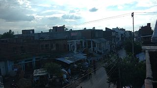
Muzhappilangad (മുഴപ്പിലങ്ങാട്) is a coastal census town near Thalassery in Kannur district in the Indian state of Kerala. It is a suburb of kannur city

Puthunagaram is a town and gram panchayat in the Palakkad district, state of Kerala, India.It is about 10 km south of Palakkad and 8 Km from Kollengode. Palakkad-Pollachi railway line passes through this town.

Ambedkar Nagar is a district in the Indian state of Uttar Pradesh. This district is a part of Ayodhya division in the Awadh region of the state. This district was established on 29 September 1995 by carving out parts of the erstwhile Faizabad district. It was created by the then Chief Minister Mayawati and named in memory of Bhimrao Ambedkar, who worked for the advancement of the depressed classes. The total area of Ambedkar Nagar district is 2350 Sq. Km.
Bansi is a city and municipal board situated on a bank of the Rapti River in the Siddharthnagar district in the state of Uttar Pradesh, India. It is one of the five vidhan sabha constituencies in Siddharthnagar district and one of the most important cities of the district. The Indo Nepal border is near to the town around 40 km. Lumbini of Nepal is the best place to visit from Bansi by crossing the open border between Nepal and India. The Magh Mela is a fair which is held for a month in Bansi from 25th January to 25 February, attracting visitors from all the surrounding areas.
Bilariaganj is the second largest city and a Nagar Palika Parishad in Azamgarh division after its capital city Azamgarh in the state of Uttar Pradesh, India.
Chikkanayakanahalli is a town in Tiptur sub-division of Tumakuru district, in the state of Karnataka, India. It is 30 km away from Tiptur and 132 km from Bangalore.

Gummidipoondi is an industrial town in Chennai Metropolitan Region of Thiruvallur district in the Indian state of Tamil Nadu. Notably, it is the northernmost assembly constituency and settlement in the state of Tamil Nadu.
Hariharpur is a town and a Nagar Panchayat in Sant Kabir Nagar district in the Indian state of Uttar Pradesh.
Jalalpur is a town, tehsil and a municipal board in Ambedkar Nagar district in the Indian state of Uttar Pradesh, India.
Maharajganj is a town and a nagar panchayat in Azamgarh district in the Indian state of Uttar Pradesh. It is connected to National Highway 233B (India), linking Azamgarh to Rajesultanpur.

Manapakkam is a is a neighborhood in Chennai in the Indian state of Tamil Nadu. A census town, Manapakkam is located along the Mount-Poonamallee Road in Chennai. It is now a home to many IT companies, like DLF Cybercity Chennai and Larsen & Toubro. Manappakam has beautiful and scenic Adyar River Bank Trail suitable for morning walkers and joggers, it is a 3-km stretch extended till Chennai Airport's secondary Runway Bridge.
Tanda is a town in Ambedkar Nagar district in the Indian state of Uttar Pradesh situated on the banks of Ghaghara River. It is a nagar palika parishad and is part of Ayodhya division in Uttar Pradesh. The town is situated 20 kilometres (12 mi) north east from district headquarter Akbarpur. Tanda is also a tehsil in the district. It has one of the largest handloom weaving industries for manufacturing varieties like gamchha, lungi, polyester clothing, check-shirt clothes material in state of Uttar Pradesh.
Gola Bazar is a town and a nagar panchayat in Gorakhpur district in the Indian state of Uttar Pradesh. It is also known for its gold market. It is located near the Saryu (Ghaghra) river. This river itself is a border between Gorakhpur and Azamgarh. Distance from Gorakhpur City is around 54 km via kauriram. It is one of the tehsils of Gorakhpur. It is very famous for its ghats which are on the bank of river Saryu. Gola market is very famous among the villages and other towns around it.
Baskhari is a town located in Ambedkar Nagar district in the Indian state of Uttar Pradesh.
Goshainganj, also known as Gosainganj, is a town and nagar panchayat in the Ayodhya district of the Indian state of Uttar Pradesh. Located 32 km from the district headquarters Ayodhya, Goshainganj has one of the oldest markets of the district.
Rajepur is a town in Ambedkar Nagar district in the Indian state of Uttar Pradesh and is Subpost Office of Rajesultanpur.
Rajesultanpur or Raje Sultanpur is a town and nagar panchayat in Ambedkar Nagar district in the Indian state of Uttar Pradesh.
Ghughurpatti is a village in Ambedkar Nagar district in the Indian state of Uttar Pradesh and is a sub post office of Rajesultanpur.

Jahangirganj is a nagar panchayat and Market in Ambedkar Nagar district in the Indian state of Uttar Pradesh and is Subpost Office. It is found 45 km towards East from District headquarters Akbarpur, Ambedkar Nagar and 242 km from State capital Lucknow.
Balrampur is a town in Ambedkar Nagar district in the Indian state of Uttar Pradesh and is Subpost Office of Rajesultanpur.


