Ashrafpur Kichhauchha is a town and a nagar panchayat in Ambedkar Nagar District in the state of Uttar Pradesh, India. It is well known worldwide as here the shrine of the famous Chisti Sufi saint Sultan Syed Makhdoom Ashraf Jahangir Semnani is located, which attracts millions of devotees irrespective of religion, caste, creed and sex all the year round. The nearest railway station is the Akbarpur station which is about 23 kilometers. Akbarpur station is connected by rail to big cities such as Kolkata, Delhi, Lucknow, Varanasi and Mumbai.
Dostpur is a town and a nagar panchayat in Sultanpur district in the state of Uttar Pradesh, India. The town borders Sultanpur and Ambedkarnagar. Purvanchal Expressway passes near the town.
Durga Nagar Part-V is a census town in Cachar district in the state of Assam, India.

FRI and College Area is a census town of Forest Research Institute, in Dehradun district of Uttarakhand, India.
Jaitwara is a town and a nagar panchayat in Satna district in the Indian state of Madhya Pradesh.
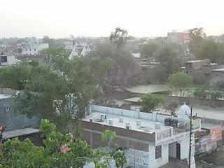
Jalalpur is a town, tehsil and a municipal board in Ambedkar Nagar district in the Indian state of Uttar Pradesh, India.
Kursath is a town and a nagar panchayat in Hardoi district in the Indian state of Uttar Pradesh. It has ten wards named: Jawahar Nagar, Azad Nagar, Gauri Nagar, Pant Nagar, Rajendra Nagar, Patel Nagar, Gandhi Nagar, Subhash Nagar, Ram Nagar and Ashok Nagar.
Lateri is a town and a nagar panchayat in Vidisha district in the Indian state of Madhya Pradesh.
Mhowgaon is a Nagar Panchayat under Sub Division Dr. Ambedkar Nagar (Mhow) in Indore district in the Indian state of Madhya Pradesh. The total geographical area of Mhowgaon nagar panchayat is 13.5 km2 and it is the smallest city by area in the sub district. The population density of the city is 2309 persons per km2. Mhowgaon is divided into 15 wards for which elections are held every 5 years. Among them, Mhowgaon Ward No. 2 is the most populous ward with a population of 3440 and Mhowgaon Ward No. 15 is the least populous ward with a population of 957. Mhowgaon Nagar Panchayat has total administration over 6,373 houses to which it supplies basic amenities like water and sewerage. It is also authorized to build roads within Nagar Panchayat limits and impose taxes on properties coming under its jurisdiction.
Niwari is a tehsil/town and a nagar panchayat in Tikamgarh district of Indian state, Madhya Pradesh. It is adjacent to the Jhansi and Mahoba districts of Uttar Pradesh.
Nyotini is a town and nagar panchayat in Hasanganj tehsil of Unnao district, Uttar Pradesh, India. Located 3 km southeast of Hasanganj on the right bank of the Sai river, Nyotini was historically one of the main centres of Muslim settlement in the district and it has several mosques and shrines. As of 2011, its population is 7,577, in 1,212 households.
Pendra is a nagar panchayat in the Gaurella-Pendra-Marwahi district in the Indian state of Chhattisgarh.
Prithvipur is a town and a nagar parishad in Niwari district in the Indian state of Madhya Pradesh. It is the administrative headquarters of Prithvipur tehsil in the Niwari sub-division of the district.
Thongkhong Laxmi Bazar is a town and a nagar panchayat in Imphal West district in the Indian state of Manipur.
Tikait Nagar is a town and a nagar panchayat in Barabanki district in the Indian state of Uttar Pradesh.
Akbarpur is a city, municipal corporation, tehsil, and the administrative headquarters of Ambedkar Nagar district in the state of Uttar Pradesh, India. It is a part of Ayodhya division.
Tanda is a town in Ambedkar Nagar district in the Indian state of Uttar Pradesh situated on the banks of Ghaghara River. It is a nagar palika parishad and is part of Faizabad division in Uttar Pradesh. The town is situated 20 kilometres (12 mi) north east from district headquarter Akbarpur. Tanda is also a tehsil in the district. It has one of the largest handloom weaving industries for manufacturing varietis like gamchha, lungi, polyester clothing, check-shirt clothes material in state of Uttar Pradesh.
Sadat is a town and a nagar panchayat in Ghazipur district in the Indian state of Uttar Pradesh.
Sikandara is a town in Kanpur Dehat district in the Indian state of Uttar Pradesh. It is headquarters of tehsil Sikandara.
Bachuwapar is a Kasba/Town in Ambedkar Nagar district in the Indian state of Uttar Pradesh and is Subpost Office of Rajesultanpur.
