Tanda, Ambedkar Nagar

Last updated • 4 min readFrom Wikipedia, The Free Encyclopedia

Tanda
Town
India Uttar Pradesh location map.svg
Red pog.svg
Tanda
Location in Uttar Pradesh, India
India location map 3.png
Red pog.svg
Tanda
Tanda (India)
Coordinates: 26°33′N82°39′E / 26.55°N 82.65°E / 26.55; 82.65
CountryFlag of India.svg  India
State Uttar Pradesh
Division Ayodhya
District Ambedkar Nagar
Elevation
78 m (256 ft)
Population
 (2011) [1]
  Total
95,516
Language
  Official Hindi [2]
  Additional official Urdu [2]
  Regional Awadhi [3]
Time zone UTC+5:30 (IST)
PIN
224190
Vehicle registration UP-45

Tanda is a town [4] in Ambedkar Nagar district in the Indian state of Uttar Pradesh situated on the banks of Ghaghara River. It is a nagar palika parishad and is part of Ayodhya division in Uttar Pradesh. The town is situated 20 kilometres (12 mi) north east from district headquarter Akbarpur. Tanda is also a tehsil in the district. [5] It has one of the largest handloom weaving industries for manufacturing varieties like gamchha, lungi, polyester clothing, check-shirt clothes material in state of Uttar Pradesh.

Contents

History

Tanda has a rich historical background. It used to be a barren land until the Mughal Emperor Farrukhsiyar asked Raja Syed Mohammad Hayat [6] to make a civilisation on the bank of the Ghaghara river in 1714 A.D. The royal estate of Tanda stretched from the borders of old Awadh State to the borders of Bihar.

Before Indian Rebellion of 1857, Tanda’s then Raja Syed Hussain Ali, with his brother Raja Syed Abbas Ali, stood against British army troops, which were moving towards Delhi, and fought a fierce battle in which many of the Estate’s soldiers died. It was Raja Syed Mohammad Raza who by his virtue of intelligence was able to hold on the legacy.Raja Syed Hussain Abbas continues with the legacy. Today Raja Syed Kazim Raza holds the heritage.(the only legal heir)

Demographics

According to the 2011 census of India, the Tanda Nagar Palika Parishad had a population of 95,516, of which 49,429 were males while 46,087 were females. The population of children in the age range 0-6 was 12,090 which is 12.66% of total population of Tanda. The total number of literates in Tanda was 64,736, which constituted 67.8% of the population with male literacy of 71.5% and female literacy of 63.8%. The effective literacy rate of 7+ population of Tanda was 77.6%, of which male literacy rate was 81.8% and female literacy rate was 73.1%. The Scheduled Castes and Scheduled Tribes population was 7,094 and 3 respectively. Tanda had 14597 households in 2011. [1]

The most commonly spoken languages are Hindi, Awadhi and Urdu. [3]

Government and politics

Administration

As of 2022, Ram Murti Verma from Samajwadi Party is the MLA in the Uttar Pradesh Legislative Assembly representing Tanda constituency of Uttar Pradesh Legislative Assembly. [7]

Lalji Verma, Ex-MLA Ex-minister of Uttar Pradesh Govternment hails from the same constituency. Dr. Masood Ahmad was the education minister from Prithvipur village near Hanswar of this region.

Civic amenities and services

Hospitals

Economy

Tanda is an industrial city known for its Tanda Terricot clothes which are manufactured on power looms, and has an earlier history of weaving on hand looms. Things changed with the introduction of electricity in the early 1960s.

Other important industrial establishments in the region include a power plant run by the National Thermal Power Corporation. National Thermal Power Corporation has an installed capacity of 440 MW (4 x 110 MW). A newly built powerplant with additional two independent power house of capacity 660 MW X 2 introduced in 2019, The power plant also houses a residential colony along with a hospital and the educational institutions like DALIMSS and Vivekanand School.

Transportation

By train

Tanda is well connected by road to the rest of the country. The rail connections are used primarily for goods transportation for the power plant and the cement factory. For passenger transportation, Akbarpur Junction, Ayodhya Cantt and Ayodhya Junction is the main option. Akbarpur has located about 58 km from Ayodhya. Tanda is around 187 km from Lucknow.

By air

The nearest international airports are the Lal Bahadur Shastri Airport in Varanasi and Chaudhary Charan Singh International Airport in Lucknow. Nearest domestic airport is Valmiki Airport Faizabad, Ayodhya.

Road

View of Tanda Kalwari Bridge from Ghaghara River. Tanda Kalwari Bridge.jpg
View of Tanda Kalwari Bridge from Ghaghara River.

The town is situated 20 kilometres (12 mi) north east from district headquarter Akbarpur. The town is directly connected with Basti by National Highway 28 passing through Tanda-Kalwari Bridge. The town is connected to Banda by National Highway 128 via Akbarpur, Sultanpur and Raebareli. Road connectivity:

Education

Related Research Articles

<span class="mw-page-title-main">Basti district</span> District of Uttar Pradesh in India

Basti district is one of the districts of Uttar Pradesh state, India, and a part of Basti Division. Basti city is the district headquarters.

<span class="mw-page-title-main">Ambedkar Nagar district</span> District in Uttar Pradesh, India

Ambedkar Nagar is one of the 75 districts of the Indian state of Uttar Pradesh. This district is a part of Ayodhya division in the Awadh region of the state. This district was established on 29 September 1995 by carving out parts of the erstwhile Faizabad district. It was created by the then Chief Minister Mayawati and named in memory of B. R. Ambedkar, who worked for the advancement of the depressed classes. The total area of Ambedkar Nagar district is 2350 Sq. Km.

<span class="mw-page-title-main">Khalilabad, India</span> Municipality in Uttar Pradesh, India

Khalilabad is a city and a municipal board in Sant Kabir Nagar district in the Indian state of Uttar Pradesh. It is the district headquarters of Sant Kabir Nagar district.

Bansi is a city and municipal board situated on a bank of the Rapti River in the Siddharthnagar district in the state of Uttar Pradesh, India. It is one of the five vidhan sabha constituencies in Siddharthnagar district and one of the most important cities of the district. The Indo Nepal border is near to the town around 40 km. Lumbini of Nepal is the best place to visit from Bansi by crossing the open border between Nepal and India. The Magh Mela is a fair which is held for a month in Bansi from 25 January to 25 February, attracting visitors from all the surrounding areas.

Bilariaganj is the second largest city and a nagar palika parishad in Azamgarh division after its capital city Azamgarh in the state of Uttar Pradesh, India.

Jalalpur is a town, tehsil and a municipal board in Ambedkar Nagar district in the Indian state of Uttar Pradesh, India.

<span class="mw-page-title-main">Akbarpur, Ambedkar Nagar</span> City in Uttar Pradesh, India

Akbarpur is a city, municipal corporation, tehsil, and the administrative headquarters of Ambedkar Nagar district in the state of Uttar Pradesh, India. It is a part of Ayodhya division.

<span class="mw-page-title-main">Hanswar</span> Village in Uttar Pradesh, India

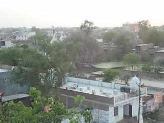
Hanswar is a village in the Ambedkar Nagar district of Uttar Pradesh, India, located east of Tanda. Demographically, Hanswar resembles the rest of the Purvanchal area in which it is located.

Baskhari is a town located in Ambedkar Nagar district in the Indian state of Uttar Pradesh.

Basti is a city, municipal board and administrative headquarters of Basti district in the Indian state of Uttar Pradesh. The district is part of Basti division. It is situated 202 kilometres east of the state capital, Lucknow.

<span class="mw-page-title-main">Ambedkar Nagar Lok Sabha constituency</span> Lok Sabha Constituency in Uttar Pradesh, India

Ambedkar Nagar Lok Sabha constituency is one of the 80 Lok Sabha (parliamentary) constituencies in the Indian state of Uttar Pradesh. This Lok Sabha Constituency came into existence in 1996 as 11th Lok Sabha was held in April - May 1996. On 29 September 1995 Ambedkar Nagar district was carved out from Faizabad division in the memory of B. R. Ambedkar.

Katehri, also spelled as Katehari, is a town in Ambedkar Nagar district in the Indian state of Uttar Pradesh. Katehri is also a block in Ambedkar Nagar district, Uttar Pradesh.

Goshainganj, also known as Gosainganj, is a town and nagar panchayat in the Ayodhya district of the Indian state of Uttar Pradesh. Located 32 km from the district headquarters Ayodhya, Goshainganj has one of the oldest markets of the district.

Rajesultanpur or Raje Sultanpur is a town and nagar panchayat in Ambedkar Nagar district in the Indian state of Uttar Pradesh.

Tarun is a town in Bikapur tehsil, Ayodhya district in the Indian state of Uttar Pradesh, India. Tarun is 30 km south of district headquarters Ayodhya city.

Naipura is a Village of Tanda Ambedkar Nagar, Uttar Pradesh. Naipura is Tehsil of Tanda and It belongs to Faizabad division. Located 26 km toward north from District headquarter Akbarpur, Ambedkar Nagar, 13 km from Tanda, and 200 km from state capital Lucknow. The villagers mostly speak the Hindi local language.

Mundera is a Village of Tanda, Ambedkar Nagar, Uttar Pradesh. Mundera is Tehsil of Baskhari and belongs to Faizabad division. Mundera is administered by Akbarpur, which is 35 km away.

Aalapur is a town and tehsil in Ambedkar Nagar district, Uttar Pradesh, India. It is a part of Faizabad division in Uttar Pradesh state. Aalapur is 33 km east of district headquarters Akbarpur city.

Bhiyaon or Bhiyawan is a village block in Jalalpur, Ambedkar Nagar district of the Indian state of Uttar Pradesh. It belongs to Akbarpur Division. It is located 39 km east of the district headquarters, Akbarpur, and 230 km from Lucknow.

Haiderganj is a town in Bikapur tehsil in Ayodhya district of Uttar Pradesh state of India. Haiderganj is 40 km south of district headquarters Ayodhya city.

References

  1. 1 2 "Census of India: Tanda". www.censusindia.gov.in. Retrieved 8 December 2019.
  2. 1 2 "52nd Report of the Commissioner for Linguistic Minorities in India" (PDF). nclm.nic.in. Ministry of Minority Affairs. Archived from the original (PDF) on 25 May 2017. Retrieved 7 December 2018.
  3. 1 2 "C-16 Population By Mother Tongue". census.gov.in. Retrieved 2 March 2021.
  4. "Municipalities | Ambedkarnagar | India" . Retrieved 7 January 2023.
  5. "Tehsil - Ambedkarnagar - India" . Retrieved 21 August 2021.
  6. "Read the eBook The imperial gazetteer of India (Volume 13) by William Wilson Hunter online for free (page 21 of 68)". www.ebooksread.com. Retrieved 20 May 2021.
  7. "Tanda, Uttar Pradesh Assembly Election Results 2022 LIVE Updates". India Today. Retrieved 10 March 2022.
  8. "Adarsh Janta Inter College". bharatibiz.com. Retrieved 4 March 2022.
  9. "QAUMI INTER COLLEGE TANDA - Kasba, District Ambedkar Nagar (Uttar Pradesh)". schools.org.in. Retrieved 4 March 2022.