Bansi is a city and municipal board situated on a bank of the Rapti River in the Siddharthnagar district in the state of Uttar Pradesh, India. It is one of the five vidhan sabha constituencies in Siddharthnagar district and one of the most important cities of the district. The Indo Nepal border is near to the town around 40 km. Lumbini of Nepal is the best place to visit from Bansi by crossing the open border between Nepal and India. The Magh Mela is a fair which is held for a month in Bansi from 25th January to 25 February, attracting visitors from all the surrounding areas.
Chikkanayakanahalli is a town in Tiptur sub-division of Tumakuru district, in the state of Karnataka, India. It is 30 km away from Tiptur and 132 km from Bangalore.
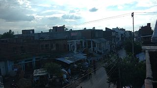
Hariharpur is a town and a Nagar Panchayat in Sant Kabir Nagar district in the Indian state of Uttar Pradesh.
Harrai is a Nagar Panchayat in Chhindwara district in the Indian state of Madhya Pradesh.
Jalalpur is a town, tehsil and a municipal board in Ambedkar Nagar district in the Indian state of Uttar Pradesh, India.
Jaswantnagar is a town and a municipal board in Etawah district in the Indian state of Uttar Pradesh.
Kiraoli is a town and a nagar panchayat in Agra district in the Indian state of Uttar Pradesh.

Kothavalasa is a town in Vizianagaram district of the Indian state of Andhra Pradesh. It is located in Kothavalasa mandal of Vizianagaram revenue division. It is located 30 km from the city of Visakhapatanam
Maharajganj is a town and a nagar panchayat in Azamgarh district in the Indian state of Uttar Pradesh. It is connected to National Highway 233B (India), linking Azamgarh to Rajesultanpur.
Mairang is the headquarters of Eastern West Khasi Hills district of Meghalaya, India. It is located at about 40 km from the state capital Shillong, and 45 km (approx.) from Nongstoin along National Highway 106.
Tanda is a town in Ambedkar Nagar district in the Indian state of Uttar Pradesh situated on the banks of Ghaghara River. It is a nagar palika parishad and is part of Ayodhya division in Uttar Pradesh. The town is situated 20 kilometres (12 mi) north east from district headquarter Akbarpur. Tanda is also a tehsil in the district. It has one of the largest handloom weaving industries for manufacturing varieties like gamchha, lungi, polyester clothing, check-shirt clothes material in state of Uttar Pradesh.
Gola Bazar is a town and a nagar panchayat in Gorakhpur district in the Indian state of Uttar Pradesh. It is also known for its gold market. It is located near the Saryu (Ghaghra) river. This river itself is a border between Gorakhpur and Azamgarh. Distance from Gorakhpur City is around 54 km via kauriram. It is one of the tehsils of Gorakhpur. It is very famous for its ghats which are on the bank of river Saryu. Gola market is very famous among the villages and other towns around it.
Baskhari is a town located in Ambedkar Nagar district in the Indian state of Uttar Pradesh.
Goshainganj, also known as Gosainganj, is a town and nagar panchayat in the Ayodhya district of the Indian state of Uttar Pradesh. Located 32 km from the district headquarters Ayodhya, Goshainganj has one of the oldest markets of the district.
Motihari is the headquarters of East Champaran district in the Indian state of Bihar.
Rajesultanpur or Raje Sultanpur is a town and nagar panchayat in Ambedkar Nagar district in the Indian state of Uttar Pradesh.
Ghughurpatti is a village in Ambedkar Nagar district in the Indian state of Uttar Pradesh and is a sub post office of Rajesultanpur.
Bachuwapar is a Kasba/Town in Ambedkar Nagar district in the Indian state of Uttar Pradesh and is Subpost Office of Rajesultanpur.
Jahangirganj is a nagar panchayat and Market in Ambedkar Nagar district in the Indian state of Uttar Pradesh and is Subpost Office. It is found 45 km towards East from District headquarters Akbarpur, Ambedkar Nagar and 242 km from State capital Lucknow.
Balrampur is a town in Ambedkar Nagar district in the Indian state of Uttar Pradesh and is Subpost Office of Rajesultanpur.

