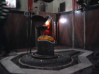
Gyanpur is a town and a nagar panchayat in Bhadohi district in the Indian state of Uttar Pradesh and the administrative headquarters of Bhadohi district.

Handia is a town and a nagar panchayat in the Allahabad district of the Indian state of Uttar Pradesh.

Harpalpur is a town and a nagar panchayat in Chhatarpur District in the Indian state of Madhya Pradesh.

Jalalpur is a town, tehsil and a municipal board in Ambedkar Nagar district in the Indian state of Uttar Pradesh, India.

Kachhwa is a town and a nagar panchayat in Mirzapur district in the Indian state of Uttar Pradesh.

Kadipur is a town, tehsil and a nagar panchayat in Sultanpur district in the Indian state of Uttar Pradesh.

Kiraoli is a town and a nagar panchayat in Agra district in the Indian state of Uttar Pradesh.
Koeripur is a town and a nagar panchayat in Lambhua tehsil of the Sultanpur district in the Indian state of Uttar Pradesh, India. It is a part of Faizabad division in Uttar Pradesh state. Keoripur is 41 km away from district headquarters Sultanpur city.

Lal Gopalganj Nindaura is a town and a nagar panchayat in Allahabad district in Indian state of Uttar Pradesh.

Machhlishahr is a town in Jaunpur district in the Indian state of Uttar Pradesh. It is situated 30 km west of district headquarters Jaunpur. NH-231 passes through the city. Machhlishahr – Janghai – Bhadohi four-lane highway is under construction which will boost the economy of the region. Machhlishahr is a Nagar panchayat and there has been a longstanding demand for making it a Nagar palika parishad. In 2020, Machhalisahar nagar panchayat has secured 33rd all India rank in Swachh Survekshan cleanliness survey.

Musafirkhana is a town and tehsil in Amethi district in Indian state of Uttar Pradesh. The word "Musafirkhana" means "Sarai," or "Dharamshala". Musafirkhana is located 32 km northwest of Amethi, 27 km from Nihalgarh and 20 km from Jagdishpur. Gauriganj and Amethi are accessible from Musafirkhana via roadways; the nearest railway station is the Musafirkhana railway station on the Lucknow–Varanasi rail route via Sultanpur, and the nearest airport is the Amausi airport. It is surrounded by more than 100 villages. The town is between 26.37° north latitude and 81.8° east longitude at a height of 102 metres (434 feet) above mean sea level.

Phulpur is a town and a nagar panchayat in Azamgarh district in the Indian state of Uttar Pradesh.

Pinahat is a town and a nagar panchayat in Agra district in the Indian state of Uttar Pradesh and situated on the Bank of Chambal River. It is about 55 km from Agra. The distance between Pinahat and Chambal is only 2 km.

Swamibagh is a town and a nagar panchayat in Agra district in the Indian state of Uttar Pradesh.

Vijaigarh is a town and a nagar panchayat in Aligarh district in the Indian state of Uttar Pradesh.

Jafarabad is a town and nagar panchayat in Jaunpur district in the Indian state of Uttar Pradesh.

Raya is a town and a nagar panchayat in the Mathura district of the Indian state of Uttar Pradesh.

Dewa Sharif or Dewa is a town and a nagar panchayat in Barabanki district in the state of Uttar Pradesh, India. It is famous for the shrine of Haji Waris Ali Shah. This town is also known by the name of Dewa Sharif in respect for the shrine. It is about 26 km north-east of capital Lucknow.

Lambhua is a town, tehsil, and a Nagar panchayat in Sultanpur district in the Indian state of Uttar Pradesh. It is located on the National Highway 731.

Daulatpur is a village in the Sultanpur District in the Indian state of Uttar Pradesh.


