Kadipur

Last updated
Hanuman visited this place and now it is a temple named Bijethua Bijethua Mahavir Dham.jpg
Hanuman visited this place and now it is a temple named Bijethua

Kadipur
Kādīpur
Town
Kadipur block map.png
Map showing Kadipur CD block
India Uttar Pradesh location map.svg
Red pog.svg
Kadipur
Location in Uttar Pradesh, India
India location map 3.png
Red pog.svg
Kadipur
Kadipur (India)
Coordinates: 26°10′N82°23′E / 26.17°N 82.38°E / 26.17; 82.38
CountryFlag of India.svg  India
State Uttar Pradesh
District Sultanpur
Area
[1]
  Total4 km2 (2 sq mi)
Elevation
90 m (300 ft)
Population
 (2011) [2]
  Total8,010
  Density2,000/km2 (5,200/sq mi)
Language
  Official Hindi [3]
  Additional official Urdu [3]
  Regional Awadhi
Time zone UTC+5:30 (IST)
PIN
228145
Vehicle registration UP-44
Blocks Dostpur, Akhand Nagar, Kadipur, Karaundi Kala

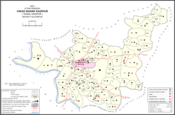
Kadipur is a town, tehsil and a nagar panchayat in Sultanpur district in the Indian state of Uttar Pradesh. [4] It is located a short distance from the bank of the Gomti River, at a crossroads between two roads heading from Sultanpur to Surapur and from Pratapgarh to Dostpur and then on to Akbarpur. [5] On the north side of town is a stream with a steep ravine that drains the surrounding area. [5] The road to Sultanpur crosses over this stream on a bridge. [5] The lands surrounding Kadipur are average quality for agricultural purposes. [5] As of 2011, Kadipur has a population of 8,010 people, in 1,216 households. [1]

Contents

Kadipur tehsil has 4 blocks: Akhand Nagar, Dostpur, Kadipur and Karaundi Kala. The Chairman of Kadipur is Vijay Bhan Singh.

Geography

Kadipur is located at 26°10′N82°23′E / 26.17°N 82.38°E / 26.17; 82.38 . [6] It has an average elevation of 90 metres (295 feet).

It is situated on the bank of Gomti River.

History

Kadipur was historically a relatively minor village without any particular importance until it was made the headquarters of a tehsil. [5] It was chosen mainly because it was centrally located within the tehsil. [5] At the turn of the 20th century, Kadipur had the tehsil offices, a thana, a pound, and a thriving upper primary school. [5] It also had a bazar, which was described as "a very small one for a tahsili town". [5] A village bank had also been established. [5] As of 1901, its population was 793, with the majority of the population being Brahmins. [5] Kadipur was then held by some minor Rajkumar zamindars, with some of the Brahmins holding under-proprietary rights. [5]

Demographics

Historical population
YearPop.±%
1991 5,235    
2001 6,794+29.8%
2011 8,010+17.9%
Source: 2011 Census of India [1]

As of 2011 Indian Census, Kadipur had a total population of 8,010, of which 4,114 were males and 3,896 were females. Population within the age group of 0 to 6 years was 1,083. The total number of literates in Kadipur was 5,571, which constituted 69.6% of the population with male literacy of 75.6% and female literacy of 63.1%. The effective literacy rate of 7+ population of Kadipur was 80.4%, of which male literacy rate was 87.2% and female literacy rate was 73.2%. The Scheduled Castes population was 1,304. Kadipur had 1216 households in 2011. [2]

According to the 2001 census, Kadipur had a population of 6795. Males constitute 53% of the population and females 47%. Kadipur has an average literacy rate of 62%, higher than the national average of 59.5%: male literacy is 69%, and female literacy is 55%. In Kadipur, 16% of the population is under 6 years of age. [7]

Amenities

As of 2011, Kadipur has 2 hospitals with a total of 34 beds. [1] It has 17 primary schools. [1] There is no public library.A fire station is under construction on Chanda Road almost one kilometre from the Patel Chowk;  . [1] Wastewater and sewage are disposed of using an open drainage system. [1] Water supply comes from both tube well and hand pump sources. [1]

Villages

Kadipur CD block has the following 94 villages: [1]

Village nameTotal land area (hectares)Population (in 2011)
Taukalpur 94.3417
Dhanepur 65557
Banauta 115.11,027
Andaraypur 2982,692
Kotiya 97.2592
Salahpur 113.3707
Budhana 96.2823
Madanpur Kalan 230.61,084
Laxmanpur 161.22,332
Arjanipur 38.4534
Higungapur 76.1897
Malapur Jagdishpur 296.33,579
Chandnaia 65.8457
Lauhara 88.31,020
Bhuwapur Sazaia 51.6194
Kakana 144.72,026
Amrathuo Dadiya 4833,079
Hamjapur Pathan 185.32,601
Bankegan 733.67,223
Chatur Khijrabad 62.3473
Pandela 126.51,360
Daulatpur 111.61,261
Gaura Bibipur 193.91,759
Mangrawa 1751,871
Kalikapur 174.41,255
Katghara Khurd 88.2721
Kaymaspur 92.3149
Kamrawan 163.51,526
Raibigo 909.65,933
Karsari 549.14,963
Baruaaripur 2084,214
Katghar Mutarwahi 116.6545
Ganapur 37.92
Saidpur Kalan 80.1637
Bachhapara 59.4634
Khijarabad 56.2203
Bhimalpur 43.8306
Narayanapara 59.41,008
Gopalpur Newajpur 246.22,293
Ranipur Kaysth 246.22,293
Bhaluaahi 31.2473
Mustfabad 32.10
Aldamaoo Noorpur 165.11,293
Makhdoompur 38.60
Bhikhpur Aqbalpur 53.8115
Khatiwpur 63.31,158
Saraykalyan 86.61,563
Jalalpur 209.62,474
Mohammdabad 66.81,469
Mithanepur 19.9816
Bakshoopur 26.2106
Nasirpur Saidan 64.1638
Paharpur Shrirampur 182.12,308
Bhadaiya 30.3396
Aasaipur 18.8350
Prannathpur 67.7503
Sarayani 305.22,890
Prannathpur Khurd 53.3211
Sangapur 56.2262
Kadipurkhurd 387.73,491
Saraya Kamaura 113.61,057
Taukalpur Nagara 87.63,461
Khandaura 147.51,474
Tailokpur Newada 410.81,426
Jafapur 107.91,394
Narottam 99.81,067
Pokhadaha 129.81,586
Laghaura 68.6897
Bhawanipur 66.11,337
Bijethuaa Rajapur 285.63,307
Jalalpur Bakhra 148.11,743
Kumhi 525.64,367
Palidawapur 256.92,576
Hamidpur 127.21,422
Khalispur Mubarakpur 254.12,394
Katghara 70.4939
Rohiyawa 82.2761
Bahorapur 139.1735
Biraiepur Bhatpura 294.52,821
Gangapur 52.5359
Jalapur Rohiyawan 115.8652
Sukhaoopur 103.13
Rampur Ukhtanda 75.2205
Paharpur Basya 298.11,154
Sizilpur 192.91,505
Bari 244.81,638
Malipurnunra 434.43,658
Mudaladin 183.51,425
Rampur Khurd 151.11,349
Karopi 126.71,053
Majhgawan 4743,257
Kumaihamjapur 1391,218
Bhiti Paharpur 1251,318

Related Research Articles

<span class="mw-page-title-main">Sultanpur, Uttar Pradesh</span> City in Uttar Pradesh, India

Sultanpur is a city situated on the banks of holy river Gomti in the Indian state of Uttar Pradesh. It is the administrative headquarters of Sultanpur district and is a part of Ayodhya division in Uttar Pradesh, India. It is situated 135 kilometres east of state capital Lucknow.

<span class="mw-page-title-main">Sultanpur district</span> District of Uttar Pradesh in India

Sultanpur district is a district in the Awadh region of the Indian state of Uttar Pradesh. This district is a part of Ayodhya division in Uttar Pradesh. The administrative headquarters of the district is Sultanpur city. The total area of Sultanpur district is 2672.89 Sq. km.

Dostpur is a town and a nagar panchayat in Sultanpur district in the state of Uttar Pradesh, India. The town borders Sultanpur and Ambedkarnagar. Purvanchal Expressway passes near the town.

Jalalpur is a town, tehsil and a municipal board in Ambedkar Nagar district in the Indian state of Uttar Pradesh, India.

Koeripur is a town and a nagar panchayat in Lambhua tehsil of the Sultanpur district in the Indian state of Uttar Pradesh, India. It is a part of Faizabad division in Uttar Pradesh state. Keoripur is 41 km away from district headquarters Sultanpur city.

<span class="mw-page-title-main">Musafirkhana</span> Town in Uttar Pradesh, India

Musafirkhana is a town and tehsil in Amethi district in Indian state of Uttar Pradesh. The word "Musafirkhana" means "Sarai," or "Dharamshala". Musafirkhana is located 32 km northwest of Amethi, 20 km from Jagdishpur. Gauriganj and Amethi are accessible from Musafirkhana via roadways; the nearest railway station is the Musafirkhana railway station on the Lucknow–Varanasi rail route via Sultanpur, and the nearest airport is the Amausi airport. It is surrounded by more than 100 villages. The town is between 26.37° north latitude and 81.8° east longitude at a height of 102 metres (434 feet) above mean sea level.

Hyderabad is a town and nagar panchayat in Hasanganj tehsil of Unnao District, Uttar Pradesh, India. It is located on the main Unnao-Sandila road, near its intersection with the road connecting Lucknow and Bangarmau. Major commodities produced in Hyderabad include roasted rice, food products, and earthenware pottery. As of 2011, its population is 7,697 people, in 1,328 households.

<span class="mw-page-title-main">Gauriganj, India</span> Town in Uttar Pradesh, India

Gauriganj is a city, tehsil and administrative headquarters of Amethi district in Ayodhya division, Uttar Pradesh, India. It is situated about 126 km from Lucknow, the capital of Uttar Pradesh. It is located in Eastern Uttar Pradesh. Before July 2010, Gauriganj was part of Sultanpur district and then taking Gauriganj, Amethi, Jais, Jagdispur and Salon, formed a new district called Chatrapati Sahuji Maharaj Nagar, later named Gauriganj and now Amethi. Gauriganj is connected with State Highway 34 and National Highway 128.

Lambhua is a town, tehsil, and a Nagar panchayat in Sultanpur district in the Indian state of Uttar Pradesh. It is located on the National Highway 731.

<span class="mw-page-title-main">Akhand Nagar</span>

Akhand Nagar is a community development block in Kadipur tehsil of Sultanpur district, Uttar Pradesh, India. It consists of 106 inhabited villages with a total population of 168,686 people in 25,112 households.

<span class="mw-page-title-main">Baramadpur</span> Village in Uttar Pradesh, India

Baramadpur is a village in Akhand Nagar block of Kadipur tehsil in Sultanpur district of Uttar Pradesh, India. As of 2011, it has a population of 3,251 people, in 442 households. It has one primary school and one primary health centre and it hosts both a regular market and a weekly haat. It is part of the nyaya panchayat of Sajampur.

Rajesultanpur or Raje Sultanpur is a town and nagar panchayat in Ambedkar Nagar district in the Indian state of Uttar Pradesh.

Madaria is a village in Gola Block and Tehsil (sub-district) of Gorakhpur district in the Indian State of Uttar Pradesh. The total geographical area of village is 75.21 hectares. The village has 247 households. The village has its Gram Panchayat and Post Office. The native language is Hindi. Madaria is located 61.1 km from Gorakhpur and 7 km from sub-district headquarters Gola Bazar.

<span class="mw-page-title-main">Sajampur</span> Village in Uttar Pradesh, India

Sajampur is a village in Akhand Nagar block of Kadipur tehsil in Sultanpur district of Uttar Pradesh, India. As of 2011, it has a population of 1,749 people, in 246 households. It has one primary school and no healthcare facilities and it does not host a regular market or a weekly haat. It serves as the seat of a nyaya panchayat which also includes 13 other villages.

<span class="mw-page-title-main">Muradabad, Sultanpur</span> Village in Uttar Pradesh, India

Muradabad is a village in Akhand Nagar block of Kadipur tehsil in Sultanpur district, Uttar Pradesh, India. As of 2011, it has a population of 1,543 people, in 238 households. It has one primary school and no healthcare facilities and it hosts both a regular market and a weekly haat. It belongs to the nyaya panchayat of Sajampur.

<span class="mw-page-title-main">Karai, Sultanpur</span> Village in Uttar Pradesh, India

Karai is a village in Akhand Nagar block of Kadipur tehsil in Sultanpur district, Uttar Pradesh, India. As of 2011, it has a population of 1,399 people, in 196 households. It has one primary school and no healthcare facilities and it does not host a regular market or a weekly haat. It belongs to the nyaya panchayat of Sajampur.

<span class="mw-page-title-main">Raipur, Akhand Nagar</span> Village in Uttar Pradesh, India

Raipur is a village in Akhand Nagar block of Kadipur tehsil in Sultanpur district, Uttar Pradesh, India. As of 2011, it has a population of 1,738 people, in 307 households. It has one primary school and no healthcare facilities and it does not host a regular market or a weekly haat. It belongs to the nyaya panchayat of Sajampur.

<span class="mw-page-title-main">Ramnagar, Akhand Nagar</span> Village in Uttar Pradesh, India

Ramnagar is a village in Akhand Nagar block of Kadipur tehsil in Sultanpur district, Uttar Pradesh, India. As of 2011, it has a population of 983 people, in 144 households. It has no healthcare facilities and it does not host a regular market or a weekly haat. It belongs to the nyaya panchayat of Sajampur.

<span class="mw-page-title-main">Daulatpur, Kadipur</span> Village in Uttar Pradesh, India

Daulatpur is a village in Kadipur block of Kadipur tehsil in Sultanpur district, Uttar Pradesh, India. As of 2011, it has a population of 1,261 people, in 172 households. It has one primary school and no healthcare facilities and it does not host a regular market or a weekly haat. It belongs to the nyaya panchayat of Kalikapur Kalan.

<span class="mw-page-title-main">Jaisinghpur, Sultanpur</span> Village in Uttar Pradesh, India

Jaisinghpur is a village and tehsil headquarters in Sultanpur district, Uttar Pradesh, India. As of 2011, it has a population of 2,211 people, in 353 households. It has 4 primary schools and one hospital. It hosts a haat on Tuesdays and Saturdays mostly dealing in tat patti. It serves as the headquarters of a nyaya panchayat which also includes 23 other villages. It is also the seat of a community development block, which was inaugurated in 1953.

References

  1. 1 2 3 4 5 6 7 8 9 "Census of India 2011: Uttar Pradesh District Census Handbook - Sultanpur, Part A (Village and Town Directory)" (PDF). Census 2011 India. pp. 521–38, 758–73. Retrieved 30 November 2021.
  2. 1 2 "Census of India: Kadipur". www.censusindia.gov.in. Retrieved 17 January 2020.
  3. 1 2 "52nd Report of the Commissioner for Linguistic Minorities in India" (PDF). nclm.nic.in. Ministry of Minority Affairs. Archived from the original (PDF) on 25 May 2017. Retrieved 11 January 2019.
  4. "Pin Code: KADIPUR, SULTANPUR, UTTAR PRADESH, India, Pincode.net.in". pincode.net.in. Retrieved 17 January 2020.
  5. 1 2 3 4 5 6 7 8 9 10 11 Nevill, H.R. (1903). Sultanpur: A Gazetteer, Being Volume XLVI Of The District Gazetteers Of The United Provinces Of Agra And Oudh. Allahabad: Government Press. pp. 187–9. Retrieved 30 November 2021.
  6. Falling Rain Genomics, Inc - Kadipur
  7. "Census of India 2001: Data from the 2001 Census, including cities, villages and towns (Provisional)". Census Commission of India. Archived from the original on 16 June 2004. Retrieved 1 November 2008.