Basti district is one of the districts of Uttar Pradesh state, India, and a part of Basti Division. Basti city is the district headquarters.

Barabanki district is one of the five districts of Faizabad division, in the central Awadh region of Uttar Pradesh, India. Barabanki city is the administrative headquarters of Barabanki district. Total area of Barabanki district is 3891.5 Sq. Km.

Faizabad district, officially Ayodhya district, is one of the 75 districts of Indian state of Uttar Pradesh. The city of Ayodhya, which is believed to be the birth place of Hindu deity Rama, is the administrative headquarters of the district. The official name of the district was changed from Faizabad to Ayodhya in November 2018 by Yogi Adityanath-led Government of Uttar Pradesh. The district occupies an area of 2,522 square kilometres (974 sq mi), and had a population of 2,470,996 in the 2011 census. Awadhi is the common language of the people of Faizabad district.

Ambedkar Nagar is a district in the Indian state of Uttar Pradesh. This district is a part of Faizabad division in the Awadh region of the state. This district was established on 29 September 1995 by carving out parts of the erstwhile Faizabad district. It was created by the then Chief Minister Mayawati and named in memory of Bhimrao Ambedkar, who worked for the advancement of the deprived classes, women and other weaker sections of society. The total area of Ambedkar Nagar district is 2350 Sq. Km.
Obra is a town, Tehsil and Assembly constituency of Uttar Pradesh which is recently upgraded from the stature of Nagar Panchayat in Sonebhadra district in the Indian state of Uttar Pradesh. Obra is located 137 km from Varanasi at the Banks of Renu & Sone River with population of 46,574 As per 2011 India Census. State-owned UPRVUNL and UPJVUNL have a coal-fired thermal power plant and a hydro electric power plant here, respectively. The before mentioned industries are the major source of employment either directly or indirectly. Recreational places in Obra include Jawahar Bal Udayan, Ambedkar Stadium, Lord Shiva's temple, Sone river banks, parsoi and kharatiya villages etc. Restructuring of government residential colony is ongoing as new power plants are being constructed.
Akbarpur is a city, municipal corporation, tehsil, and the administrative headquarters of Ambedkar Nagar district in the state of Uttar Pradesh, India. It is a part of Ayodhya division.
Tanda is a town in Ambedkar Nagar district in the Indian state of Uttar Pradesh situated on the banks of Ghaghara River. It is a nagar palika parishad and is part of Faizabad division in Uttar Pradesh. The town is situated 20 kilometres (12 mi) north east from district headquarter Akbarpur. Tanda is also a tehsil in the district. It has one of the largest handloom weaving industries for manufacturing varietis like gamchha, lungi, polyester clothing, check-shirt clothes material in state of Uttar Pradesh.

Chhatrapati Shahu Ji Maharaj University (CSJMU), formerly Kanpur University, is a public state university located in Kanpur, Uttar Pradesh, India. It is administered under the state legislature of the government of Uttar Pradesh.
Milkipur is a town and tehsil in Ayodhya district in the Indian state of Uttar Pradesh. Milkipur is 32 km south of district headquarters Ayodhya city. District Ayodhya consists of 11 blocks and Milkipur is a block in Ayodhya, Uttar Pradesh.
Sikandara is a town in Kanpur Dehat district in the Indian state of Uttar Pradesh. It is headquarters of tehsil Sikandara.
Kanpur Dehat district is a district in Uttar Pradesh state in northern India. The administrative headquarters of the district are at Mati-Akbarpur. This district is part of Kanpur division. Kanpur was formerly spelled Cawnpore.
Ambedkar Nagar Lok Sabha constituency is one of the 80 Lok Sabha (parliamentary) constituencies in the Indian state of Uttar Pradesh. This constituency came into existence in 2008 as a part of the implementation of delimitation of parliamentary constituencies based on the recommendations of the Delimitation Commission of India constituted in 2002.

Amethi district is the 72nd district of the state of Uttar Pradesh in northern India. This district is a part of Faizabad division in the Awadh region of the Uttar Pradesh. It covers an area of 2329.11 km². Gauriganj is the administrative headquarters of the district.
Goshainganj, also known as Gosainganj, is a town and nagar panchayat in the Faizabad district of the Indian state of Uttar Pradesh. Located 32 km from the district headquarters Ayodhya, Goshainganj has one of the oldest markets of the district.
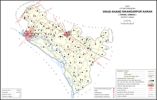
Maharamau is a small village in the Sikandarpur Karan block of Unnao district, Uttar Pradesh, India. As of 2011, its population was 550 in 106 households. It has one primary school and no healthcare facilities.
Lalji Verma is an Indian politician. Ex. Minister Uttar Pradesh government and leader of the BSP legislative assembly.

Ram Murti Verma is an Indian politician and former Minister of Milk and Dairy development in the Uttar Pradesh government under Akhilesh Yadav ministry. As a member of the Samajwadi Party, Verma represents the Tanda constituency in the 18th Legislative Assembly of Uttar Pradesh. Before that, he represented the Akbarpur constituency in the Sixteenth Legislative Assembly of Uttar Pradesh.
Tarun is a town in Bikapur tehsil, Faizabad district in the Indian state of Uttar Pradesh, India. Tarun is 30 km south of district headquarters Ayodhya city.
Mai is a village in Sadabad Block in Mahamaya Nagar District of Uttar Pradesh State, India. It belongs to Aligarh Division. It is located 40 km towards the South of the District headquarters Hathras and 16 km from Sadabad. 350 km from the State capital Lucknow. Mai Pin code is 281306 and the postal head office is Sadabad. Chirawali, Saroth, Ghooncha, Nanau, Garhumrao, Nagla Banarasi are the nearby Villages to Mai. Mai is surrounded by Khandauli Block towards the East, Baldeo Block towards the west, Agra Block towards the South, and Sehpau Block towards the East.
Haiderganj is a town in Bikapur tehsil in Faizabad district of Uttar Pradesh state of India. Haiderganj is 40 km south of district headquarters Ayodhya city.

