Maya the Ayodhya district of the Indian state of Uttar Pradesh, India. Maya is 24 km away from district headquarters Ayodhya city.

Faizabad is a city located in Ayodhya district in the Indian state of Uttar Pradesh. It is situated on the southern bank of the River Saryu about 6.5 km from Ayodhya City, the district headquarter, 130 km east of the state capital Lucknow. Faizabad was the first capital of the Nawabs of Awadh and has monuments built by those Nawabs, like the Tomb of Bahu Begum, Gulab Bari. It was also the headquarters of Faizabad district and Faizabad division before November 2018. Faizabad is a twin city of Ayodhya and it is administered by Ayodhya Municipal Corporation.

Ayodhya district is one of the 75 districts in the northern Indian state of Uttar Pradesh. The city of Ayodhya is its administrative headquarters. The district occupies an area of 2,522 square kilometres (974 sq mi), and had a population of 2,470,996 in the 2011 census. Ayodhya district shares its borders with 6 districts of Uttar Pradesh. It is bordered by Gonda and Basti districts on the northern side, Amethi and Sultanpur districts on the south, and Ambedkar Nagar and Barabanki districts share the border on the east and west.
Bansi is a city and municipal board situated on a bank of the Rapti River in the Siddharthnagar district in the state of Uttar Pradesh, India. It is one of the five vidhan sabha constituencies in Siddharthnagar district and one of the most important cities of the district. The Indo Nepal border is near to the town around 40 km. Lumbini of Nepal is the best place to visit from Bansi by crossing the open border between Nepal and India. The Magh Mela is a fair which is held for a month in Bansi from 25 January to 25 February, attracting visitors from all the surrounding areas.
Bhadarsa is a town and nagar panchayat in Ayodhya district in state of Uttar Pradesh, India. Bhadarsa is 22 km south of district headquarters Ayodhya city.
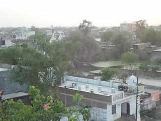
Bikapur is a town, tehsil and nagar panchayat of Ayodhya district of Uttar Pradesh state in India. Bikapur is 25 km south of the district headquarters Ayodhya city.
Ghiror, also spelled Ghiraur, is a town and a nagar panchayat in Mainpuri district in the state of Uttar Pradesh, India. It is also the headquarters of a community development block comprising 74 villages. As of 2011, Ghiror has a population of 15,911, in 2,687 households.
Mau Aima is an industrial town and a nagar panchayat in Prayagraj district in the Indian state of Uttar Pradesh. It is remarkably popular for its power loom industry.
Rudauli is a town, tehsil and a municipal board in Ayodhya district in the Indian state of Uttar Pradesh. Rudauli is 50 km west of the district headquarters Ayodhya.
Akbarpur is a city, municipal corporation, tehsil, and the administrative headquarters of Ambedkar Nagar district in the state of Uttar Pradesh, India. It is a part of Ayodhya division.
Goshainganj, also known as Gosainganj, is a town and nagar panchayat in the Ayodhya district of the Indian state of Uttar Pradesh. Located 32 km from the district headquarters Ayodhya, Goshainganj has one of the oldest markets of the district.
Lambhua is a town, tehsil, and a Nagar panchayat in Sultanpur district in the Indian state of Uttar Pradesh. It is located on the National Highway 731.
Rajesultanpur or Raje Sultanpur is a town and nagar panchayat in Ambedkar Nagar district in the Indian state of Uttar Pradesh.
Sohawal is a town and tehsil in Ayodhya district in the Indian state of Uttar Pradesh and is sub post office of Ayodhya. Sohawal is 18 km west of district headquarters Ayodhya.
Amaniganj is a town in Milkipur tehsil, Ayodhya district in the Indian state of Uttar Pradesh. Amaniganj is situated on Milkipur-Rudauli road and is 51 km away from district headquarters Ayodhya city. Amaniganj is a block in Ayodhya, Uttar Pradesh.
Masodha is a town in Ayodhya district in the Indian state of Uttar Pradesh. It is a sub post office of Ayodhya and is close to the Ayodhya city. Masodha is 6 km south of the district magistrate's office. Masodha is also a block in Ayodhya district.
Tarun is a town in Bikapur tehsil, Ayodhya district in the Indian state of Uttar Pradesh, India. Tarun is 30 km south of district headquarters Ayodhya city.
Nandigram, also known by ancient name Bharatkund, is a village and religious place in Sohawal tehsil in Ayodhya district in the Indian state of Uttar Pradesh, India. During the exile of Lord Ram, King Bharat ruled from Nandigram instead of the kingdom's capital Ayodhya. Nandigram is 19 km (12 mi) south of district headquarters Ayodhya city.
Haiderganj is a town in Bikapur tehsil in Ayodhya district of Uttar Pradesh state of India. Haiderganj is 40 km south of district headquarters Ayodhya city.
Dhamhar is a village in Bikapur tehsil, Ayodhya district in the Uttar Pradesh state of India.


