
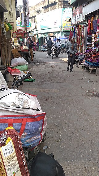
Bachhrawan is a town and nagar panchayat in Raebareli district in the state of Uttar Pradesh, India. It is the seat of a community development block. It is located on the main Raebareli-Lucknow road, at the intersection with roads leading to Maharajganj, Haidergarh, and Gurbakhshganj. The railway runs parallel with the Raebareli-Lucknow road, and there is a train station on the west side of town. First upgraded to municipal status in 1935, Bachhrawan hosts a Ramlila festival on Asvina Sudi 10, which involves a dramatic reenactment of the Ramayana. Vendors bring various everyday items to sell at the festival. As of 2011, the population of Bachhrawan is 12,521, in 2,359 households.
Jaspur is a developing town and a municipal board in Udham Singh Nagar district in the Indian state of Uttarakhand.

Kadipur is a town, tehsil and a nagar panchayat in Sultanpur district in the Indian state of Uttar Pradesh. It is located a short distance from the bank of the Gomti River, at a crossroads between two roads heading from Sultanpur to Surapur and from Pratapgarh to Dostpur and then on to Akbarpur. On the north side of town is a stream with a steep ravine that drains the surrounding area. The road to Sultanpur crosses over this stream on a bridge. The lands surrounding Kadipur are average quality for agricultural purposes. As of 2011, Kadipur has a population of 8,010 people, in 1,216 households.
Kherli is a city and a municipality in Alwar district in the Indian state of Rajasthan.Kherli mandi(Grain Market) is the second largest mandi in Rajasthan. Once upon a time it was so much famous that till now old jaipur people knows this as ganj kherli i.e. kherli mandi. Kherli is between the golden triangle where it is nearest to Agra(125 km) Jaipur(150 km) and Delhi(175 km).This area also comes under NCR but still they are not getting benefit of close proximity to these 3 big cities.

Maharajganj is a town and nagar panchayat in Rae Bareli district, Uttar Pradesh, India. It serves as the headquarters of a tehsil. As of 2011, its population is 6,673, in 1,037 households.
Sadabad is a town and a nagar panchayat in Hathras district in the Indian state of Uttar Pradesh.
Sirathu is a town and Nagar Panchayat in Kaushambi district in the Indian state of Uttar Pradesh. It is one of oldest town in Kaushambi district. The town has a population of approximately 2700.
Antu is a town and a nagar panchayat in the Community Development Block Sandwa Chandrika, Pratapgarh Teshil, Pratapgarh district in the state of Uttar Pradesh, India, located 20.6 km northwest of the district administrative headquarter Bela Pratapgarh and 4.7 km northeast of Sandwa Chandrika. The territory of the town has 2 square kilometers. It is divided into 10 wards. The postal Zip Code is 230501.

Salon is a town and nagar panchayat in Raebareli district in the Indian state of Uttar Pradesh. It serves as the headquarters of a tehsil as well as a community development block. Originally it was also the headquarters of the entire district, but they were moved after the Indian Rebellion of 1857. It is located a bit to the south of the Sai river, at the junction of the Raebareli-Pratapgarh and Jais-Khaga roads. Other roads lead to Dalmau, Manikpur, and Kunda. To the east is a large jhil.
Chail is a town and a nagar panchayat in Kaushambi district in the state of Uttar Pradesh, India. Nearest Market - Manauri bajar

Jahanabad is a town and a nagar panchayat in Pilibhit district in the Indian state of Uttar Pradesh.
Siddharthnagar district is one of the 75 districts of the Indian state of Uttar Pradesh also known as the birthplace of Gautama Buddha. Siddharthnagar is the district headquarters. Siddharthnagar district is a part of Basti division. It was under Kosala kingdom and also the Shakya Kingdom in ancient times.
Majhola is a town and a nagar panchayat in Pilibhit district in the Indian state of Uttar Pradesh. This town is located 25 km away from district headquarters on state highway 29 connecting Pilibhit to Tanakpur town in Uttaranchal. It is well connected by metre gauge railway line to District headquarters. Geographically, town is located adjacent to Uttaranchal border in terai region. Terai region is famous for its fertile land and industrious farmers. Agriculture is the mainstay of the town economy. It has one sugar factory in cooperative sector, one distillery and few flour mills. Both sugar factory and distillery are now defunct. Demographic profile of town consists of people from different social groups. Dominant among them are farmers which are mainly Sikhs and upper caste group migrants from eastern Uttar Pradesh. Others are business class upper caste people from western Uttar Pradesh who dominates the town economy. The town has two intermediate colleges and one convent school. There are many places of worship belonging to different religions. The place had a very vibrant sport culture which slowly diminished due to exodus of youth out of town for employment.
Siddharthnagar also known as Naugarh is a city and the district headquarters of Siddharthnagar in Uttar Pradesh, India. It is one of the five Vidhan Sabha constituencies in Siddharthnagar district, though the constituency has been renamed to Kapilvastu. It is a town located near Lumbini, the birthplace of Gautam Buddha. Lumbini is the best place to visit from Siddharthnagar, It is situated north from Siddharthnagar railway station at the distance of 20 Kilometer.
Kashia East, aka Kashia poorab is a proposed town area nagar panchayat including Muratganj in Kaushambi district in the Indian state of Uttar Pradesh.
Manauri is a satellite township/neighborhood of Allahabad, Uttar Pradesh state of India. It is a market, 18 km west of Allahabad city headquarter. It lies on the border of Allahabad and Kaushambi district of Uttar Pradesh. On this town, a Railway Station lying nearby on the New Delhi - Howrah main line and an Air Force Station nearby on NH-2 is also named. Due to proximity of the Town with main Railway line and National highway, it has developed into a local trade market. The town has a huge population of more than 15 thousand, both of Hindus and Muslims. The main occupation is grains, vegetable and fruits agriculture along with traditional works like metal works, blacksmith, carpenter, glass works, and construction labours.

Khiron is a village and corresponding community development block in Rae Bareli district, Uttar Pradesh, India. Located on the main Raebareli-Unnao road, Khiron is an old Muslim town that historically served as the seat of a pargana. As of 2011, the village has a population of 9,955, in 1,714 households. It has six primary schools and one medical clinic. It serves as the headquarters of a nyaya panchayat that also includes 11 other villages.

Dih, also spelled Deeh, is a village and corresponding community development block in Salon tehsil of Rae Bareli district, Uttar Pradesh, India. It is located 22 km from Raebareli, the district headquarters, near the point where the road to Parshadepur intersects the road leading from Jais to the Gukana ghat. The Sai river flows a short distance to the south. As of 2011, Dih has a population of 12,110 people, in 2,186 households. It has three primary schools and no healthcare facilities, as well as a post office, a library, and an Anganwadi centre. It is the headquarters of a nyaya panchayat, which also includes 8 other villages.
Mau is a large village in Dih block of Rae Bareli district, Uttar Pradesh, India. It is located on the road from Fursatganj to the Gukana ghat on the Ganges, 4 miles west of Nasirabad and 8 miles from Jais. A road branches off at Mau and connects to Nasirabad. To the northwest of the village is a large lake called the Bara Tal.
Rokha is a large village in Dih block of Rae Bareli district, Uttar Pradesh, India. Historically the namesake of a pargana, Rokha is a predominantly agricultural village consisting of many hamlets. It is located 28 km from Raebareli, the district headquarters. The large village of Mau also borders Rokha to the north. Rokha is connected by road with Nasirabad and Jais to the northeast and Suchi to the southwest.

