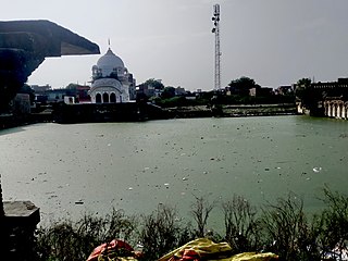
Rura is a Nagar Panchayat in Kanpur Dehat District in Uttar Pradesh state of the India. The town is situated on the banks of Lower Ganga canal. The district headquarters is 15 km away at Mati. The town is located at a distance of 49 km from famous industrial and educational hub of Kanpur Nagar.
Shivli or Sheoli is a town and a nagar panchayat in Kanpur Dehat district in the Indian state of Uttar Pradesh. It is located at 26°37′0″N80°3′0″E and has an average elevation of 128 meters (423 feet).

Mehsi is a High Deployment City and a municipality in the Purvi Champaran district in the Indian state of Bihar. It is a part of the Tirhut Division. The town is the entry point of the Purvi Champaran district. There are many smaller factories manufacturing buttons for the clothing Industry, although most of the population depends upon commercial business and Business agriculture.
Kanpur Dehat district is a district in Uttar Pradesh state in northern India. The administrative headquarters of the district are at Mati-Akbarpur. This district is part of Kanpur division. Kanpur was formerly spelled Cawnpore.

Bhaupur is a town in Kanpur Dehat district in the state of Uttar Pradesh, India.With World Bank funding development of Bhaupur Industrial Sector UPSIDC Amritsar-Kolkata dedicated freight corridor is being carried out.
Rasulpur Gogumau is a village in Kanpur Dehat district in the Indian state of Uttar Pradesh.
Paman is a village in Kanpur Dehat district in the state of Uttar Pradesh, India.
Tilaunchi is a village in Kanpur Dehat district in the state of Uttar Pradesh, India.
Chaunrah is a village in Kanpur Dehat district in the state of Uttar Pradesh, India.
Parjani is a town in Kanpur Dehat district in the state of Uttar Pradesh, India.
Derapur is a town in Kanpur Dehat district in the state of Uttar Pradesh, India. It is the headquarters of the Tehsil of the same name. Derapur is 61 km (38 mi) away from Kanpur city.
Binaur is a town in Kanpur district in the state of Uttar Pradesh, India.
Bairia is a nagar panchayat in Bairia tehsil in Ballia District of Uttar Pradesh State, India. It belongs to Azamgarh Division. It is located 35 km to the east of the district headquarters Ballia. It is a block headquarters and tehsil headquarters. Bairia is a nagar panchayat located in Bairia Tehsil of Ballia district, Uttar Pradesh with total 3904 families residing. The Bairia nagar panchayat has population of 28394 of which 14981 are males while 13413 are females as per Population Census 2011.
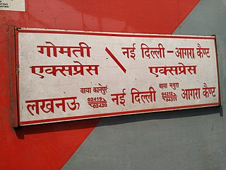
The 12419 / 12420 Gomti Express is a Superfast Express train belonging to Indian Railways – Northern Railway zone that runs between Lucknow NR and New Delhi in India.
Bhatauli is an Indian village of Kanpur Dehat district in Uttar Pradesh.It is an adjacent to city Rura, Kanpur Dehat District, Uttar Pradesh, India. Bhatauli is the commercial center of grain and vegetables. It is well known place for potatoes cold storage. Many primary schools are in government sector while many others in private (recognized). Saraswati Gyan Mandir Inter College is also here. Jog Mai is a center of faith. The Shiv Bajrang Dham Kishunpur is 200 metres (660 ft) away.
Injuwarampur is a village in Kanpur Dehat district in the state of Uttar Pradesh, India.
Jawahar Navodaya Vidyalaya, Kanpur Dehat (JNVKAND) is a co-educational boarding school near Jalalpur, Kanpur Dehat district, India. JNVKAND is funded by the Indian Ministry of Human Resources Development.

Akbarpur Inter College is a senior secondary school in Kanpur Dehat district, Uttar Pradesh, India. The school is affiliated with U P Madhyamik Shiksha Parishad. It is a government aided institution.

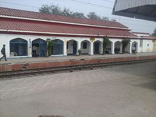
Jhinjhak railway station is a station in Jhinjhak in Kanpur Dehat District, Uttar Pradesh, India. It lies on (NCR)/North Central Railway line. Nearest station to east is Rura at a distance 19 km and Kanpur is at 63 km. In the west nearest station is Phaphund and Etawah.

Lucknow - Agra Fort Intercity Express is an Intercity Express train of the Indian Railways connecting Agra Fort and Lucknow Junction in Uttar Pradesh. It is currently being operated with 12179/12180 train numbers on a daily basis.

