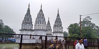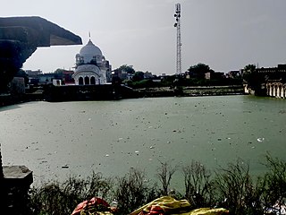
Kanpur division is one of the 18 administrative geographical units of the northern Indian state of Uttar Pradesh. Kanpur city is the administrative headquarters of the division. Kanpur was formerly spelled Cawnpore. The division consists of 6 districts:-

Kannauj district is an administrative district of Uttar Pradesh state in northern India, along the river Ganges. The historic town of Kannauj, northwest of Kanpur, is the administrative center. The district was carved out of Farrukhabad district on 18 September 1997. The native dialect of this district is Kannauji.
Akbarpur is a town in Kanpur Dehat district in the state of Uttar Pradesh, India.
Pukhrayan is a town and a Municipality in Amrodha Block in Kanpur Dehat district in the Indian state of Uttar Pradesh. Found to the south-west of Mati on National Highway 25, Pukhrayan is 2 km (1.2 mi) from Bhognipur.

Rasulabad is a town and a nagar panchayat in Kanpur Dehat district in the Indian state of Uttar Pradesh.
Rura is a Nagar Panchayat in Kanpur Dehat District in the Indian state of Uttar Pradesh on the banks of Lower Ganga canal, 49 km from Kanpur Nagar.
Shivli or Sheoli is a town and a nagar panchayat in Kanpur Dehat district in the Indian state of Uttar Pradesh. It is located at 26°37′0″N80°3′0″E and has an average elevation of 128 meters (423 feet).
Sikandara is a town in Kanpur Dehat district in the Indian state of Uttar Pradesh. It is headquarters of tehsil Sikandara.
Gajner is a town located 37 kilometres from the city of Kanpur in the Kanpur Dehat district of the state of Uttar Pradesh, India. Gajner is located 11 kilometres from the district headquarters of Kanpur Dehat. Gajner is a connecting link of Kanpur, Ghatampur, Musanagar and Pukhrayan.

Chapar Ghata is a fort village in Kanpur Dehat district in the state of Uttar Pradesh, India.

Kanpur Dehat district is a district in Uttar Pradesh state in northern India. The administrative headquarters of the district are at Mati-Akbarpur. This district is part of Kanpur division. Kanpur was formerly spelled Cawnpore.

Bhaupur is a town in Kanpur Dehat district in the state of Uttar Pradesh, India.With World Bank funding development of Bhaupur Industrial Sector UPSIDC Amritsar-Kolkata dedicated freight corridor is being carried out.
Tilaunchi is a village in Kanpur Dehat district in the state of Uttar Pradesh, India.
Chaunrah is a village in Kanpur Dehat district in the state of Uttar Pradesh, India.

Maitha is a village in Kanpur Dehat district in the state of Uttar Pradesh, India.Maitha is founded new tehsil in Kanpur Dehat district and comes under Kanpur Metropolitan Area
Roshan Mau is a town in Kanpur Dehat district in the state of Uttar Pradesh, India.
Ambiyapur is a village in Kanpur Dehat district in the state of Uttar Pradesh, India.
Parjani is a town in Kanpur Dehat district in the state of Uttar Pradesh, India.
Dharau is a village in Kanpur Dehat district in the state of Uttar Pradesh, India.
Bhatauli is an Indian village of Kanpur Dehat district in Uttar Pradesh.It is an adjacent to city Rura, Kanpur Dehat District, Uttar Pradesh, India. Bhatauli is the commercial center of grain and vegetables. It is well known place for potatoes cold storage. Many primary schools are in government sector while many others in private (recognized). Saraswati Gyan Mandir Inter College is also here. Jog Mai is a center of faith. The Shiv Bajrang Dham Kishunpur is 200 metres (660 ft) away.


