
Kanpur ( ), formerly anglicized as Cawnpore, is the second largest city of the Indian state of Uttar Pradesh. It was the primary financial and commercial centre of Northern India. Founded in the year 1207 by a Rajput ruler Raja Kanh Deo, Kanpur became one of the most important commercial and military stations of British India. Kanpur is often regarded as the heart of Uttar Pradesh. Kanpur has been the major financial and industrial centre of North India and also the ninth-largest urban economy in India. Today it is famous for its colonial architecture, gardens, sweets, dialect, IT parks and fine quality leather, plastic and textile products which are exported mainly to the West. Kanpur is also the financial capital of Uttar Pradesh.

Etawah district is one of the districts in the western portion of Uttar Pradesh state of India. Etawah town is the district headquarters. The district covers an area of 2311 km2. It has a population of 1,581,810.

Hamirpur district is one of the 75 districts of Uttar Pradesh state of India and Hamirpur town is the district headquarters. Hamirpur district is a part of Chitrakoot Division. The district occupies an area of 4,121.9 km2. The district has a population of 1,104,285. As of 2011 it is the third least populous district of Uttar Pradesh, after Mahoba and Chitrakoot. Two major rivers Yamuna and Betwa meet here. On the banks of river Betwa lies the "Coarse sand" which is exported to many parts in U.P.

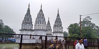
Kanpur division is one of the 18 administrative geographical units of the northern Indian state of Uttar Pradesh. Kanpur city is the administrative headquarters of the division. Kanpur was formerly spelled Cawnpore. The division consists of 6 districts:-
Kannauj district is an administrative district of Uttar Pradesh state in northern India, along the river Ganges. The historic town of Kannauj, northwest of Kanpur, is the administrative center. The district was carved out of Farrukhabad district on 18 September 1997. The native dialect of this district is Kannauji.

Unnao district is a district of Uttar Pradesh state in central India. The city of Unnao is the district headquarters. The district is part of Lucknow Division.
Akbarpur is a town in Kanpur Dehat district in the state of Uttar Pradesh, India.
Amraudha is a town and a nagar panchayat in Kanpur Dehat district in the state of Uttar Pradesh, India. It is a Development block in Bhognipur tehsil.
Bindki is a city, sub-district and a municipality in Fatehpur district in the state of Uttar Pradesh, India.
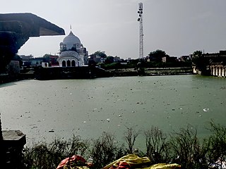
Rura is a Nagar Panchayat in Kanpur Dehat District in Uttar Pradesh state of the India. The town is situated on the banks of Lower Ganga canal. The district headquarters is 15 km away at Mati. The town is located at a distance of 49 km from famous industrial and educational hub of Kanpur Nagar.

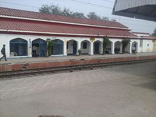
Tundla is a town and a municipal board in Firozabad district in the Indian state of Uttar Pradesh. It is an important railway junction between the Delhi-Kanpur main line and the Agra branch line. Tundla is a railway town that sprang up when the railway was built in the late 1800s. It is served by Tundla Junction railway station. As of 2011, Tundla has a population of 50,423 people, in 8,744 households.
Bhognipur or Bhoganipur is a town in Kanpur Dehat district in the Indian state of Uttar Pradesh. It is the headquarters of the Tehsil of the same name and consists of the Amraudha and Malasa Development Blocks.
Rajpur is a town in Kanpur Dehat district in the state of Uttar Pradesh. The town has various facilities including schools, a hospital, and a market for a normal Indian lifestyle. It is located approximately 17 km west of Bhognipur and 12 km east of Sikandara on NH 2A. It is a development block of Sikandara tehsil. The nearest Railway Station is Pukhrayan with a distance of approx. 20 km and the nearest airport is CCSA, Amaus, Lucknow, approximately 160 km away.
Kanpur Dehat district is a district in Uttar Pradesh state in northern India. The administrative headquarters of the district are at Mati-Akbarpur. This district is part of Kanpur division. Kanpur was formerly spelled Cawnpore.

Bhaupur is a town in Kanpur Dehat district in the state of Uttar Pradesh, India.With World Bank funding development of Bhaupur Industrial Sector UPSIDC Amritsar-Kolkata dedicated freight corridor is being carried out.
Parjani is a town in Kanpur Dehat district in the state of Uttar Pradesh, India.
Derapur is a town in Kanpur Dehat district in the state of Uttar Pradesh, India. It is the headquarters of the Tehsil of the same name. Derapur is 61 km (38 mi) away from Kanpur city.
Injuwarampur is a village in Kanpur Dehat district in the state of Uttar Pradesh, India.
Durrajpur is a village situated at Kanpur Dehat district, Uttar Pradesh, India. The village is 7 km from the sub-district Sikandra and 32 km from sub-district Mati. This village is 90 km from the main city Kanpur. The population of this village is around 900.

