
Bithoor or Bithur is a town in Kanpur District, 23.4 kilometres (14.5 mi) by road north of the centre of Kanpur city, in Uttar Pradesh, India. Bithoor is situated on the right bank of the Ganga, and is a centre of Hindu pilgrimage. According to Hindu scriptures, Bithoor is the birthplace of Bhagwan Shri Ram's sons Luv and Kush. Bithoor is also the centre for War of Independence of 1857 as Nana Sahib, a popular freedom fighter who was based there. The city is enlisted as a municipality of Kanpur metropolitan area.

Kannauj district is an administrative district of Uttar Pradesh state in northern India, along the river Ganges. The historic town of Kannauj, northwest of Kanpur, is the administrative center. The district was carved out of the Farrukhabad district on 18 September 1997. The native dialect of this district is Kannauji.

Achhalda is a town and a nagar panchayat in Auraiya district in the Indian state of Uttar Pradesh. It is also spelled as Achalda.
Akbarpur is a town in Kanpur Dehat district in the state of Uttar Pradesh, India.
Armapur Estate is a census town in Kanpur Nagar District in the state of Uttar Pradesh, India.
Bilhaur is a town and a municipal board in Kanpur Nagar district which is situated in the state of Uttar Pradesh, India. It is 56 km from Kanpur and situated where the Isan River joins the River Ganges. Araul is nearest village of Bilhaur and distance is 11 km.
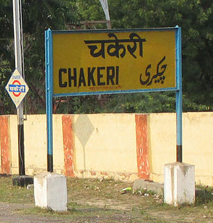
Chakeri is a census town in Kanpur metropolitan area, situated about 16 kilometres east of Kanpur city in the state of Uttar Pradesh, India. It is an industrial town with textiles and food products as its major productions. Chakeri Airforce Station, North India's second largest Airforce base is situated here. Chakeri also has reputed educational institutions and colleges. Central Leather Research Institute, the only government leather research institute in North India is situated here. Grand Trunk Road made by the great emperor Sher Shah Suri passes from Chakeri. The town is enlisted as a Town Area of Kanpur metropolitan area.
Choubepur Kalan is a census town in Kanpur district in the state of Uttar Pradesh, India.
Ganj Dundawara is a city and a municipal board in Kasganj District and the Aligarh zone in the state Uttar Pradesh, India.
Ghiraur is a town and a nagar panchayat in Mainpuri district in the state of Uttar Pradesh, India.
Jalalpur is a town and a municipal board in Ambedkar Nagar district in the India state of Uttar Pradesh.
Kamalganj is a town and a nagar panchayat in Farrukhabad district in the Indian state of Uttar Pradesh. The town is one of the key contributors to Potato production in the district. Kamalganj was named after Muslim religion promoter and social worker 'Kamal Baba'.
Lakhna is a town and a nagar panchayat in Etawah district in the Indian state of Uttar Pradesh.
Northern Railway Colony is a census town in Kanpur Nagar district in the Indian state of Uttar Pradesh.
Pukhrayan is a town and a Municipality in Kanpur Dehat district in the Indian state of Uttar Pradesh. Found to the south-west of Mati on National Highway 25, Pukhrayan is 2 km (1.2 mi) from Bhognipur.
Purwa is a town and a nagar panchayat in Unnao district in the Indian state of Uttar Pradesh.

Rasulabad is a town and a nagar panchayat in Kanpur Dehat district in the Indian state of Uttar Pradesh.
Shivrajpur is a town and a nagar panchayat in Kanpur Nagar district in the Indian state of Uttar Pradesh.It comes under Kanpur Metropolitan Area. Tecson India Solution
Sirathu is a town and Nagar Panchayat in Kaushambi district in the Indian state of Uttar Pradesh. It is one of oldest town in Kaushambi district. The town has a population of approximately 2700.
Sikandara is a town in Kanpur Dehat district in the Indian state of Uttar Pradesh. It is headquarters of tehsil Sikandara.

