
Akbarpur is a town in Kanpur Dehat district in the state of Uttar Pradesh, India.
Amraudha is a town and a nagar panchayat in Kanpur Dehat district in the state of Uttar Pradesh, India. It is a Development block in Bhognipur tehsil.

Jhinjhak is a town and a Municipal council in Kanpur Dehat district, India. The town is situated on the Lower Ganges Canal and is approximately 20 kilometres (12 mi) from the industrial city of Dibiyapur.
Pukhrayan is a town and a Municipality in Kanpur Dehat district in the Indian state of Uttar Pradesh. Found to the south-west of Mati on National Highway 25, Pukhrayan is 2 km (1.2 mi) from Bhognipur.

Rasulabad is a town and a nagar panchayat in Kanpur Dehat district in the Indian state of Uttar Pradesh.
Dhaukalpur Malasa is a village in Kanpur Dehat district, Uttar Pradesh, India.
Sikandara is a town in Kanpur Dehat district in the Indian state of Uttar Pradesh. It is headquarters of tehsil Sikandara.
Rajpur is a town in Kanpur Dehat district in the state of Uttar Pradesh, with having all facilities like schools, hospital,Market for a normal Indian Lifestyle. approximately 17 km west of Bhognipur& 12 km east of Sikandra On NH 2A. It is a development block of [Sikandra] tehsil. The nearest Railway Station is Pukhrayan with a distance of approx 20 km & Airport is CCIA Amausi Lucknow distance 160 km approx. Jainpur is very famous and hanuman temple is located 0.5 km away from rajpur towards bhognipur direction.
Gajner is a town located 37 kilometers from the city of Kanpur in the Kanpur Dehat district of the state of Uttar Pradesh, India. Gajner is 15 km distance from Sub District Headquarter Akbarpur and it is 11 km distance from District Headquarter Kanpur Dehat. Gajner C.D. Block name is Sarbankhera and Gajner Pin code is 209121.
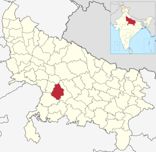
Kanpur Dehat district is a district in Uttar Pradesh state in northern India. The administrative headquarters of the district are at Mati-Akbarpur. This district is part of Kanpur division. Kanpur was formerly spelled Cawnpore.
Tilaunchi is a village in Kanpur Dehat district in the state of Uttar Pradesh, India.
Chaunrah is a village in Kanpur Dehat district in the state of Uttar Pradesh, India.
Derapur is a town in Kanpur Dehat district in the state of Uttar Pradesh, India. It is the headquarters of the Tehsil of the same name. Derapur is 61 km (38 mi) away from Kanpur city.
Mangalpur is a town and a gram panchayat in Kanpur Dehat district in the Indian state of Uttar Pradesh.
Rasulabad is both a tehsil and a town in the Kanpur Dehat district, Uttar Pradesh, India.
Sikandra Vidhan Sabha Constituency is a part of the Kanpur Dehat district of Uttar Pradesh and it comes under Etawah
Bhatauli is an Indian village of Kanpur Dehat district in Uttar Pradesh.It is an adjacent to city Rura, Kanpur Dehat District, Uttar Pradesh, India. Bhatauli is the commercial center of grain and vegetables. It is well known place for potatoes cold storage. Many primary schools are in govt. sector while many others in private (recognized). Saraswati Gyan Mandir Inter College is also here. Jog Mai is a center of faith. The Shiv Bajrang Dham Kishunpur is 200 metres (660 ft) away.
RSGU Post Graduate College is situated in the city of Pukhrayan, Kanpur Dehat district, Uttar Pradesh state, India. It is a Government Aides college and is affiliated to Chhatrapati Shahu Ji Maharaj University of Kanpur.

National Highway 19 is a national highway in India. It was previously referred to as Delhi–Kolkata Road and is one of the busiest national highways in India. After renumbering of national highways, Delhi to Agra route is now national highway 44 and Agra to Kolkata route is numbered national highway 19. It constitutes a major portion of the historical Grand Trunk Road. It is also part of AH1 of Asian Highway Network, that traverses from Japan to Turkey.
Durrajpur is a village situated at Kanpur Dehat district, Uttar Pradesh, India. The village is 7 km from the sub-district Sikandra and 32 km from sub-district Mati. This village is 90 km from the main city Kanpur. The population of this village is around 900.

