Kalpi

Last updated

Kalpi
Kalpriya
Chaurasi Gumbad 2.JPG
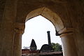
South facing view of Chaurasi Gumbad
India Uttar Pradesh location map.svg
Red pog.svg
Kalpi
India location map 3.png
Red pog.svg
Kalpi
Coordinates: 26°07′N79°44′E / 26.12°N 79.73°E / 26.12; 79.73
CountryIndia
State Uttar Pradesh
District Jalaun
Founded byVasu Dev
Government
  TypeMunicipality
  BodyNagar Palika Parishad
  ChairmanBaikunthi Devi
Elevation
112 m (367 ft)
Population
 (2011)
  Total51,670
Languages
  Official Hindi
Time zone UTC+5:30 (IST)
PIN
285204 [1]
Vehicle registration UP 92
Website up.gov.in
The historical Chaurasi Gumbad built during Lodhi Sultanate Chaurasi Gumbad..JPG
The historical Chaurasi Gumbad built during Lodhi Sultanate
The part of circular dome of Chaurasi Gumbad Part of circular dome of Chaurasi Gumbad..JPG
The part of circular dome of Chaurasi Gumbad

Kalpi is a historical city and municipal board in Jalaun district in Uttar Pradesh, India. It is on the right bank of the Yamuna. [2] Once Kalpi was more important Than Orai It is situated 78 kilometres south-west of Kanpur from which it is connected by both road and rail.

Contents

History

The ancient name of Kalpi was Kalapriya. [3]

Paleolithic

Lithics and fauna from the Middle Paleolithic of Kalpi have been described, aged at around 45,000 ka. These tools consist of diminutive quartzite choppers, possible manuports, cores, atypical points, scrapers, and debitage; bone tools include end-scrapers, points, notched tools, burins, and atypical end scrapers in greater abundance than their stone counterparts. They exhibit evidence of charring, suggesting fire usage. [4]

Medieval

In 1196, it fell to Qutb-ud-din Aibak, the viceroy of Mohammed Ghori, and during the subsequent Muslim period it played a significant part in the history of central India. In the early 16th-century Rajput king of Chittor Rana Sanga defeated Ibrahim Lodhi twice and establish his control over some parts of Uttar Pradesh including Kalpi and Chandawar and appointed Manik Chand Chauhan to rule there. [5] Rana Sanga also died in Kalpi in January 1528 poisoned by his own Nobles. [6] The city was then captured by the Mughals under Babur. During Akbar's reign, Kalpi was a governor's seat and had a mint for copper coinage. [2] The witty Raja Birbal of Akbar's court is considered to be born near this city. About the middle of the 18th century the city was lost by the Mughals and it passed into the hands of the Marathas. [2]

Modern

The town was captured by the British in 1803, and after 1806 remained in British possession [2] until India's independence in 1947. Kalpi was a part of Bundelkhand Agency, formed in 1811, and also housed its headquarters from 1818 to 1824. During this period the political agent to Governor General of India was appointed and headquartered in Kalpi. The British East India Company made it one of their principal stations for providing "commercial investment". [2] In May 1858 Hugh Rose (Lord Strathnairn) defeated here a force of Indian rebels led by the Rani of Jhansi. [2] The fortified post of Kalpi, the former residence of the rulers of Jalaun State, was dismantled in 1860 by the British and its place was taken by a market known as Whiteganj. [7] Tourist sites include Vyas temple, Lanka Meenar, 84 Gumbaj and many Dargah like Dargah of Meer Syed Mohammad Tirmizi, and Sufi Khanqah colled Khanqahe Muhammadia, Kalpi is also the birthplace of Ved Vyas ji. There is a Kali Haveli and Rang Mahal of Beerbal named Rang Mahal.

Geography

Kalpi is located at 26°07′N79°44′E / 26.12°N 79.73°E / 26.12; 79.73 . [8] It has an average elevation of 112 metres (367 feet).The climate in Kalpi is warm and temperate. The rainfall in Kalpi is significant, with precipitation even during the driest month. The temperature averages 25.9 °C. The average annual rainfall is 892 mm. [9]

Location

The old town, which is on the Yamuna river has the ruin of a fort, and several temples of interest, while in the neighborhood are many ancient tombs. [2] Away from the river to the south-east is a lofty modern town ornamented with representations of the battles of the Ramayana.

The Gaud Sarasawath Brahmin (GSB) community who are followers of Kashi Math Samsathan Varanasi has set up a temple of Shri Bala Veda Vyasa in memory of the great sage Veda Vyasa. In 1998 Sudhindra Thirtha, the swami of Kashi Math Samsthan, envisioned setting this temple right at the birthplace of Veda Vyasa. It is also a tourist attraction. [10] [11]

Economy

Kalpi is still a centre of local trade (principally in grain, ghee and cotton) with a station on the North Central Railway (India) line from Jhansi to Kanpur, which crosses the Yamuna here. [2] In late 1970s and early 1980s, Kalpi was one of the areas in central India affected by dacoits, and was frequented by the much dreaded Phoolan Devi gang. It has been declared an industrial belt by the Government of India and handmade paper is produced there.

Transport

Railways

Kalpi is a major Railway Station of Kanpur-Jhansi railway section of North Central Railway.

Kalpi Railway Station (Platform) Kalpi Railway Station (Plateform).JPG
Kalpi Railway Station (Platform)

Roadways

Kalpi lies on NH 27 on Kanpur-Jhansi section of National Highway. It is connected to cities of Kanpur, Jhansi and Orai by UPSRTC Buses at Kalpi bus station.

Airways

The nearest airport is at Kanpur near Chakeri (100 kilometres) which has direct flights to Delhi, Mumbai and Kolkata but is expected to be connected to major cities of India by 2021.

Related Research Articles

<span class="mw-page-title-main">Ajmer</span> City in Rajasthan, India

Ajmer is one of the major and oldest cities in the Indian state of Rajasthan and the centre of the eponymous Ajmer District. It is located at the centre of Rajasthan. It is also known as heart of Rajasthan. The city was established as "Ajayameru" by a Chahamana ruler, either Ajayaraja I or Ajayaraja II, and served as their capital until the 12th century CE.

<span class="mw-page-title-main">Gwalior</span> Metropolis in Madhya Pradesh, India

Gwalior is a major city in the central Indian state of Madhya Pradesh; it lies in northern part of Madhya Pradesh and is one of the Counter-magnet cities. Located 343 kilometres (213 mi) south of Delhi, the capital city of India, 120 kilometres (75 mi) from Agra and 414 kilometres (257 mi) from Bhopal, the state capital, Gwalior occupies a strategic location in the Gird region of India. The historic city and its fortress have been ruled by several historic Indian kingdoms. From the Kachchhapaghatas in the 10th century, Tomars in the 13th century, it was passed on to the Mughal Empire, then to the Maratha in 1754, and the Scindia Dynasty of Maratha Empire in the 18th century. In April 2021, It was found that Gwalior had the best air quality index amongst the 4 major cities in Madhya Pradesh.

<span class="mw-page-title-main">Agra</span> Metropolis in Uttar Pradesh, India

Agra is a city on the banks of the Yamuna river in the Indian state of Uttar Pradesh, about 230 kilometres (140 mi) south-east of the national capital Delhi and 330 km west of the state capital Lucknow. With a population of roughly 1.6 million, Agra is the fourth-most populous city in Uttar Pradesh and twenty-third most populous city in India.

<span class="mw-page-title-main">Jalgaon</span> City in Maharashtra, India

Jalgaon is a city in Maharashtra, India. The city is located in North Maharashtra in the subregion of Khandesh, and serves as the administrative headquarters of its namesake district, the Jalgaon district. The Girna river flows from the western part of the city. Jalgaon is colloquially known as the "Banana city of India" as the region's farmers grow approximately two-thirds of Maharashtra's banana production.

<span class="mw-page-title-main">Banda, Uttar Pradesh</span> City in India

Banda is a city and a municipal board in Banda district in the state of Uttar Pradesh, India. Banda is divided between north, east, west and south Banda. Banda lies south of the Yamuna river in the Bundelkhand region. It is the administrative headquarters of Banda District. The town is well connected to major cities with railways and state highways. The town is near the right bank of the river Ken, 189 km south-west of Allahabad.

<span class="mw-page-title-main">Jhansi</span> Metropolis in Uttar Pradesh, India

Jhansi is a historic city in the Indian state of Uttar Pradesh. Balwant Nagar was the old name of Jhansi. It lies in the region of Bundelkhand on the banks of the Pahuj River, in the extreme south of Uttar Pradesh. Jhansi is the administrative headquarters of Jhansi district and Jhansi division. Also called the Gateway to Bundelkhand, Jhansi is situated near and around the rivers Pahuj and Betwa at an average elevation of 285 m (935 ft). It is about 420 kilometres (261 mi) from national capital New Delhi and 315 kilometres (196 mi) from state capital Lucknow.

<span class="mw-page-title-main">Jalaun</span> City in Uttar Pradesh, India

Jalaun is a city and a municipal board in Jalaun district in the Indian state of Uttar Pradesh.

<span class="mw-page-title-main">Jalaun district</span> District of Uttar Pradesh in India

Jalaun district is a district of Uttar Pradesh, India. The district is named after the town of Jalaun, which was the former headquarters of a Maratha governor, but the administrative headquarters of the district is at Orai.

<span class="mw-page-title-main">Orai</span> City in Uttar Pradesh, India

Orai is a city in Uttar Pradesh, India, and the administrative headquarters of Jalaun District. All administrative offices of Jalaun District, including the District Collectorate, police, telecom and various other government organizations are located in this city. In 2019, Orai received the award of 'Fastest Mover' Small City among India under Swachh Survekshan, an annual cleanliness survey carried by the Quality Council of India.

<span class="mw-page-title-main">Kulpahar</span> City in Uttar Pradesh, India

Kulpahar is a city in Mahoba district in the Indian state of Uttar Pradesh. It is a historical town in the Bundelkhand region. Before 11 Feb 1995 Kulpahar was a Tehsil of Hamirpur District. On 11 Feb 1995 Mahoba District was carved out of Hamirpur, and Kulpahar is now a part of the Mahoba District. Kulpahar is the largest Subdivision of Uttar Pradesh. Kulpahar is known for its closeness to Khajuraho and other historic places like Mahoba, Charkhari, Kalinjar Rath, Orchha, and Jhansi. This town holds relics of temples and man-made water bodies of the Chandela Dynasty

Akbarpur is a town in Kanpur Dehat district in the state of Uttar Pradesh, India.

Konch is a city and a municipal board in Jalaun district in the Indian state of Uttar Pradesh.

Pukhrayan is a town and a Municipality in Amrodha Block in Kanpur Dehat district in the Indian state of Uttar Pradesh. Found to the south-west of Mati on National Highway 25, Pukhrayan is 2 km (1.2 mi) from Bhognipur.

<span class="mw-page-title-main">Benares State</span> Indian kingdom and later princely state (1740–1948)

Benares or Banaras State was a kingdom and later princely state in what is today Uttar Pradesh, India. On 15 October 1948, Benares' last ruler signed the accession to the Indian Union.

Rath is a small town with a municipal board in Hamirpur district in the Indian state of Uttar Pradesh. Rath is a Tehsil of Hamirpur District. It is situated 506 km southeast of New Delhi.

<span class="mw-page-title-main">Ramnagar Fort</span> Fortification near the Ganga River in Varanasi, India

The Ramnagar Fort is a fortification in Ramnagar, Varanasi, India. It is located near the Ganges on its eastern bank, opposite to the Tulsi Ghat. The sandstone structure was built in the Rajputana style in 1750 by Kashi Naresh Maharaja Balwant Singh. The current king and the resident of the fort is Anant Narayan Singh, who is also known as the Maharaja of Benares even though this royal title has been abolished since 1971.

<span class="mw-page-title-main">Tourism in Uttar Pradesh</span> Overview of tourism in the Indian state of Uttar Pradesh

Situated in the northern part of India, bordering with the capital of India New Delhi, Uttar Pradesh is one of the most popular and an established tourist destination for both Indians and non-Indians alike in India. The most populous state of India, Uttar Pradesh contains many historical monuments and places of religious significance. Geographically, Uttar Pradesh is very diverse, with Himalayan foothills in the extreme north and the Gangetic Plain in the centre. It is also home of India's most visited sites, Hinduism's holiest city, Varanasi. Kumbh city, Prayagraj. Kathak, one of the eight forms of Indian classical dances, originated from Uttar Pradesh. Uttar Pradesh is at the heart of India, hence it is also known as The Heartland of India. Cuisine of Uttar Pradesh like Awadhi cuisine, Mughlai cuisine and Bhojpuri cuisine are very famous not only in India but also many places abroad.

<span class="mw-page-title-main">Architecture of Uttar Pradesh</span> Overview of the architecture of Uttar Pradesh

The architecture of Uttar Pradesh demonstrates a diverse and eclectic combination of Buddhist, Hindu, Indo-Islamic, and Indo-European architectural styles. Three of its architectural monuments—the Taj Mahal, the Agra Fort, as well as the township of Fatehpur Sikri founded by the Mughal emperor Akbar—are designated UNESCO World Heritage Sites. The architectural structures in Uttar Pradesh include ancient Buddhist stūpas and vihāras, ancient Buddhist and Hindu monasteries, townships, forts, palaces, temples, mosques, mausoleums, memorials, and other community structures. Uttar Pradesh's architectural structures also include various Hindu temples, Ghats, etc. largely found in ancient cities like Benares (Varanasi), Brindaban (Vrindavan), Mathura, and Prayagraj (Allahabad).

<span class="mw-page-title-main">Kapal Mochan</span> Religious site in Haryana, India

Kapal Mochan is an ancient place of pilgrimage for both Hindus and Sikhs, 17 km north-east of Yamunanagar city-Jagadhari town, on the Bilaspur road in Yamunanagar district, Haryana, India. It is also called Gopal Mochan and Somsar Mochan. As per Legend, Brāhmanahatya i.e. killing of Brahmin is considered as a major sin, but one who kills a Brahmin and bath here, his Brāhmanahatya sins will be washed. Nearby Bilaspur, Haryana in Yamuna Nagar District which takes its name from the corrupted form of "Vyas Puri", was the ashram of Ved Vyasa rishi where he wrote the Mahabharta on the banks of Sarasvati river near Adi Badri where Sarasvati river leaves Himalayas and enters the plains.

Ait is a small town located in Jalaun district of Uttar Pradesh.

References

  1. "Kalpi Pincode 285204 STD code 05164".
  2. 1 2 3 4 5 6 7 8 Chisholm, Hugh, ed. (1911). "Kalpi"  . Encyclopædia Britannica . Vol. 15 (11th ed.). Cambridge University Press. p. 644.
  3. A.M. Shastri (1969). India as Seen in the Bṛhatsaṁhitā of Varāhamihira. Motilal Banarsidass. p. 15. ISBN   9780896842212.
  4. Chauhan, Parth R. (2008). "Large mammal fossil occurrences and associated archaeological evidence in Pleistocene contexts of peninsular India and Sri Lanka". Quaternary International. 192 (1): 20–42. doi:10.1016/j.quaint.2007.06.034.
  5. Gopinath Sharma 1954, p. 27.
  6. Gopinath Sharma 1954, p. 44.
  7. Great Britain India Office. The Imperial Gazetteer of India . Oxford: Clarendon Press, 1908.
  8. "Maps, Weather, and Airports for Kalpi, India". Fallingrain.com. Retrieved 31 January 2019.
  9. "Kalpi climate: Average Temperature, weather by month, Kalpi weather averages - Climate-Data.org". En.climate-data.org. Retrieved 31 January 2019.
  10. "कालपी -महर्षि वेद व्यास मंदिर. Maharashi Ved Vyaas birth place Mandir, Kalpi, UP. Vision TV World". YouTube .
  11. "He kindled wisdom and benevolence". 18 January 2016.

Bibliography