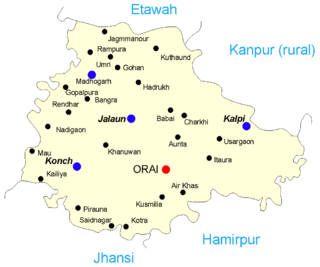
Jalaun is a city and a municipal board in Jalaun district in the Indian state of Uttar Pradesh.

Jalaun district is a district of Uttar Pradesh, India. The district is named after the town of Jalaun, which was the former headquarters of a Maratha governor, but the administrative headquarters of the district is at Orai.

Lansdowne is a cantonment town in Pauri Garhwal is a district in the Indian state of Uttarakhand.
Bakewar is a town and a nagar panchayat in Etawah district in the state of Uttar Pradesh, India. It is 22 km from district headquarters Etawah. Bakewar is famous for its very good education system, Agriculture Training Institute and for National highway no. 2. Bakewar is situated at national highway no. 2. It is between Agra and Kanpur, the two biggest cities of Uttar Pradesh. Agra is 145 km north and Kanpur is 135 km on south of Bakewar. Bharthana is the nearest railway (11 km) of Bakewar, situated in the east.
Hirekeruru is a panchayat town in Haveri district in the Indian state of Karnataka. The name "the village of the big pond". The name is pronounced as "Hee ray kay roor".
Khadda is a town, a Nagar panchayat and a Tehsil in Kushinagar district in the Indian state of Uttar Pradesh. It is situated approximately 8 km from the border of Bihar and 18 km from the India-Nepal border.
Konch is a city and a municipal board in Jalaun district in the Indian state of Uttar Pradesh.
Kukshi is a town in Dhar district of Madhya Pradesh state, India. Kukshi has population of around 37,482 making it a Tier-3 city and a Semi-Urban centre. It is a Nagar Parishad. Kukshi is famous for the business of cotton, mirchi, gold and silver, and ready made garments.
Madhogarh is a town and a nagar panchayat in Jalaun district in the Indian state of Uttar Pradesh. Madhogarh is famous for ghee.

Mauganj is the 53rd district in the Indian state of Madhya Pradesh. Bagheli is the regional language of Mauganj. Mauganj is the seat of legislative assembly in Madhya Pradesh. Its nearest towns are Manikwar, Hanumana, Deotalab, Naigadhi.

Musafirkhana is a town and tehsil in Amethi district in Indian state of Uttar Pradesh. The word "Musafirkhana" means "Sarai," or "Dharamshala". Musafirkhana is located 32 km northwest of Amethi, 20 km from Jagdishpur. Gauriganj and Amethi are accessible from Musafirkhana via roadways; the nearest railway station is the Musafirkhana railway station on the Lucknow–Varanasi rail route via Sultanpur, and the nearest airport is the Amausi airport. It is surrounded by more than 100 villages. The town is between 26.37° north latitude and 81.8° east longitude at a height of 102 metres (434 feet) above mean sea level.
Pathardi is a town and a municipal council in Ahmednagar district in the Indian state of Maharashtra.
Rehli is a city and a municipality in Sagar district in the Indian state of Madhya Pradesh.
Rura is a Nagar Panchayat in Kanpur Dehat District in Uttar Pradesh state of the India. The town is situated on the banks of Lower Ganga canal. The district headquarters is 15 km away at Mati. The town is located at a distance of 49 km from famous industrial and educational hub of Kanpur Nagar.
Valasaravakkam is a neighbourhood in the Chennai district of the Indian state of Tamil Nadu and a residential suburb of the city of Chennai. It is located in the Maduravoyal Taluk at a distance of approximately 15 kilometres from the Kilometer Zero stone. Valasaravakkam lies on the Arcot Road, one of Chennai's arterial roads. It is under the Maduravoyal election constituency. In October, 2011 Valasaravakkam Municipality ceased to exist and the area became part of Chennai Corporation as Ward Nos 149 and 152, Southern Region, Corporation of Chennai. As of 2011, the town had a population of 47,378. Famous Sivan temple is in Kesavardhini.
Daulatpur Chowk is a Nagar Panchayat in Tehsil Ghanari of Una district in the State of Himachal Pradesh, India. Daulatpur Chowk is also connected through Railway line which comes from Una Himachal. Railway station of Daulatpur chowk is situated in the nearby village Chalet which is approximately 2 km from Bus Stand.
Chandur is a census town and Municipality and it is a Mandal Headquarters of Chandur Mandal in Nalgonda district & in the state of Telangana, India. It is located in Chandur mandal of Nalgonda division Postal code or Pin code: 508255. A beautiful and peaceful town. There are various legends about the etymology of the name one of the folklore says Chandi uuru as there is a famous Chandi maata temple of which the deity resembles to the goddess Durga of Vijayawada and is said to be commenced at the same time of the famous temple.
Antu is a town and a nagar panchayat in the Community Development Block Sandwa Chandrika, Pratapgarh Teshil, Pratapgarh district in the state of Uttar Pradesh, India, located 20.6 km northwest of the district administrative headquarter Bela Pratapgarh and 4.7 km northeast of Sandwa Chandrika. The territory of the town has 2 square kilometers. It is divided into 10 wards. The postal Zip Code is 230501.
Manasa is a town with nagar palika in Neemuch district in the Indian state of Madhya Pradesh. It was under the princely state of Holker before Indian independence.
Alampur is a town and a nagar panchayat in Bhind district in the Indian state of Madhya Pradesh. Alampur is known for its history, for the chhatri of Malhar Rao Holkar which is in Alampur.