Chaunrah

Last updated

Chaunrah
village
India Uttar Pradesh location map.svg
Red pog.svg
Chaunrah
Location in Uttar Pradesh, India
India location map.svg
Red pog.svg
Chaunrah
Chaunrah (India)
Coordinates: 26°9′55″N79°46′56″E / 26.16528°N 79.78222°E / 26.16528; 79.78222 Coordinates: 26°9′55″N79°46′56″E / 26.16528°N 79.78222°E / 26.16528; 79.78222
CountryFlag of India.svg  India
State Uttar Pradesh
District Kanpur Dehat
Languages
  Official Hindi
Time zone IST (UTC+5:30)
Vehicle registration UP-
Coastline 0 kilometres (0 mi)
Website up.gov.in

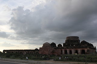
Chaunrah is a village in Kanpur Dehat district in the state of Uttar Pradesh, India.

Kanpur Dehat district District of Uttar Pradesh in India

Kanpur Dehat district is a district of Uttar Pradesh state in northern India. The administrative headquarters of the district are at Mati-Akbarpur. This district is part of Kanpur division.

Uttar Pradesh State in northern India

Uttar Pradesh is a state northern India. It is the most populous state in the Republic of India as well as the most populous country subdivision in the world. It is located in the north-central region of the Indian subcontinent, has over 200 million inhabitants. It was created on 1 April 1937 as the United Provinces of Agra and Oudh during British rule, and was renamed Uttar Pradesh in 1950. The state is divided into 18 divisions and 75 districts with the capital being Lucknow. The main ethnic group is the Hindavi people, forming the demographic plurality. On 9 November 2000, a new state, Uttarakhand, was carved out from the state's Himalayan hill region. The two major rivers of the state, the Ganga and Yamuna, join at Allahabad (Prayagraj) and then flow as the Ganges further east. Hindi is the most widely spoken language and is also the official language of the state.

India Country in South Asia

India, also known as the Republic of India, is a country in South Asia. It is the seventh largest country by area and with more than 1.3 billion people, it is the second most populous country as well as the most populous democracy in the world. Bounded by the Indian Ocean on the south, the Arabian Sea on the southwest, and the Bay of Bengal on the southeast, it shares land borders with Pakistan to the west; China, Nepal, and Bhutan to the northeast; and Bangladesh and Myanmar to the east. In the Indian Ocean, India is in the vicinity of Sri Lanka and the Maldives, while its Andaman and Nicobar Islands share a maritime border with Thailand and Indonesia.

It is located in Amraudha development block of Bhognipur tehsil.

Amraudha Town in Uttar Pradesh, India

Amraudha is a town and a nagar panchayat in Kanpur Dehat district in the state of Uttar Pradesh, India. It is a Development block in Bhognipur tehsil.

Bhognipur city in Uttar Pradesh, India

Bhognipur is a town in Kanpur Dehat district in the Indian state of Uttar Pradesh. It is the headquarters of the Tehsil of the same name and consists of the Amraudha and Malasa Development Blocks

Transport

Chaunrah Railway Station is on the railway line connecting Jhansi with Kanpur. Jhansi-Lucknow Passenger and Jhansi-Kanpur Passenger are among the main trains that pass through this station. To the south-west is Kalpi Railway Station (5 km), the nearest station. Going north, Pukhrayan Railway Station (9 km) is the station next to Chaunrah. Kanpur Central Railway Station is The nearest major railway station. The Station Code is: CNH

Pukhrayan town in Uttar Pradesh, India

Pukhrayan is a town and a Municipality in Kanpur Dehat district in the Indian state of Uttar Pradesh. Found to the south-west of Mati on National Highway 25, Pukhrayan is 4 km from Bhognipur.


Geography

Chaunrah is located at 26°9′55″N79°46′56″E / 26.16528°N 79.78222°E / 26.16528; 79.78222 .


Related Research Articles

Kalpi Town in Uttar Pradesh, India

Kalpi is a town and a municipal board in Jalaun district in the Indian state of Uttar Pradesh. It is on the right bank of the Yamuna. It is situated 78 kilometre south-west of Kanpur from which it is connected by both road and rail.

Jalaun district District of Uttar Pradesh in India

Jalaun district is a district of Uttar Pradesh state of India.

Chirgaon Town in Uttar Pradesh, India

Chirgaon is a town and a municipal board in Jhansi district in the Indian state of Uttar Pradesh, India.

Dibiyapur City in Uttar Pradesh, India

Dibiyapur is in Auraiya district in the most populous state of Uttar Pradesh in India. It is situated on State Highway 21. It is linked to Phaphund railway station on Kanpur-Delhi section of Howrah-Delhi main line which is operated by North Central Railway. The district administrative headquarter of the town is Auraiya.

Rura city in Uttar Pradesh, India

Rura is an adarsh town and a Nagar Panchayat in Kanpur Dehat District in Uttar Pradesh state of the India. The town is situated on the banks of Lower Ganga canal. It is a major town in the Kanpur Dehat. Bhatauli is adjacent to Rura city which is known as Bhatauli-Rura town.The nearby cities are Kanpur (44 km) towards the east and Etawah (96 km) towards the west. The district headquarters is nearly 15 km away at Akbarpur-Mati. It comes under Kanpur Metropolitan Area.

Kanpur Central railway station

Kanpur Central or Cawnpore North Barracks(CNB) is a railway station located in the city of Kanpur and is one of the five central Indian railway stations. It is the busiest Indian Railways station in terms of passengers, recording more than 2.3 million passengers per day, and is the second-busiest railway station in India in terms of frequency of trains, with around 611 trains passing through daily. The station is a major intercity rail and commuter rail station in the region. More than 1580 stations are directly connected to it, the highest number of connections to a single station in the country. As so, it is the most profitable railway station in India.

Bhaupur human settlement in India

Bhaupur is a town in Kanpur Dehat district in the state of Uttar Pradesh, India.World Bank Funding Develop Bhaupur Industrial Sector UPSIDC Ludhiyana Kolkata Dedicated Coridore

Rasulpur Gogumau village in Uttar Pradesh, India

Rasulpur Gogumau is a town in Kanpur Dehat district in the state of Uttar Pradesh, India.

Paman, Kanpur Dehat village in Uttar Pradesh, India

Paman is a village in Kanpur Dehat district in the state of Uttar Pradesh, India.

Tilaunchi is a village in Kanpur Dehat district in the state of Uttar Pradesh, India.

Lalpur, Kanpur Dehat village in Uttar Pradesh, India

Lalpur is a village in Kanpur Dehat district in the state of Uttar Pradesh, India.

Ambiyapur Village in Uttar Pradesh, India

Ambiyapur is a village in Kanpur Dehat district in the state of Uttar Pradesh, India.

Parjani town in Uttar Pradesh, India

Parjani is a town in Kanpur Dehat district in the state of Uttar Pradesh, India.

Binaur town in Uttar Pradesh, India

Binaur is a town in Kanpur district in the state of Uttar Pradesh, India.

Kanpur Bridge Left Bank railway station

Kanpur Bridge Left Bank is a small railway station in Shuklaganj, in the Unnao district of Uttar Pradesh, India. It lies on the Kanpur–Lucknow line. It comes after the Ganges bridge has been crossed. Only a few trains such as LKM [Lucknow-Kanpur-Memo], a type of local train halts for only 1 or 2 minutes or some express train halts for some special reason or has to be given a pass.

Jhansi Junction railway station

Jhansi Junction is a major railway junction in the city of Jhansi in Bundelkhand region of Uttar Pradesh. It is one of the busiest and largest railway stations in India. It is a major intercity hub and a technical stoppage for many superfast trains in India. Jhansi has its own division in the North Central Railway zone of Indian Railways. It lies on the main Delhi-Chennai and Delhi-Mumbai line. The station code is JHS. The Station Director is Girish Kanchan. Vivaan Solar, a Gwalior based company has won contract to install a total of 1.5 MW rooftop solar power project at the wagon repair workshop of Jhansi Junction railway station. The company will install rooftop solar panels on production sheds and service buildings of the complex.

Khajuraho railway station

Khajuraho railway station is located in Chhatarpur district of Madhya Pradesh and serves as an entry point for the Khajuraho Group of Monuments, medieval Hindu famous for their erotic sculptures. Between 950 and 1150, the Chandela monarchs built these temples.

Ait is a small town located in Orai of Jalaun district, Uttar Pradesh. It is located 23 km from Orai city and 90 km from city of Jhansi. Pin- 285201

Ait railway station

Ait railway station is a small railway station located in Jalaun, Konch in the Indian state of Uttar Pradesh. Nearby major railway station is Jhansi Jn and the airport is Gwalior Airport. It belongs to North Central, Jhansi Jn.