Sonbhadra or Sonanchal is the second largest district by area of Uttar Pradesh after Lakhimpur Kheri. The district headquarters is in the town of Robertsganj. Sonbhadra is also known as the "Energy Capital of India" for hosting multiple power plants.

Ballia is a city with a municipal board in the Indian state of Uttar Pradesh. The eastern boundary of the city lies at the junction of two major rivers, the Ganges and the Ghaghara. The city is situated 140 km (87 mi) east of Varanasi and about 380 km from the state capital Lucknow. It is home to a protected area, the Jai Prakash Narayan bird sanctuary. Ballia is around 4 km (2.5 mi) from Bihar.

Chandauli district is a district of Uttar Pradesh state of India, and Chandauli town is the district headquarters. Chandauli district, a part of Varanasi Division, became a separate district on 20 May 1997.

Varanasi district is a district in the Indian state of Uttar Pradesh, with the holy city of Varanasi as the district headquarters. It is also the headquarters of the Varanasi division which contains 4 districts.

Bhadohi district is a district of Uttar Pradesh state in northern India. It is also referred to as Sant Ravidas Nagar. It is the smallest district by area in the state of Uttar Pradesh which was created on June 30, 1994 by dividing western part of the district Varanasi. It is surrounded by Varanasi district on east, Allahabad on west, Jaunpur north and Mirzapur district in south. The state capital Lucknow is distanced at 234 KM from Bhadohi. Its district headquarters is situated in the city of Gyanpur. The district is popularly known for carpet weaving as it is one of largest centres of Carpet Industries in India and therefore it also known as the 'Carpet City of India'. Carpets of Bhadohi have 'Geographical Indication' tag attached to it. Bhadohi has huge geographical significance and position attached to it due to its location between two culturally important and rich heritage cities of Prayagraj and Varanasi.

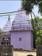
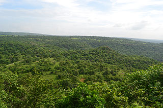
Mirzapur district is one of the 75 districts in the Indian state of Uttar Pradesh. The district is bounded on the north by Bhadohi and Varanasi districts, on the east by Chandauli district, on the south by Sonbhadra district and on the northwest by Prayagraj. The district occupies an area of 4521 km2. Mirzapur city is the district headquarters. Mirzapur district is a part of Mirzapur division. This district is known for the Vindhyavasini temple in Vindhyachal and several tourist attractions like waterfalls like Rajdari and Devdari and dams. It consist of several Ghats where historical sculptures are still present. During the Ganges festival these Ghats are decorated with lights and earthen lamps.

Indian breads are a wide variety of flatbreads and crêpes which are an integral part of Indian cuisine. Their variation reflects the diversity of Indian culture and food habits.

Robertsganj also known as Sonbhadra City is a city and a municipal board in Sonbhadra district in the Indian state of Uttar Pradesh.
Pharenda, or Anandnagar, is a city in the Maharajganj district of the province of Uttar Pradesh in northern India. It is located approximately 44 kilometres north of Gorakhpur near the border with Nepal. District of Pharenda is Maharajganj. This is situated on the Buddhist Circuit which is built from Sarnath to Lumbini. It lies on NH-24 and near NH 29. It is about 45 km from Gorakhpur, 40 km from Siddharthnagar, 30 km from Maharajganj and 55 km from Sonauli Indo-Nepal border. This place is named after Seth Anandram Jaypuriya. There is closed sugar Mill which was started in about 1935 and closed in 1995. Near Anand Nagar there is a temple is Durga devi mandir, popularly known as Lehara Devi mandir.
Karhal is a town and Nagar Panchayat in Mainpuri district in the Indian state of Uttar Pradesh. It is also a tehsil that is subdivided into two blocks, Karhal and Barnahal. It is one of the Vidhan Sabha constituency of Uttar Pradesh.

Musafirkhana is a town and tehsil in Amethi district in Indian state of Uttar Pradesh. The word "Musafirkhana" means "Sarai," or "Dharamshala". Musafirkhana is located 32 km northwest of district headquarters Amethi.
Saiyad Raja is a town and a nagar panchayat in Chandauli district in the Indian state of Uttar Pradesh. It is 12 km from the district headquarters at Chandauli. This town also happens to be the last town on U.P Bihar G.T Road border. National Highway 97 terminates at Saiyedraja. Nearest airport is Varanasi Airport.
Shankargarh is a town and a nagar panchayat in Prayagraj district in the Indian state of Uttar Pradesh.It Is Also Known As Kasauta Shankargarh.
Chakia is a small town and the sub-divisional headquarters of Chakia Tehsil in the District of Chandauli of Varanasi Division in the northern Indian state of Uttar Pradesh.
Mughalsarai, officially known as Pandit Deen Dayal Upadhyaya Nagar, is a city and a municipal board in the Chandauli district of Uttar Pradesh. Located around 16 kilometres from Varanasi, it is an important railway junction.
Bahorwa or Banspar Bahorwa is a village situated in the Belthara Road tehsil, district Ballia, and division Azamgarh, Uttar Pradesh India.
Bhimapar is a village and a Gram panchayat in Ghazipur district of Uttar Pradesh, India. Bhimapar is a developing and new face town. It is 57 km from Varanasi and 57 km from Ghazipur.

Dhanapur is a block of Chandauli district in Uttar Pradesh in India. It falls under Sakaldiha tehsil region. Dhanapur village is the block headquarters. It is 42 km away from Varanasi. It is well-connected to nearby towns and cities by a network of roads. It is situated within the fertile plains of the region, benefiting from its proximity to the Ganges River basin. This block has total 84 gram panchayat.
Bhadon is a village and Gram Panchayat located in Martinganj tehsil of the Azamgarh District in the Indian state of Uttar Pradesh, near the border with Jaunpur District. It is 37.7 kilometres (23.4 mi) north-east of the district headquarters in Azamgarh and 229.9 kilometres (142.9 mi) from the state capital of Lucknow.

Bisauri is a village of the Jaunpur district, Uttar Pradesh, Northern India. Bisauri's Postal Index Number is 222129 and its post office is at Patrahi. The village is also a Gram Panchayat, comprising itself and the village of Tiwaripur.