Related Research Articles

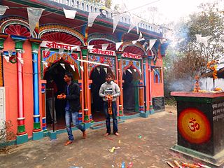
Gorakhpur is a city in the Indian state of Uttar Pradesh, along the banks of the Rapti river in the Purvanchal region. It is situated 272 kilometers east of the state capital Lucknow. It is the administrative headquarters of Gorakhpur district, North Eastern Railway Zone and Gorakhpur division. The city is home to the Gorakhnath Math, a Gorakhnath temple. The city also has an Indian Air Force station, since 1963. Gita Press, the world's largest publisher of Hindu religious texts like Ramayana and Mahabharat is also located in Gorakhpur which was established here in 1926.
Malshiras is a town and the headquarters of Malshiras taluka in Solapur district of Maharashtra state in western India. Its governing body is promoted to Nagar Panchayat from a Gram Panchayat in 2017. There are many popular towns in Malshiras taluka such as Akluj, Natepute, Mahalung, Malinagar, Velapur and popular Villages like Goradwadi, Bhamburdi, Medad and Palasmandal.
Basti district is one of the districts of Uttar Pradesh state, India, and a part of Basti Division. Basti city is the district headquarters.

Deoria district, one of the districts of eastern Uttar Pradesh, India has its headquarters located at Deoria and is a part of Gorakhpur division. It came into existence on 16 March 1946 from Gorakhpur district.
Maharajganj district is one of the 75 districts of Uttar Pradesh state in northern India, and the town of Maharajganj is the district headquarters. District is a part Gorakhpur division. It is located in Terai regions of Himalayas, bordering Nepal in North.

Sitapur district is one of the districts which is situated in Uttar Pradesh state of India, with Sitapur town as the district headquarters. Sitapur district is a part of Lucknow division. In Education Sector there are many good Schools and Institutes are giving their best education to students like Sacred Heart School, British Foundation etc.

Bhadohi district is a district of Uttar Pradesh state in northern India. The city of Gyanpur is the district headquarters. Bhadohi is one of largest centres of Carpet Industries in India and known as 'Carpet City'. Carpets of Bhadohi have 'Geographical Indication' tag attached to it. Bhadohi has huge geographical significance and position attached to it due to its location between two culturally important and rich heritage cities of Prayagraj and Varanasi.
Charkhi Dadri is a city and headquarters of Charkhi Dadri district in the state of Haryana located in southern Haryana, India, about 90 km from the national capital Delhi. The town was made by joining the villages of Charkhi and Dadri after urban development. Charkhi Dadri is on NH 148B between Narnaul to Bathinda and NH 348B between Meerut to Pilani segment passing through the city.

Gorakhpur district is one of the 75 districts of Uttar Pradesh state in northern India. This district is a part of the Gorakhpur division. The city of Gorakhpur, or Gorakhpur is the administrative headquarters of this district and Gorakhpur division. It borders Sant Kabir Nagar district to the west, Kushinagar and Deoria districts to the east, and Maharajganj and Azamgarh districts to the north and south.
Udgir, is second largest city and municipal council in Latur district of the Indian state of Maharashtra. It is located in the Marathwada division of the state. The city is located very close to the borders of Karnataka and Telangana states. Udgir is home to the historical Udgir Fort. The town and nearby villages rely mainly on agriculture, which serves as a major source of income for the population.
Ahmednagar district is the largest district of Maharashtra state in western India. The historical Ahmednagar city is the headquarters of the district. Ahmednagar and Sangamner are largest cities in the district. Ahmednagar was the seat of the Ahmednagar Sultanate of late medieval period. This district is known for the towns of Shirdi associated with Sai Baba, Meherabad associated with Meher Baba, Shani Shinganapur with Shanidev, and Devgad with Lord Dattatreya. Ahmednagar district is part of Nashik Division. The district is bordered by Aurangabad district to the northeast, Nashik district to the northwest, Thane and Pune districts to the southwest, Solapur district to the south and Beed district to the southeast.
Bisalpur is a City and a municipal board situated nearby Pilibhit City in the Pilibhit district of the state of Uttar Pradesh, India. The town is known for its sugar factory as well as its annual Ram Leela and Dushera festival. Bisalpur is in between the two rivers, in West Doha river and in East katna river. Before formation of new District Pilibhit, Bisalpur was under the District Bareilly. In 1913 AD after formation of new District Pilibhit, Bisalpur has come under District Pilibhit Administration. this city is well connected with 03 major cities. Bisalpur is just 290 km away from National capital New Delhi and 250 km from the state capital Lucknow. Bisalpur is famous for Annual Ramleela Fest, Dubey Taalab, Guleshwarnath Temple ,Dargah Hazrat Gazi kamaal Degree college and Nagaich Market., Bisalpur is known for many things and places and people of Bisalpur have contributed in various fields one such example is Freedom fight Raees Mohammad who was a Freedom fighter and a military man resident of mohalla gayaspur he have won many medals for his extraordinary work he did for the country. he is well known for his charm and Character he played in the public domain now his generation resides in the Bisalpur mohalla gyaspur.. Another important place is its railway station which has been modified for the broadgauge .This will really help to get well connected with different cities of india.
Biswan is a town and a municipal board in Sitapur district in the state of Uttar Pradesh, India.
Hargaon is a town and a nagar panchayat in Sitapur district in the Indian state of Uttar Pradesh.
Khadda is a town, a Nagar panchayat and a Tehsil in Kushinagar district in the Indian state of Uttar Pradesh. It is situated approximately 8 km from the border of Bihar and 18 km from the India-Nepal border.
Akbarpur is a city, municipal corporation, tehsil, and the administrative headquarters of Ambedkar Nagar district in the state of Uttar Pradesh, India. It is a part of Ayodhya division.

Athani is a town in the Belagavi district of Karnataka, India. It is 140 kilometers from the city of Belagavi, 70 kilometers from Vijayapura, 55 kilometers from Miraj, 100 kilometers from Kolhapur, and 624 kilometers from Bengaluru.

Dabra is town and a municipality in Gwalior district in the state of Madhya Pradesh, India located near NH-44 national highway. It serves the headquarters for both a tehsil and a coterminous community development block.
Shuklapuri or Shukul Puri is a village and gram panchayat in Barhalganj, Gorakhpur district, Uttar Pradesh, India. It has a post office with pin code 273402.

Narajole is a village and gram panchayat in Daspur I CD Block in Ghatal subdivision of Paschim Medinipur district in the state of West Bengal, India.
References
Report of Tour in the Gorakhpur District in 1875-76 and 1876-77, Vol. XVIII
| | This Gorakhpur district location article is a stub. You can help Wikipedia by expanding it. |