
The Gorakhnath Math is a temple of the Nath monastic order group of the Nath tradition. The name Gorakhnath derives from the medieval saint, Gorakshanath, a yogi who travelled widely across India and authored a number of texts that form a part of the canon of Nath Sampradaya. The Nath tradition was founded by guru Matsyendranath. This math is situated in Gorakhpur, Uttar Pradesh within large premises. The temple performs various cultural and social activities and serves as the cultural hub of the city.
Basti district is one of the districts of Uttar Pradesh state, India, and a part of Basti Division. Basti town is the district headquarters. In the freedom struggle of 1857, about 250 martyrs of Amorha State were hanged by the British Government from peepal trees located at Chhawani.
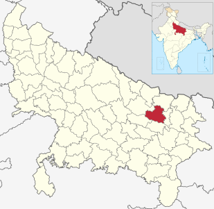
Maharajganj district is one of the 75 districts of Uttar Pradesh state in northern India, and the town of Maharajganj is the district headquarter. District is a part Gorakhpur division. It is located in Terai regions of Himalayas, bordering Nepal in North.

Anandnagar is a city and a nagar panchayat in Maharajganj district in the state of Uttar Pradesh, India. It is situated near NH 29. It is about 45 km from Gorakhpur, 40 km from Siddharthnagar, 30 km from Maharajganj and 55 km from Sonauli Indo-Nepal Border. This place is named after Seth Anandram Jaypuriya. There is closed sugar Mill which was started in about 1935 and closed in 1995. Near Anand Nagar there is a temple is Durga devi mandir, popularly known as Lehara Devi mandir.
Pharenda, is a small city in the province of Uttar Pradesh in northern India. It is located approximately 44 kilometres north of Gorakhpur near the border with Nepal. District of Pharenda is Maharajganj. This is situated on the Buddhist Circuit which is built from Sarnath to Lumbini .It lies on NH-24
Hata is a town having 25 wards and a Nagarpalika in Kushinagar district in the Indian state of Uttar Pradesh. It is situated 36 km away from Gorakhpur in east. It is a major town of Kushinagar district situated on NH -28. Nearest railway station is Gauri Bajar, which is 17 km away from the town and the next major market of Kaptanganj is located 23 km away from it. The gram panchayat of Dhadha Bujurg is located 3 km west from the town. Hata is the main market for wholesaler, local vendors & retailers.

Nawabganj is a Nagar palika and an administrative subdivision of Bareilly district in the Indian state of Uttar Pradesh. A Sub Divisional Magistrate (SDM), also called Sub Divisional Officer (SDO), or pargana-adhikari is the head official.

Kanpur Dehat district is a district of Uttar Pradesh state in northern India. The administrative headquarters of the district are at Mati-Akbarpur. This district is part of Kanpur division.
Ashta Bhuja Prasad Shukla was a B.J.P. member of the Lok Sabha from Khalilabad Uttar Pradesh, India. His father's name was Kapil Dev Shukla. Born on 20 December 1955 in the village of Katarsoyam in Basti district (U.P.) received his preliminary education in village Nauerdeur, Gorakhpur at his maternal uncle place his maternal uncle Rajdeo Pandey was Gram pradhan of village which has aformidale influence of polity on his young mind.He got married in June, 1978 to Smt. Savitri Shukla and has one son and three daughters.
Reotipur is a village located in the Ghazipur district of Uttar Pradesh, India. Reotipur is a large village located in Sewarai tehsil of Ghazipur district, Uttar Pradesh with total 3457 families residing. The Reotipur village has population of 26597(2011 population census). This village is very old, believed to be established somewhere around 14th century.
Belwania is a small village situated between Padrauna and Chhitauni on the National Highway 28B in the Kushinagar District of Uttar Pradesh State in India. It is under the Gram Panchayat of Dargauli and the current Gram Pradhan of the Dargauli Gram Panchayat is Mr. Phul Badan 'Saroj'. The village is situated almost on the border of Uttar Pradesh and Bihar.
Terha is a village and gram panchayat in Unnao district, Uttar Pradesh, India. Baba Bankhandeswer temple is in this village. Hublal Inter College, Durga Mandir, Bajaj Interprises, Verma Machinery Store, BAJAJ KIRANA STORE, Bank Of India, Saraswti Vidya Mandir and Mahavir Prasad Vidyarthi Smarak Siksha Niketan are schools in Terha.
Suhwal is a village in Ghazipur District under Reotipur block. It is situated on Ghazipur to Buxar Road 8 km from Ghazipur City. It has population of 10814 as per 2011 Census. The Village is quite old. It has its own local administration under Panchayati Raj system, with Gram Pradhan as head of local administration. There are two Government Secondary Schools, 3 Governments Primary Schools and few other privately run Schools. There is a small permanent Market in western Side of Village and also a weekly Market.The Village is a center of Shopping and Primary Education for other many small Villages situated on its fringe.
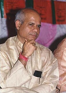
Shiv Pratap Shukla is an Indian politician and was the Minister of State for Finance in the First Modi ministry. He is Member of Parliament in the upper house of the Indian Parliament. He represents the state of Uttar Pradesh. He was appointed Vice President of the Bharatiya Janata Party (BJP), Uttar Pradesh in February 2012 under the presidency of Surya Pratap Shahi. He is known for his work during his tenure as the Cabinet Minister in the state of Uttar Pradesh, when he initiated an Education for all scheme which tied together ten districts for the first time and for his efforts to reform conditions for prisoners, and various Rural Development Schemes.
Amorha Khas is a gram panchayat in Basti district in the Indian state of Uttar Pradesh. In the freedom struggle of 1857, about 250 martyrs of Amorha State were hanged by the British Government from peepal trees located at Chhawani.
Chhawani is a historic place near Amorha in Basti district in the Indian state of Uttar Pradesh. it is also known as a place of freedom struggle of Raja Zalim Singh's State Amorha.
Dhanauli Rampur is a village located in Ghosi tehsil of Mau district, Uttar Pradesh. It has total 530 families residing. Dhanauli Rampur has population of 3,452 as per government records.

