
Gorakhpur is a city in the Indian state of Uttar Pradesh, along the banks of the Rapti river in the Purvanchal region. It is situated 272 kilometres east of the state capital, Lucknow. It is the administrative headquarters of Gorakhpur district, North Eastern Railway Zone and Gorakhpur division. The city is home to the Gorakhnath Math, a Gorakhnath temple. The city also has had an Indian Air Force station since 1963. Gita Press, the world's largest publisher of Hindu religious texts like Ramayana and Mahabharata, has been established here since 1926.

Serampore is a city in Hooghly district in the Indian state of West Bengal. It is the headquarters of the Srirampore subdivision. It is a part of the area covered by Kolkata Metropolitan Development Authority (KMDA) and Greater Kolkata. It is a pre-colonial city on the west bank of the Hooghly River. It was part of Danish India under the name Frederiknagore from 1755 to 1845.

Purulia district is one of the twenty-three districts of West Bengal state in Eastern India. Purulia is the administrative headquarters of the district. Some of the other important towns of Purulia district are Raghunathpur-Adra, Jhalda, Anara and Balarampur.
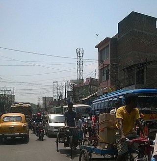
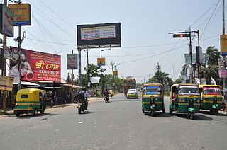
Habra is a city and a municipality under Barasat sadar subdivision in North 24 Parganas district of the Indian state of West Bengal. It is situated on the Jessore Road between Kolkata and the Bangladesh border at Petrapole. Its location makes it an important town for export and import of goods between India and Bangladesh.
Chakpara is a census town in Bally Jagachha CD Block of Howrah Sadar subdivision in Howrah district in the Indian state of West Bengal. It is a part of Kolkata Urban Agglomeration.
Dharmapur is a census town in Chinsurah Mogra CD Block in Chinsurah subdivision of Hooghly district in the state of West Bengal, India. It is a part of Kolkata Urban Agglomeration.
Gangoh is a town and a municipal board in Saharanpur district in the state of Uttar Pradesh, India. It lies about 40 km south-west of Saharanpur city. Other nearby towns are Karnal, Haryana, which is about 35 km south-west of Gangoh; Yamunanagar, Haryana, about 50 km to the north-west; and Shamli, Uttar Pradesh, about 50 km to the south. The town lies about 150 km north-east of the national capital, Delhi.
Nautanwa is a town and Nagar Palika in Maharajganj district in the state of Uttar Pradesh, India. It is about 87 km from Gorakhpur, NH24 and 68 km NH730 from Maharajganj and 7 km from Sonauli Indo-Nepal Border.
Pharenda, or Anandnagar, is a city in the Maharajganj district of the province of Uttar Pradesh in northern India. It is located approximately 44 kilometres north of Gorakhpur near the border with Nepal. District of Pharenda is Maharajganj. This is situated on the Buddhist Circuit which is built from Sarnath to Lumbini. It lies on NH-24 and near NH 29. It is about 45 km from Gorakhpur, 40 km from Siddharthnagar, 30 km from Maharajganj and 55 km from Sonauli Indo-Nepal border. This place is named after Seth Anandram Jaypuriya. There is closed sugar Mill which was started in about 1935 and closed in 1995. Near Anand Nagar there is a temple is Durga devi mandir, popularly known as Lehara Devi mandir.
Guma is a census town(CT) in the Habra II CD block of Barasat sadar subdivision in North 24 Parganas district in the Indian state of West Bengal.
Khalia is a census town in Bally Jagachha CD Block of Howrah Sadar subdivision in Howrah district in the Indian state of West Bengal. It is a part of Kolkata Urban Agglomeration.

Kuchinda is the town and a notified area council in Sambalpur district in the Indian state of Odisha. It is located about 80 km (49.71 mi) from the district headquarters of Sambalpur, and about 48 km (29.83 mi) away from Jharsuguda. Kuchinda is famous for its "Dushera". Kuchinda is also famous for the Gudguda waterfall. Most of the people of Kuchinda sub-division depends on farming. Kuchinda is more of a tribal area.
Kalyani is a planned urban city in Nadia district in the Indian state of West Bengal. It is also a municipality and Community Development Block in Nadia. It is located around 40 kilometers from Kolkata — the capital of West Bengal. Kalyani is the administrative headquarters of Kalyani subdivision. It resides on the eastern banks of Hooghly River, and is part of the Kolkata Metropolitan Development Authority (KMDA).
Muragachha is a census town in Barrackpore II CD Block in Barrackpore subdivision in North 24 Parganas district in the Indian state of West Bengal. It is close to Kolkata and also a part of Kolkata Urban Agglomeration.
Panchpara is a census town in Sankrail CD Block of Howrah Sadar subdivision in Howrah district in the Indian state of West Bengal. It is a part of Kolkata Urban Agglomeration.
Sadpur is a census town in the Habra I CD block in the Barasat Sadar subdivision in the North 24 Parganas district in the Indian state of West Bengal.
Warisaliganj is a Community Development block and a Municipal Council in Nawada district in the Indian state of Bihar.
Chandpur is a census town in Barrackpore II CD Block in Barrackpore subdivision in North 24 Parganas district in the state of West Bengal, India. It is close to Kolkata and also a part of Kolkata Urban Agglomeration.

Saifai is a large village and university town in the Etawah district of the Indian state of Uttar Pradesh. It is also a sub-division (Tehsil) and Block of the Etawah district. It is the birthplace of Mulayam Singh Yadav, the founding president of the Samajwadi Party, former Minister of Defence in India, and former Chief Minister of Uttar Pradesh.
Kolthur is a village in Kasaragod taluk of Kasaragod district in Indian state of Kerala.
