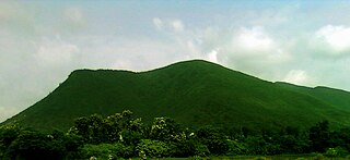
Air Force Area is an area in Gorakhpur in the Indian state of Uttar Pradesh. It is spread over a large area including Kushmi Jungle, Forest Club, and Vinod Van Zoo, located near Gorakhpur airport. Air Force Area has a one-passenger railway station, the Kushmi railway station. The Area has a local railway station; called Gorakhpur Cantt (Chawani) which is the passway to the Main Railway Station of Gorakhpur Junction
Barhalganj is a town in the municipality of Gorakhpur, Uttar Pradesh. The town is surrounded by several rivers, which are of religious significance to the Hindu population in Uttar Pradesh. Barhalganj is situated on the left bank of the Ghaghra river, a tributary of the Ganges, and the town is connected to the district of Mau by a bridge over the Saryu river.
Bhatni Bazar is a town and a Nagar Panchayat in the Deoria district in the Indian state of Uttar Pradesh. It is the capital of the Development block Bhatni.
Dhampur is a city and a municipal board in Bijnor district in the state of Uttar Pradesh, India. It is located at 29.51°N 78.50°E, and lies in Northern India.
Nautanwa is a town and Nagar Palika in Maharajganj district in the state of Uttar Pradesh, India. It is about 87 km from Gorakhpur, NH24 and 68 km NH730 from Maharajganj and 7 km from Sonauli Indo-Nepal Border.
Pharenda, or Anandnagar, is a city in the Maharajganj district of the province of Uttar Pradesh in northern India. It is located approximately 44 kilometres north of Gorakhpur near the border with Nepal. District of Pharenda is Maharajganj. This is situated on the Buddhist Circuit which is built from Sarnath to Lumbini. It lies on NH-24 and near NH 29. It is about 45 km from Gorakhpur, 40 km from Siddharthnagar, 30 km from Maharajganj and 55 km from Sonauli Indo-Nepal border. This place is named after Seth Anandram Jaypuriya. There is closed sugar Mill which was started in about 1935 and closed in 1995. Near Anand Nagar there is a temple is Durga devi mandir, popularly known as Lehara Devi mandir.
Hariharpur is a town and a Nagar Panchayat in Sant Kabir Nagar district in the Indian state of Uttar Pradesh.
Harpalpur is a town and a nagar panchayat in Chhatarpur District in the Indian state of Madhya Pradesh.
Khadda is a town, a nagar panchayat and a tehsil in Kushinagar district in the Indian state of Uttar Pradesh. It is situated approximately 8 kilometres (5.0 mi) from the border with Bihar and 18 kilometres (11 mi) from the India-Nepal border.
Maharajganj is a town and a nagar panchayat in Azamgarh district in the Indian state of Uttar Pradesh. It is connected to National Highway 233B (India), linking Azamgarh to Rajesultanpur.
Mundera Bazar is a town and a nagar panchayat in Gorakhpur district in the Indian state of Uttar Pradesh. MRs. Sunita Gupta, is the chairman of this nagar panchayat.
Nichlaul is a town and a nagar panchayat in Maharajganj district in the Indian state of Uttar Pradesh. It is situated 25 km from district headquarter Maharajganj and 80 km from Gorakhpur. It is situated near the Indo-Nepal border.
Pipraich is a town and a nagar panchayat in Gorakhpur district in the Indian state of Uttar Pradesh. The Pipraich block comes under the tehsil Sadar. It was declared a town on 25 November 1871, under the Bengal Chaukidari Act, of 1856 and is now administered as a town area under the U.P. Town Areas Act of 1914.
GIDA Sahjanwan is industrial area of Gorakhpur in the state of Uttar Pradesh. It is fast developing an industrial area abbreviated as GIDA with many factories, including IGL, Parle and ARP, as well as power looms, plywood and the only jute mill in Uttar Pradesh.
Shohratgarh is a town and tehsil in Siddharthnagar district, Uttar Pradesh state of India.

Nelli-marla is a census town in Vizianagaram district of the Indian state of Andhra Pradesh. It is in Nellimarla mandal of Vizianagaram revenue division.
Gola Bazar is a town and a nagar panchayat in Gorakhpur district in the Indian state of Uttar Pradesh. It is also known for its gold market. It is located near the Saryu (Ghaghra) river. This river itself is a border between Gorakhpur and Azamgarh. Distance from Gorakhpur City is around 54 km via kauriram. It is one of the tehsils of Gorakhpur. It is very famous for its ghats which are on the bank of river Saryu. Gola market is very famous among the villages and other towns around it.
Hata is a town located at NH-28 having 25 wards and a Nagarpalika in Kushinagar district in the Indian state of Uttar Pradesh. It is situated 36 km away from Gorakhpur in east. It is a major town of Kushinagar district situated on NH -28. Nearest railway station is Gauri Bajar, which is 17 km away from the town and the next major market of Kaptanganj is located 23 km away from it. Hata is the main market for wholesaler, local vendors & retailers.
Baskhari is a town located in Ambedkar Nagar district in the Indian state of Uttar Pradesh.
Badlapur is an administrative division in Jaunpur District in the Indian state of Uttar Pradesh. It was accorded the status of Town Area Nagar Panchayat on 27 June 2014.

