
Srikakulam is a city and the headquarters of Srikakulam district in the Indian state of Andhra Pradesh. As of 2011 census, it has a population of 165,735. There are many other places of Buddhist Tourism such as Salihundam, Kalinga Patnam, Dabbaka Vaani Peta, Nagari Peta, Jagati Metta, Singupuram etc. in Srikakulam District. The Buddhist heritage site of Salihundam has some unique features. It has a beautiful star atop a stupa, rock cut massive stupas inside chaitya grihas, brick stupas with wheel pattern plan, votive stupas, inscriptions on the steps leading to the stupas and museum housing over two dozen sculpted statue and figurines of Buddha, Jain Teerthankars and other deities

Vizianagaram, also known as Vijayanagaram, is a city and the headquarters of the Vizianagaram district in the Indian state of Andhra Pradesh. It is located in the Eastern Ghats, about 24 km (15 mi) west of the Bay of Bengal and 40 km (25 mi) north-northeast of Visakhapatnam. The city has a population of 228,025 and was established as the capital of the Vizianagaram estate by Raja Vijayaram Raj from the Pusapati dynasty. The rulers had a notable role in the history of the region in the 18th century and were patrons of education and arts.
Krishnapatnam or Kistnapatam is a port town in Muthukur mandal of Nellore district in Andhra Pradesh, India.

Bobbili is a town in Vizianagaram district of the Indian state of Andhra Pradesh.

Proddatur (1915) is a city in the YSR Kadapa District of Andhra Pradesh, located on the banks of the Penna River. The city is a municipality, and also the mandal headquarters of Proddatur mandal. It is the second-largest town in former Kadapa District. It is the oldest municipality which formed before Independence.

Tadepalligudem is a city in West Godavari district of the Indian state of Andhra Pradesh. It is a Selection Grade municipality and the mandal headquarters of Tadepalligudem mandal and Tadepalligudem Revenue Division. Tadepalligudem is one of the biggest City in West Godavari district

Ichchapuram is a town in the Srikakulam district of the Indian state of Andhra Pradesh. The town is located nearly 142 km from the district capital, Srikakulam. It is located on the border of Odisha and Andhra Pradesh. Ichchapuram municipality is the largest urban local body in the Srikakulam district. It had a population of 36,493 as of 2011.

Pamuru is a town in Prakasam district of the Indian state of Andhra Pradesh. It is the mandal headquarters of Pamuru mandal in Kanigiri revenue division. This is the border town of Prakasam district. This is near from Nellore than Ongole around 100 km and also near by Kadapa. It is 66 km away from Podili, 38 km away from Kanigiri, 60 km away from Kandukur.
Kotabommali is a mandal in the Srikakulam district of the Indian state of Andhra Pradesh.
Laveru is a village in Srikakulam district of the Indian state of Andhra Pradesh. Laveru is located on Subhadrapuram-Cheepurupalli road that connects National Highway-5 to Cheepurupalli railway station on Howrah-Chennai mainline. The village is located in Pedda Gedda river basin.
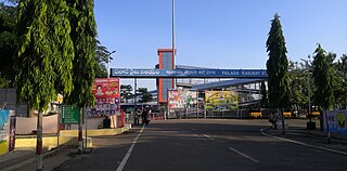
Palasa is one of the twin towns located in the Srikakulam district of Andhra Pradesh, India. The town is situated between Srikakulam and Berhampur. It is categorized as the second grade municipality. Also the town serves as the headquarters of Palasa Mandal.

Pathapatnam is a town in Srikakulam district of the Indian state of Andhra Pradesh. It is located in Pathapatnam mandal of Tekkali revenue division. Pathapatnam is located on the border of Srikakulam district of Andhra Pradesh and Gajapati district of Odisha. Parlakhemundi, the headquarters of Gajapati District, can be considered as twin town of Pathapatnam because of its close proximity. It is located around 65 km from srikakulam. It was the old capital of Paralakhemundi Gajapati Maharajah of his erstwhile kingdom.
Polaki is a village in Srikakulam district of Andhra Pradesh in India.
Veeraghattam is an Indian town in Parvathipuram Manyam district of Andhra Pradesh. It is located in Veeraghattam mandal of Palakonda revenue division.
Madapam is a village in Narasannapeta mandal, located in Srikakulam district of the Indian state of Andhra Pradesh.
Nadendla is a village in Palnadu district of the Indian state of Andhra Pradesh. It is the headquarters of Nadendla mandal in Narasaraopet revenue division.
Lolugu is a village near Srikakulam town in Ponduru mandal division, Andhra Pradesh, India.
Chagallu is a village in Palnadu district of the Indian state of Andhra Pradesh. It is located in Nekarikallu mandal of Sattenapalle revenue division.
Nagayalanka mandal is one of the 25 mandals in Krishna district of the Indian state of Andhra Pradesh. It is under the administration of Machilipatnam revenue division and has its headquarters at Nagayalanka. The mandal is bounded by Avanigadda and Koduru mandals. It lies at the mouths of Krishna River where it empties into Bay of Bengal.
Mulapeta Port is an under-construction deep sea port located at Mulapeta in Srikakulam district of Andhra Pradesh, India. The port is being constructed under the Andhra Pradesh Maritime Board, an organization of the Government of Andhra Pradesh. It is estimated that the construction cost of the port will more than ₹43 billion.


