
Kanpur Nagar district, meaning Urban Kanpur District is one of the districts of the Uttar Pradesh state of India. It is a part of Kanpur division and its district headquarters is Kanpur. Kanpur was formerly spelled Cawnpore.

Rampur district is one of the districts of Uttar Pradesh state of India, and Rampur town is the district headquarters. Rampur district is a part of Moradabad division. The district occupies an area of 2,367 km2 (914 sq mi).
Kemri is a town and nagar panchayat in Rampur district in the Indian state of Uttar Pradesh.

Bighapur is a town and nagar panchayat in Unnao district of Uttar Pradesh, India. First officially classified as a town for the 1981 census, it now serves as a tehsil headquarters(established in Patan). Important items manufactured here include clay pots, leather products, and wooden furniture. As of 2011, the population of Bighapur is 6,501, in 1,201 households.
Bindki is a city, sub-district and a municipality in Fatehpur district in the state of Uttar Pradesh, India.
Dhampur is a city and a municipal board in Bijnor district in the state of Uttar Pradesh, India. It is located at 29.51°N 78.50°E, and lies in Northern India.

Fatehpur is a town in Barabanki district in the state of Uttar Pradesh in India. It is also a Nagar panchayat, Police station and Tehsil. It is the second biggest urban area of the district after Barabanki city. It is about 35 km north-east of Lucknow, the state capital.
Kabrai is a city and a Nagar Panchayat, And a combination of 5 villages. POORANCHANDRA KUSWAHA is chairman of Kabrai nagar panchayat in Mahoba district in the Indian state of Uttar Pradesh in Bundelkhand Region. Kabrai is a City where stone mining is leading business. It is also known as stone city of uttar pradesh. There are around 350 stone crushers in and around the town. Most of city's revenue comes from mining. Due to this, place also has mining mafias. Kabrai is known for major business firms some of the name includes, Siddh Gopal Sahu,kamlesh soni ,Dheerendra pratap singh, Jaywant Singh Ankit Tripathi, Mahesh Tiwari,Bapu g gurudev BIP, A.K. Tripathi, Sankar Pratap Tiwari. Kabrai is situated between Banda and Mahoba and well connected by NH 86 and NH 76 Kanpur Kabrai Road. Kabrai has a well known temple by the name of Kalshaha Baba, panch pahadi behind the name there us story that one a person was trekking on hill and there was Kalash filled with gold rolling towards him and told him to collect it and also do some good work for poor people from that day temple name is called Kalshah Baba. Kabrai is well also Connected with Railway Network. One can board trains from Kabrai Railway Station.
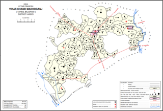
Madhoganj is a town and Nagar Panchayat in Bilgram tehsil of Hardoi district, Uttar Pradesh, India. It is located on the north side of the main road from Sitapur to Kanpur, with other roads leading to Bilgram to the northwest, Mallawan to the south, and Beniganj and Balamau to the east. As of 2011, the population of Madhoganj is 11,523, in 2,180 households. It is also the seat of a community development block.
Maudaha is a city and a Municipal Board in Hamirpur district, Uttar Pradesh, India.
Maurawan, also spelled Mauranwan, is a town and nagar panchayat in Purwa tehsil of Unnao district, Uttar Pradesh, India. It is located 12 km from Purwa on the road to Raebareli, and 3 km to the southwest of the town is the large Basaha lake. As of 2011, its population is 15,484, in 2,399 households.
Nyotini is a town and nagar panchayat in Hasanganj tehsil of Unnao district, Uttar Pradesh, India. Located 3 km southeast of Hasanganj on the right bank of the Sai river, Nyotini was historically one of the main centres of Muslim settlement in the district and it has several mosques and shrines. As of 2011, its population is 7,577, in 1,212 households.

Purwa is a town and nagar panchayat in Unnao district, Uttar Pradesh, India. It is located 32 km southeast of Unnao, the district headquarters. Roads connect it with several major cities including Unnao, Lucknow, Kanpur, and Rae Bareli. As of 2011, its population is 24,467 people, in 4,128 households.
Rampur Maniharan is a tehsil and a nagar palika in Saharanpur district in the Indian state of Uttar Pradesh.

Rasulabad is a town and a nagar panchayat in Kanpur Dehat district in the Indian state of Uttar Pradesh.

Tundla is a town and a municipal board in Firozabad district in the Indian state of Uttar Pradesh. It is an important railway junction between the Delhi-Kanpur main line and the Agra branch line. Tundla is a railway town that sprang up when the railway was built in the late 1800s. It is served by Tundla Junction railway station. As of 2011, Tundla has a population of 50,423 people, in 8,744 households.

Bhaupur is a town in Kanpur Dehat district in the state of Uttar Pradesh, India.With World Bank funding development of Bhaupur Industrial Sector UPSIDC Amritsar-Kolkata dedicated freight corridor is being carried out.
Ait is a small town located in Jalaun district of Uttar Pradesh.
Jamanka is a large village located in the Gabhana area of Aligarh district in the Indian state of Uttar Pradesh.

Rampur Khurd is a village in Sareni block of Rae Bareli district, Uttar Pradesh, India. It is located 20 km from Lalganj, the tehsil headquarters. As of 2011, it has a population of 303 people, in 65 households. It has no schools and no healthcare facilities, and it hosts a weekly haat but not a regular market. It belongs to the nyaya panchayat of Murarmau.
