Related Research Articles
Kamarajar Port Limited, formerly Ennore Port, is located on the Coromandel Coast, Chennai about 18 km north of Chennai Port. It is the 12th major port of India, and the first port in India which is a public company. The Kamarajar Port Limited is the only corporatised major port and is registered as a company. Chennai Port Trust acquired around 67% stake of Centre in the Kamarajar Port Limited on 27 March 2020. The remaining 23 percent was already held by the Chennai Port Trust.

Cochin Shipyard Ltd (CSL) is the largest shipbuilding and maintenance facility in India. It is part of a line of maritime-related facilities in the port-city of Kochi, in the state of Kerala, India.
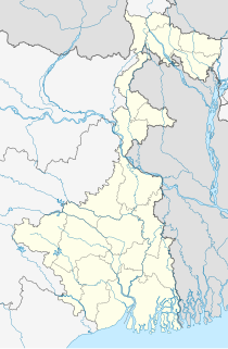
Sagar Island is an island in the Ganges delta, lying on the Continental Shelf of Bay of Bengal about 100 km south of Kolkata. This island forms the Sagar CD Block in Kakdwip subdivision of South 24 Parganas district in the Indian State of West Bengal. Although Sagar Island is a part of Sundarbans, it does not have any tiger habitation or mangrove forests or small river tributaries as is characteristic of the overall Sundarban delta. This island is a place of Hindu pilgrimage. Every year on the day of Makar Sankranti, hundreds of thousands of Hindus gather to take a holy dip at the confluence of river Ganges and Bay of Bengal and offer prayers (puja) in the Kapil Muni Temple. Kolkata Port Trust has a pilot station and a light house.
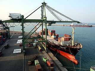
The Ministry of Ports, Shipping and Waterways, a branch of the Government of India, is the apex body for formulation and administration of the rules and regulations and laws relating to ports, shipping and waterways, headed by Shri Sarbananda Sonowal.
Kakdwip subdivision is an administrative subdivision of the South 24 Parganas district in the Indian state of West Bengal.
Sagar may refer to:
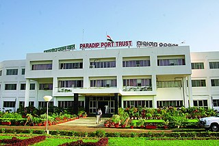
Paradip Port is a natural, deep-water port on the East coast of India in Paradip, just 53 km from Jagatsinghpur city in Jagatsinghpur district of Odisha, India. It is situated at confluence of the Mahanadi river and the Bay of Bengal. It is situated 210 nautical miles south of Kolkata and 260 nautical miles north of Visakhapatnam.
Sagar is a community development block that forms an administrative division in Kakdwip subdivision of South 24 Parganas district in the Indian State of West Bengal.

Sealdah South section consists of a set of four lines which connect the Sealdah South station in Kolkata with its southern suburbs and with the South 24 Parganas district of West Bengal, India. It is a part of the Kolkata Suburban Railway and is under the jurisdiction of the Sealdah railway division of the Eastern Railway zone of Indian Railways.
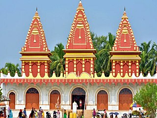
Gangasagar is a village and a gram panchayat within the jurisdiction of the Sagar police station in the Sagar CD block in the Kakdwip subdivision of the South 24 Parganas district in the Indian state of West Bengal.
The Sagarmala Programme is an initiative by the government of India to enhance the performance of the country's logistics sector. The programme envisages unlocking the potential of waterways and the coastline to minimize infrastructural investments required to meet these targets.
The National Shipping Board is an Advisory Body on matters related to shipping and shipping infrastructure(ports) .As India gained its independence in 1947 shipping had become very important for the growth of India as the Shipping Laws were created by old British law it had to be revised and in 1958 when the Merchant Shipping Law was consolidated and the opportunity was taken to provide for the formation of a Permanent statutory body called the National Shipping Board. The National Shipping Board was established on 1 March 1959.The Body was established by a recommendation to the Reconstruction Policy Sub-Committee as early as 1947. It comes under the Ministry of Ports, Shipping and Waterways (India), it looks into matters related to Indian Shipping.The National Shipping Board members are elected/nominated by Parliament, Lok Sabha (lower house of parliament and Rajya Sabha. The National Maritime Agenda 2010-2020 is an initiative of the Ministry of Ports, Shipping and Waterways & The National Shipping Board to outline the framework for the development of the port sector. The agenda also suggests policy-related initiatives to improve the operating efficiency and competitiveness of the Ports in India.
Sagar Port is a proposed seaport in Sagar Island, West Bengal, India by Government of India and Government of West Bengal.IIT Madras has been engaged to prepare a detailed project report (DPR) for the port, involving studies for shore-protection, land reclamation and physical modeling for use of dredge material. Cost of the port build up ₹30 billion. The port is scheduled to have an initial capacity to handle 60 mn tonne of bulk and containerised cargo. A rail cum road bridge over the Muriganga river is proposed to connect the Sagar Island to the mainland via Kakdwip. The length of rail-road bridge is 3.3km.
Water transport in India' has played a significant role in the country's overall economy and is indispensable to foreign trade. India is endowed with an extensive network of waterways in the form of rivers, canals, backwaters, creeks and a long coastline accessible through the seas and oceans. It has the largest carrying capacity of any form of transport and is most suitable for carrying bulky goods over long distances. It is one of the most cheap modes of transport in India, as it takes advantage of natural track and does not require huge capital investment in construction and maintenance except in the case of canals. Its fuel efficiency contributes to lower operating costs and reduced environmental impact due to carbon. India has 14500 km of inland waterways. Out of which only 5685 km are navigable by mechanized vessels.
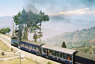
Total length of road in West Bengal is 92,023 Kilometers. Among these national highway are 2,377 kilometers, and state highway 2,393 kilometers The road density of the state is 103.69 kilometers per 100 square kilometers ; The national density is 74.7 kilometers per 100 square kilometers. The average speed of the road in the state is between 40 and 50 kilometers/hour. The speed in the village and urban areas is between 20 and 25 kilometers/hour. This is the main reason the road is low and lack of maintenance. The total length of the railway line in the state is 3,825 kilometers. Indian Railways' Eastern Railway zone and South Eastern Railway zone Headquarter are located in Kolkata. The railways on the north side of the state Under the Northeast Frontier Railway. Kolkata Metro is India's first underground metro rail service. The Darjeeling Himalayan Railway, part of the Northeast Frontier Railway, is a UNESCO World Heritage Site.
Rudranagar is a village and a gram panchayat within the jurisdiction of the Sagar police station in the Sagar CD block in the Kakdwip subdivision of the South 24 Parganas district in the Indian state of West Bengal.
Harinbari is a village within the jurisdiction of the Sagar police station in the Sagar CD block in the Kakdwip subdivision of the South 24 Parganas district in the Indian state of West Bengal.
Harwood Point is a village within the jurisdiction of the Kakdwip police station in the Kakdwip CD block in the Kakdwip subdivision of the South 24 Parganas district in the Indian state of West Bengal.
Ramganga is a village and a gram panchayat within the jurisdiction of the Patharpratima police station in the Patharpratima CD block in the Kakdwip subdivision of the South 24 Parganas district in the Indian state of West Bengal.
References
- ↑ SAGAR PORT LIMITED "Bhor Sagar Port Limited information".
{{cite news}}: Check|url=value (help) - ↑ "Development of Sea Port at Sagar Island".
- ↑ "India to get six new mega ports under Ministry of Shipping's Sagarmala project-A special purpose vehicle, named Bhor Sagar Port Limited, has also been floated under the partnership of the Kolkata Port Trust and the West Bengal Government.".