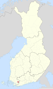
Kiikala is a former municipality of Finland. It was consolidated with Salo on January 1, 2009.
The Rutka is a river in Kirov Oblast and Mari El, Russia. It is 153 km long. The Rutka origins in Kirov Oblast, passes the Mari Depression and flows to the Cheboksary Reservoir. The Rutka frezes up in November and stays under ice until April. The river is navigable.

Vahagni is a town in the Lori Province of Armenia.
Szyjki is a village in the administrative district of Gmina Radziłów, within Grajewo County, Podlaskie Voivodeship, in north-eastern Poland.

Czechy is a village in the administrative district of Gmina Zduńska Wola, within Zduńska Wola County, Łódź Voivodeship, in central Poland. It lies approximately 6 kilometres (4 mi) west of Zduńska Wola and 45 km (28 mi) south-west of the regional capital Łódź.
Plewki is a village in the administrative district of Gmina Łyse, within Ostrołęka County, Masovian Voivodeship, in east-central Poland.
Pawłowo is a village in the administrative district of Gmina Gardeja, within Kwidzyn County, Pomeranian Voivodeship, in northern Poland. It lies approximately 12 kilometres (7 mi) east of Gardeja, 19 km (12 mi) south-east of Kwidzyn, and 90 km (56 mi) south of the regional capital Gdańsk.
Kaczek is a village in the administrative district of Gmina Nowe Miasto Lubawskie, within Nowe Miasto County, Warmian-Masurian Voivodeship, in northern Poland.
Czerwona Woda is a village in the administrative district of Gmina Olsztynek, within Olsztyn County, Warmian-Masurian Voivodeship, in northern Poland.
Wierzchówko is a settlement in the administrative district of Gmina Wierzchowo, within Drawsko County, West Pomeranian Voivodeship, in north-western Poland. It lies approximately 2 kilometres (1 mi) east of Wierzchowo, 24 km (15 mi) east of Drawsko Pomorskie, and 103 km (64 mi) east of the regional capital Szczecin.
Mirowo is a village in the administrative district of Gmina Rymań, within Kołobrzeg County, West Pomeranian Voivodeship, in north-western Poland. It lies approximately 6 kilometres (4 mi) east of Rymań, 24 km (15 mi) south of Kołobrzeg, and 90 km (56 mi) north-east of the regional capital Szczecin.
Podłęcze is a village in the administrative district of Gmina Suchań, within Stargard County, West Pomeranian Voivodeship, in north-western Poland. It lies approximately 10 kilometres (6 mi) east of Suchań, 30 km (19 mi) east of Stargard, and 61 km (38 mi) east of the regional capital Szczecin.
Kourteye is a village and rural commune in Niger.
Srbovo is a village in the municipality of Negotin, Serbia. According to the 2002 census, the village has a population of 502 people.

The University of Warmia and Mazury in Olsztyn was established on 1 September 1999, in accordance with the new Statute of Sejm signed by Polish President Aleksander Kwaśniewski, as well as Minister of Education Mirosław Handke, in August of the same year. Ryszard Górecki became its first chancellor. The Faculty of Theology was established with an agreement between Polish Episcopate and the government, in the presence of Cardinal Józef Glemp, among others. The university's first academic year started in October 1999.

Chertanovo Yuzhnoye District is an administrative district (raion) of Southern Administrative Okrug, and one of the 125 raions of Moscow, Russia.

Pöörilaid is an islet in the Baltic Sea belonging to the country of Estonia.
Soldier Idumota sometimes called Unknown Soldier, is a cenotaph located in Idumota, a suburb of Lagos, in Lagos State, Nigeria. It was built and erected in 1948 by the Nigerian government to commemorate the soldiers who died during World War I and World War II.
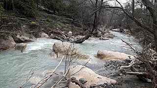
Tece Creek is a creek in Mersin Province, Turkey. Its headwaters are around Fındıkpınarı in the Toros Mountains. In upper reaches it is also called Fındık Creek. It flows to Mediterranean Sea at 36°41′54″N34°27′40″E. Tece town is by the creek.

Maadan Subdistrict or Maadan Nahiyah is a Syrian Nahiyah (Subdistrict) located in Raqqa District in Raqqa. According to the Syria Central Bureau of Statistics (CBS), Maadan Subdistrict had a population of 42,652 in the 2004 census.


