
Locust Point is a peninsular neighborhood in Baltimore, Maryland. Located in South Baltimore, the neighborhood is entirely surrounded by the Locust Point Industrial Area; the traditional boundaries are Lawrence street to the west and the Patapsco River to the north, south, and east. It once served as a center of Baltimore's Polish-American, Irish-American and Italian-American communities; in more recent years Locust Point has seen gradual gentrification with the rehabilitation of Tide Point and Silo Point. The neighborhood is also noted as being the home of Fort McHenry and the western end of its namesake tunnel that carries eight lanes of Interstate 95 under the river.

Federal Hill is a neighborhood in Baltimore, Maryland, that lies just to the south of the city's central business district. Many of the structures are included in the Federal Hill Historic District, listed on the National Register of Historic Places in 1970. Other structures are included in the Federal Hill South Historic District, listed in 2003.

Little Italy is a neighborhood located in southeastern Baltimore, Maryland. The neighborhood is known for its strong Italian-American heritage and identity. The neighborhood is still mostly populated by the descendants of Italian-American immigrants and remains a closely knit ethnic enclave.

Mount Vernon is a neighborhood of Baltimore, Maryland, located immediately north of the city's downtown. It is named for George Washington's Mount Vernon estate in Virginia, as the site of the city's Washington Monument.

Canton is a historic waterfront neighborhood in Baltimore, Maryland, United States. The neighborhood is along Baltimore's outer harbor in the southeastern section of the city, roughly 2 miles (3 km) east of Baltimore's downtown district and next to or near the neighborhoods of Patterson Park, Fell's Point, Highlandtown, and Brewers Hill.

Upton is a neighborhood in Baltimore City, Maryland, United States. The neighborhood is in the western section of the city, roughly between Fremont Avenue and McCulloh Street, extending from Dolphin Street to Bloom Street. Its principal thoroughfare is Pennsylvania Avenue.

Greektown is a neighborhood located in Baltimore, Maryland, United States.

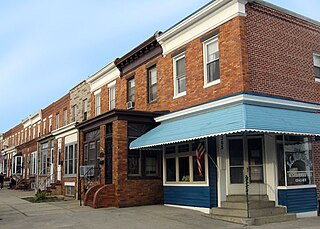
Kresson is a neighborhood of Southeast Baltimore, Maryland, United States.

Middle East is a neighborhood in the heart of East Baltimore, Maryland.

Barclay is a neighborhood in the center of Baltimore City. Its boundaries, as defined by the City Planning Office, are marked by North Avenue, Greenmount Avenue, Saint Paul and 25th Streets. The neighborhood lies north of Greenmount West, south of Charles Village, west of East Baltimore Midway, and east of Charles North and Old Goucher. The boundary between the Northern and Eastern police districts runs through the community, cutting it roughly in half.

Broadway East is a neighborhood in the East District of Baltimore. Its boundaries are the south side of North Avenue, the west side of Milton Street, the east side of Broadway, and the north side of Biddle Street. The neighborhood lies east of Oliver, north of Middle East, south of Lake Clifton, and west of Berea.
Joseph Lee, the residential part of Bayview, is a neighborhood in Baltimore, Maryland, United States. Part of the larger Bayview or Hopkins Bayview neighborhood, it borders the Greektown neighborhood. It is sometimes called the "A to K" or "ABC neighborhood" because its north-south streets are arranged in alphabetical order: Anglesea, Bonsal, Cornwall, Drew, Elrino, Folcroft, Gusryan, Hornel, Imla, Joplin, and Kane.

Berea is a neighborhood in the East District of Baltimore. Its boundaries are the south side of Sinclair Lane, the east side of Milton Avenue, the west side of Edison Highway, and the north side of Biddle Street. Berea lies between the neighborhoods of Broadway East (west) and Orangeville (east), north of the Biddle Street neighborhood and south of Four By Four.

Jonestown is a neighborhood in the southeastern district of Baltimore. Its boundaries are the north side of Pratt Street, the west side of Central Avenue, the east side of Fallsway, and the south side of Orleans Street. The neighborhood lies north of the Little Italy, south of the Old Town, west of the Washington Hill, and east of the Downtown Baltimore neighborhoods. The southern terminus of the Jones Falls Expressway is located here.

Baltimore is the most populous city in the U.S. state of Maryland. With a population of 585,708 at the 2020 census, it is the 30th-most populous city in the United States. Baltimore was designated an independent city by the Constitution of Maryland in 1851, and today it is the most populous independent city in the nation. As of the 2020 census, the population of the Baltimore metropolitan area was estimated to be 2,838,327, making it the 20th-largest metropolitan area in the country. When combined with the larger Washington, D.C. metropolitan area, the Washington–Baltimore combined statistical area (CSA) has a 2020 U.S. census population of 9,973,383, the third-largest in the country.

Sabina Mattfeldt is a neighborhood in the North District of Baltimore, located beside the Jones Falls, between the neighborhoods of Mount Washington (west) and Poplar Hill (east). Its name comes from the two streets, Sabina Avenue and Mattfeldt Avenue, where most of the neighborhood's homes are located.
East Monument Historic District or Little Bohemia, is a national historic district in Baltimore, Maryland. It is a large residential area with a commercial strip along East Monument Street. It comprises approximately 88 whole and partial blocks. The residential area is composed primarily of rowhouses that were developed, beginning in the 1870s, as housing for Baltimore's growing Bohemian (Czech) immigrant community. During the late 19th and early 20th centuries the neighborhood was the heart of the Bohemian community in Baltimore. The Bohemian National Parish of the Roman Catholic Church, St. Wenceslaus, is located in the neighborhood. The historic district includes all of McElderry Park and Milton-Montford, most of Middle East and Madison-Eastend, and parts of Ellwood Park.

Hollins Market is a neighborhood in the Sowebo area of Baltimore. It takes its name from the Hollins Market, the oldest public market building still in use in Baltimore City, which is located in the heart of the neighborhood.

South Baltimore is a neighborhood in the Southern District of Baltimore, located to the west of the neighborhood of Riverside and south of Federal Hill. Its boundaries are marked by East Ostend Street (north), Light Street (east), Race Street (west) and Interstate 95 (south).


