
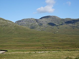
An Teallach is a mountain in Scotland. It lies to the southwest of Dundonnell and overlooks Little Loch Broom, in an area often nicknamed the "great wilderness". An Teallach means 'The Anvil' or 'The Forge' in Scottish Gaelic; although most scholars claim the latter is most correct as the mountain's name refers more to the colour of the terrain in certain lighting conditions, rather than shape.

Lurg Mhòr is a remote 986-metre (3,235 ft) mountain, a Munro, in the Northwest Highlands of Scotland at the high point of an east–west range of hills comprising Meall Mor, Lurg Mhòr and Bidein a' Choire Sheasgaich.
Bidein a' Choire Sheasgaich is a remote 945-metre (3,100 ft) mountain, a Munro, in the Northwest Highlands of Scotland at the western end of an east–west range of hills comprising a Munro Top Meall Mor, the Munro at the highest point of the ridge Lurg Mhòr, and Bidein a' Choire Sheasgaich itself.
Beinn Odhar Bheag is a mountain in the Northwest Highlands, Scotland, south of the village of Glenfinnan in Moidart, Lochaber.

Beinn a' Chlachair is a mountain in the Grampian Mountains of Scotland. It lies north of Loch Laggan, near the remote hamlet of Kinloch Laggan.

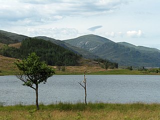
A' Ghlas-bhienn is a mountain in the Northwest Highlands of Scotland. It lies in the Kintail area of Ross-shire, close to the settlement of Morvich.

Doune Hill is a peak in the foothills of the Grampian Mountains of Scotland. It is located near the village of Luss in Argyll and Bute, west of Loch Lomond.

Beinn na Lap is a mountain in the Grampian Mountains of Scotland. It lies at the northern end of Rannoch Moor, near to Corrour railway station.

Beinn nan Aighenan is a mountain in the Grampian Mountains of Scotland. It lies in Argyll and Bute, north of the village of Taynuilt.

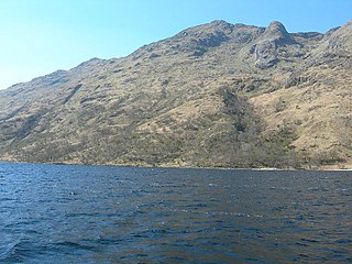
Meall Buidhe is a mountain in the Northwest Highlands, Scotland. It lies on the Knoydart peninsula in Lochaber.
Beinn Eunaich is a mountain in the Grampian Mountains of Scotland, located north of the village of Dalmally in Argyll and Bute.
Sgurr Mor is a mountain in the Northwest Highlands of Scotland, on the southern side of Loch Quoich in Lochaber.

Sgor Gaibhre is a mountain in the Grampian Mountains of Scotland. It lies on the border of Highland and Perth and Kinross, near Loch Ossian.

Beinn Talaidh is a peak on the Isle of Mull, Scotland, located in the mountainous centre of the Island.

Spidean Mialach is a mountain in the Northwest Highlands, Scotland, situated on the northern shore of Loch Quoich in Inverness-shire.

Beinn a' Chochuill is a mountain in the Grampian Mountains of Scotland, located east of Loch Etive in Argyll and Bute.

Beinn Teallach, is a mountain in the Grampian Mountains of Scotland, located east of the village of Roybridge in Lochaber.

Meall Corranaich is a mountain in the Grampian Mountains of Scotland. It lies on the northern shore of Loch Tay in Perthshire, and is part of the Ben Lawers group.

Ruadh Stac Mor is a mountain in the Northwest Highlands of Scotland. It is located in the Dundonnell and Fisherfield Forest in Wester Ross.
Toll Creagach is a mountain in the Northwest Highlands of Scotland. It lies between Glen Affric in the south and Loch Mullardoch in Inverness-shire.
