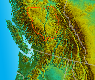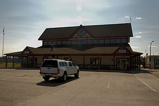
Quesnel is a small city that is part of the Cariboo Regional District of British Columbia, Canada. Located nearly evenly between the cities of Prince George and Williams Lake, it is on the main route to northern British Columbia and Yukon. Quesnel is located at the confluence of the Fraser and Quesnel Rivers. The Rocky Mountaineer train also travels through and stops overnight in Quesnel.

The Cariboo is an intermontane region of British Columbia along a plateau stretching from the Fraser Canyon to the Cariboo Mountains. The name is a reference to the caribou that were once abundant in the region. The Cariboo was the first region of the Interior north of the lower Fraser and its canyon to be settled by non-indigenous people, and played an important part in the early history of the colony and province. The boundaries of the Cariboo proper in its historical sense are debatable, but its original meaning was the region north of the forks of the Quesnel River and the low mountainous basins between the mouth of that river on the Fraser at the city of Quesnel and the northward end of the Cariboo Mountains - an area that is mostly in the Quesnel Highland and focused on several now-famous gold-bearing creeks near the head of the Willow River, the richest of them all, Williams Creek, the location of Barkerville, which was the capital of the Cariboo Gold Rush and also of government officialdom for decades afterwards. This area, the Cariboo goldfields, is underpopulated today but was once the most settled and most powerful of the regions of the province's Interior. As settlement spread southwards of this area, flanking the route of the Cariboo Road and spreading out through the rolling plateaus and benchlands of the Cariboo Plateau and lands adjoining it along the Fraser and Thompson, the meaning changed to include a wider area than the goldfields.

Quesnel Airport,, is located 2 nautical miles north of Quesnel, British Columbia, Canada.
Cottonwood River Provincial Park is a provincial park in British Columbia, Canada, located northeast of the confluence of the Fraser and Cottonwood Rivers in that province's North Cariboo region.
Fort George Canyon Provincial Park is a provincial park south of Prince George in British Columbia, Canada. The park's area is 440 acres (180 ha) and includes part of the Fraser River. No camping, campfires, swimming, kayaking, horses, pets, or rock climbing are allowed. Skiing, fishing, and hunting are allowed.
Pinnacles Provincial Park is a provincial park in British Columbia, Canada, located just west of Quesnel, north of Baker Creek.
Three Sisters Lake Provincial Park is a provincial park in British Columbia, Canada, located 35 km southeast of Prince George and northeast of the community of Hixon. In addition the three lakes which are the parks namesake the park protects a unique canyon feature on Government Creek.
Ten Mile Lake Provincial Park is a provincial park in British Columbia, Canada, ten miles (16 km) north of the city of Quesnel.

Soda Creek is a rural subdivision 38 km north of Williams Lake in British Columbia, Canada. Located on the east bank of the Fraser River, Soda Creek was originally the home of the Xat'sull First Nation. Soda Creek Indian Reserve No. 1 is located on the left (E) bank of the Fraser River, one mile south of the Soda Creek BCR (CN) station, 431.10 ha. 52°19′00″N122°16′00″W
The Red Bluff First Nation is a Dakelh First Nations government located in the northern Fraser Canyon region of the Canadian province of British Columbia. It is a member of the Carrier-Chilcotin Tribal Council, which includes both Tsilhqot'in and Carrier (Dakelh) communities.

The College of New Caledonia (CNC) is a post-secondary educational institution that serves the residents of the Central Interior of British Columbia. This region has a population of about 145,000, and it encompasses three school districts: #28 (Quesnel), #57, and #91. CNC operates six campuses in Prince George, Burns Lake, Fort St. James, Mackenzie, Quesnel and Vanderhoof.

The Nechacco sternwheeler was built for service on the Soda Creek to Fort George route on the upper Fraser River in British Columbia. She was owned by the Fort George Lumber and Navigation Company. The partners in this company were Nick Clark and Russel Peden of South Fort George, who operated a sawmill there. Nick Clark also owned the lots in that townsite and was offering them up for sale. The new steamer was intended to bring prospective property buyers to Fort George and to furnish them with supplies.
The Little Canyon is a stretch of the Quesnel River in the Cariboo Country of the Central Interior of British Columbia, Canada, near the city of the same name.

Hixon is an unincorporated community at the northern edge of the Cariboo region of the Central Interior region of British Columbia, Canada. It is part of Electoral Area E in the Regional District of Fraser-Fort George. It is located on the east (left) bank of the Fraser River, and is about midway along BC Highway 97 between the cities of Prince George (N) and Quesnel (S). It was named for Hixon Creek, which in turn is named for a 19th-century prospector in the area, by the name of Joseph Foster Hixon, who found gold here on the banks of the Fraser River back around 1866.

Rotavele is an unincorporated community in Glenn County, California. It is located on the Southern Pacific Railroad 15 miles (24 km) north of Butte City, at an elevation of 131 feet. The name is the word "elevator" reversed.
Cottonwood River is a tributary of the Fraser River in the Central Interior of British Columbia, Canada. Rising at the confluence of the Swift River and Lightning Creek at Coldspring House in the Cariboo goldfields of the northern Cariboo Plateau, it flows northwest and then turns southwest to join the Fraser just north of the city of Quesnel, which is at the confluence of the Quesnel River with the Fraser.
Cottonwood Canyon is a canyon along the Fraser River in the North Cariboo region of the Central Interior of British Columbia, Canada. It is located west of the Cariboo Mountains on the Fraser River south of its confluence with the east-flowing West Road River and north of its confluence with the northwest-flowing Cottonwood River just northwest of the city of Quesnel, The first European explorer was Simon Fraser (explorer) who ran the rapids on the first of June, 1808. One of his canoes became stranded and had to be pulled out of the canyon with a rope. It was one of the obstacles for gold rush-era steamboats operating on the Fraser from Quesnel to Fort George and up the Nechako and Stuart Rivers to Stuart Lake.
Mary Creek is a creek in the Cariboo region of British Columbia. The creek is located in Cottonwood Country which is between Quesnel and Barkerville. Mary Creek is small tributary of John Boyd Creek which flows into the Cottonwood River. Terry Toop discovered gold on Mary Creek in the fall of 1972. The nuggets found were $150 in value, and $2,200 in gold could be found in a single yard of gravel. Bullion in 15 and 20 pound lots was shipped to a refinery in Richmond. Photographs of the nuggets were published in newspapers along the coast. Other miners moved in and staked claims around the area, but the gold was depleted in 1975.
Cajon Canyon, originally named El Cajon De San Gabriel De Amuscopiabit, El Cajon in Spanish meaning "the box" in English, is a long valley ending in a box canyon in the northeastern San Gabriel Mountains, within San Bernardino County, California.


