Related Research Articles

The Bass River is a 4.7-mile-long (7.6 km) tributary of the Mullica River in southeastern New Jersey in the United States.
The Pascack Valley is the name for a region of New Jersey, United States, contained within Bergen County. It is named for the Pascack Brook. The region consists of eight municipalities: Montvale, Park Ridge, Woodcliff Lake, Hillsdale, Westwood, River Vale, Washington Township, and Emerson.
The Batsto River is a 22.9-mile-long (36.9 km) tributary of the Mullica River in the southern New Jersey Pine Barrens in the United States. The river also drains 49.42 square miles of land.
Beaver Brook is a 14.2-mile-long (22.9 km) tributary of the Pequest River in western New Jersey in the United States.
Friendship Creek is a 9.4-mile-long (15.1 km) tributary of the South Branch Rancocas Creek in southern New Jersey in the United States.
Burrs Mill Brook is a 7.9-mile-long (12.7 km) tributary of Friendship Creek in southern New Jersey in the United States.
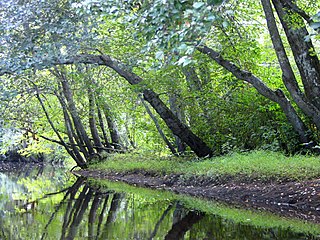
Musquapsink Brook is a tributary of Pascack Brook in Bergen County, New Jersey in the United States.

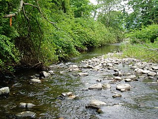
Flat Brook, also spelled as Flatbrook, is an 11.6-mile-long (18.7 km) tributary of the Delaware River in Sussex County, New Jersey in the United States.
Little Flat Brook is a 12.7-mile-long (20.4 km) tributary of Flat Brook in Sussex County, New Jersey in the United States.

Wawayanda Creek is the name of Pochuck Creek above its confluence with the tributary Black Creek. It is 17.0 miles (27.4 km) long. Wawayanda Creek, via Pochuck Creek, is a tributary of the Wallkill River in Sussex County, New Jersey in the United States. It starts northeast of Warwick, New York, and runs southwest, mostly within Orange County, flowing into New Jersey for several miles to its confluence with Black Creek just north of Highland Lakes, forming Pochuck Creek, which flows north back into New York.
Pochuck Creek is an 8.1-mile-long (13.0 km) tributary of the Wallkill River in Orange County, New York and Sussex County, New Jersey, in the United States.
Clove Brook is a 12.0-mile-long (19.3 km) tributary of Papakating Creek in Sussex County, New Jersey in the United States.
Greenwood Branch is a 9.3-mile-long (15.0 km) tributary of the North Branch Rancocas Creek in the southern New Jersey Pine Barrens in the United States.
Great Swamp Brook is a 9.1-mile-long (14.6 km) tributary of Nescochague Creek in the southern New Jersey Pine Barrens in the United States.

The Skylands Region is a region of New Jersey located in the Northern and Central part of the state. It is one of six tourism regions established by the New Jersey State Department of Tourism; the others are Gateway Region, Greater Atlantic City Region, the Southern Shore Region, the Delaware River Region, and the Shore Region.
Bear Brook is a tributary of Pascack Brook in New Jersey. It joins with the Pascack at the Woodcliff Lake Reservoir and forms part of the border between Park Ridge and Woodcliff Lake. The brook flows through portions of Bergen County in New Jersey and its headwaters lay in Rockland County, New York. In Park Ridge, a park named Atkins Glen surrounds a portion of the brook and is home to several shallow caverns, in some of which Native American artifacts have been found.
The Seboeis River is a river in Penobscot County, Maine. The river is the outflow of Snowshoe Lake in Maine Township 7, Range 7, WELS; Snowshoe Lake is fed via a short stream from Grand Lake Seboeis. The river runs 28.1 miles (45.2 km) south — through White Horse Lake, Seboeis Deadwater, Upper Seboeis River Gorge, and Gagnon Flat — to its confluence with the East Branch of the Penobscot River in T.3 R.7 WELS.
The Dwaar Kill is a 7.8-mile-long (12.6 km) tributary of the Shawangunk Kill in Ulster County, New York, in the United States.

Wallpack Valley is a valley located in Sussex County in northwestern New Jersey formed by Wallpack Ridge on the west, and Kittatinny Mountain on the east. Wallpack Ridge separates the Wallpack Valley from the valley of the Delaware River, and contains the watershed of the Flat Brook and its main tributaries Big Flat Brook and Little Flat Brook. It is a narrow valley, roughly 25 miles (40 km) in length running from Montague Township south of Port Jervis, New York to the Walpack Bend in the Delaware River near Flatbrookville in Walpack Township where the Flat Brook enters the Delaware at 300 feet above sea level.
West Branch Papakating Creek is a tributary of Papakating Creek located in Frankford and Wantage townships in Sussex County, New Jersey, in the United States.
References
- ↑ Gertler, Edward. Garden State Canoeing, Seneca Press, 2002. ISBN 0-9605908-8-9
- ↑ U.S. Geological Survey. National Hydrography Dataset high-resolution flowline data. The National Map Archived 2012-03-29 at the Wayback Machine , accessed April 1, 2011