Related Research Articles

Wood County is a county located in the U.S. state of Wisconsin. As of the 2010 census, the population was 74,749. Its county seat is Wisconsin Rapids. The county is named after Joseph Wood, a member of the Wisconsin State Assembly. Wood County comprises the Wisconsin Rapids-Marshfield, WI Micropolitan Statistical Area and is included in the Wausau-Stevens Point-Wisconsin Rapids, WI Combined Statistical Area.

Portage County is a county in the U.S. state of Wisconsin. As of the 2020 census, the population was 70,377. Its county seat is Stevens Point.

Jackson County is a county located in the U.S. state of Wisconsin. As of the 2010 census, the population was 20,449. Its county seat is Black River Falls. Jackson County was formed from Crawford County in 1853. It was named for President Andrew Jackson.
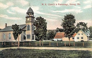
Strong is a town in Franklin County, Maine, United States. The population was 1,122 at the 2020 census. Strong is home to the annual Sandy River Festival.

Nekoosa is a city in Wood County, Wisconsin, United States. Its name derives from the Ho-Chunk word, "Nįįkuusra", "Nakrusa", or "Nįkusara" which translates to "running water." The population was 2,580 at the 2010 census.

Wisconsin Rapids is a city in and the county seat of Wood County, Wisconsin, United States. The population was 18,367 at the 2010 census.

The Door Peninsula is a peninsula in eastern Wisconsin, separating the southern part of the Green Bay from Lake Michigan. The peninsula includes northern Kewaunee County, northeastern Brown County, and the mainland portion of Door County. It is on the western side of the Niagara Escarpment. Well known for its cherry and apple orchards, the Door Peninsula is a popular tourism destination. With the 1881 completion of the Sturgeon Bay Ship Canal, the northern half of the peninsula became an island.

Wisconsin, a state in the Midwestern United States, has a vast and diverse geography famous for its landforms created by glaciers during the Wisconsin glaciation 17 thousand years ago. The state can be generally divided into five geographic regions—Lake Superior Lowland, Northern Highland, Central Plain, Eastern Ridges & Lowlands, and Western Upland. The southwestern part of the state, which was not covered by glaciers during the most recent ice age, is known as the Driftless Area. The Wisconsin glaciation formed the Wisconsin Dells, Devil's Lake, and the Baraboo Range. A number of areas are protected in the state, including Devil's Lake State Park, the Apostle Islands National Lakeshore, and the Chequamegon–Nicolet National Forest.

Blenker is an unincorporated community in the town of Milladore, in Wood County, Wisconsin, United States.

The Big Rib River is a river in central Wisconsin. It originates in northeastern Taylor County at Rib Lake, and flows into Marathon County where it joins the Wisconsin River. "Rib River" is a translation of the Native American name.
Bear Creek is a stream in the U.S. state of Wisconsin. It is a tributary to the Little Eau Pleine River.
Belle Island is a river island in Wood County, Wisconsin.
Bloody Run is a stream in the U.S. state of Wisconsin. It is a tributary to Nepco Lake.
Cat Creek is a stream in the U.S. state of Wisconsin. It is a tributary to the Yellow River.
Edwards Island is a river island in Wood County, Wisconsin. The island is on the Wisconsin River within Wisconsin Rapids city limits.
Garrison Island is a river island in Wood County, Wisconsin. The island is on the Wisconsin River at the city of Wisconsin Rapids.
Ben Hansen Park is an urban park located in and administered by the city of Wisconsin Rapids, Wisconsin.
Lyon Park is an urban park located in and administered by the city of Wisconsin Rapids, Wisconsin.
Mill Creek is a stream in the U.S. state of Wisconsin. It is a tributary to the Wisconsin River.
Sevenmile Creek is a stream in the U.S. state of Wisconsin. It is a tributary to the Wisconsin River.
References
- ↑ U.S. Geological Survey Geographic Names Information System: Big Island (Wood County, Wisconsin)
- 1 2 Rudolph, Robert S. (1970). Wood County Place Names (PDF). The University of Wisconsin Press. p. 10. Archived from the original (PDF) on 2016-04-04. Retrieved 2018-03-27.
Coordinates: 44°24′56″N89°48′27″W / 44.41556°N 89.80750°W
| | This article about a location in Wood County, Wisconsin is a stub. You can help Wikipedia by expanding it. |