
The Newaukum River is a tributary of the Chehalis River in the U.S. state of Washington. It has three main branches, the North Fork, South Fork, and Middle Fork Newaukum Rivers. The length of the three forks and the mainstem river is 56.7 miles (91.2 km).

The Feather River is the principal tributary of the Sacramento River, in the Sacramento Valley of Northern California. The river's main stem is about 73 miles (117 km) long. Its length to its most distant headwater tributary is just over 210 miles (340 km). The main stem Feather River begins in Lake Oroville, where its four long tributary forks join—the South Fork, Middle Fork, North Fork, and West Branch Feather Rivers. These and other tributaries drain part of the northern Sierra Nevada, and the extreme southern Cascades, as well as a small portion of the Sacramento Valley. The total drainage basin is about 6,200 square miles (16,000 km2), with approximately 3,604 square miles (9,330 km2) above Lake Oroville.
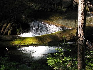
The Big Quilcene River is a river on the Olympic Peninsula in the U.S. state of Washington.

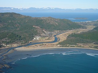
The Queets River is a river in the U.S. state of Washington. It is located on the Olympic Peninsula, mostly within the Olympic National Park and empties into the Pacific Ocean.

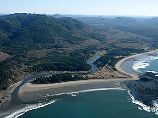
The Hoh River is a river of the Pacific Northwest, located on the Olympic Peninsula in the U.S. state of Washington. About 56 miles (90 km) long, the Hoh River originates at the snout of Hoh Glacier on Mount Olympus and flows westward through the Olympic Mountains of Olympic National Park and Olympic National Forest, then through foothills in a broad valley, emptying into the Pacific Ocean at the Hoh Indian Reservation. The final portion of the Hoh River's course marks the boundary between the south coastal segment of Olympic National Park and the Hoh Indian Reservation.

The Skokomish River is a river in Mason County, Washington, United States. It is the largest river flowing into Hood Canal, a western arm of Puget Sound. From its source at the confluence of the North and South Forks the main stem Skokomish River is approximately 9 miles (14 km) long. The longer South Fork Skokomish River is 40 miles (64 km), making the length of the whole river via its longest tributary about 49 miles (79 km). The North Fork Skokomish River is approximately 34 miles (55 km) long. A significant part of the Skokomish River's watershed is within Olympic National Forest and Olympic National Park.

The Sol Duc River is a river in the U.S. state of Washington. About 78 miles (126 km) long, it flows west through the northwest part of the Olympic Peninsula, from the Olympic Mountains of Olympic National Park and Olympic National Forest, then through the broad Sol Duc Valley. Near the Pacific Ocean the Sol Duc River joins the Bogachiel River, forming the Quillayute River, which flows about 4 miles (6.4 km) to the Pacific Ocean at La Push. Although the Quillayute River is short, its large tributary rivers—the Sol Duc, Bogachiel, Calawah, and Dickey Rivers—drain the largest watershed of the northern Olympic Peninsula, 629 square miles (1,630 km2). The Sol Duc's watershed is the largest of the Quillayute's tributaries, at 219 square miles (570 km2).
Hylebos Creek is a stream located in the U.S. state of Washington near Tacoma and emptying into Commencement Bay, part of Puget Sound. It flows through southern King County and northern Pierce County, through the cities of Tacoma, Federal Way, Milton, and Fife, as well as the Puyallup Indian Reservation.
Goodell Creek is a tributary of the Skagit River in the U.S. state of Washington.

The Satsop River is a stream in the U.S. state of Washington. It has three main tributary forks, the East Fork, West Fork, and Middle Fork Satsop Rivers. The main stem Satsop River is formed by the confluence of the West and East Forks. The Middle Fork is a tributary of the East Fork. The three forks are much longer than the main stem Satsop itself, which flows south from the confluence only a few miles to join the Chehalis River near Satsop, Washington. Other significant tributaries include the Canyon River and Little River, both tributaries of the West Fork Satsop, and Decker Creek, a tributary of the East Fork Satsop River. The Satsop River's major tributaries originate in the Olympic Mountains and its southern foothills, the Satsop Hills, within Grays Harbor and Mason counties. Most of the Satsop River's watershed consists of heavily wooded hill lands. The upper tributaries extend into Olympic National Forest, approaching but not quite reaching Olympic National Park.

The Beckler River is a tributary of the South Fork Skykomish River in the U.S. state of Washington in the United States.
The Rapid River is a tributary of the Beckler River in the U.S. state of Washington in the United States. It is 13 miles (21 km) long, with a drainage basin of 41 square miles (106 km2).
The Pysht River is a stream in the U.S. state of Washington. It originates near Ellis Mountain in the northern Olympic Mountains on the Olympic Peninsula and flows generally north, emptying into the Strait of Juan de Fuca. The Pysht and nearby Hoko River are the two largest streams flowing into the southwestern portion of the Strait of Juan de Fuca. The watershed of the Pysht River drains a region of industrial forest lands; 98% of the watershed is zoned commercial forestry and the remainder rural. Nearly all of the forests have been logged at least once and most trees are less than thirty years old. The upper portions of the watershed, which feature steep gradients, are owned by the United States Forest Service. The lower reaches, with low gradients, are largely owned by two industrial forest owners.

The Tahuya River is a stream in the U.S. state of Washington. It originates at Tahuya Lake in western Kitsap Peninsula and flows south, emptying into Hood Canal near the Great Bend.
The Sail River is a stream on the Olympic Peninsula in the U.S. state of Washington. It originates in the northern Olympic Mountains and flows north, emptying into the Strait of Juan de Fuca.
The Waatch River is a stream on the Olympic Peninsula in the U.S. state of Washington. It originates in the northwestern Olympic Mountains and empties into the Pacific Ocean through Makah Bay. The name "Waatch" comes from the Makah village name /waʔač'/, said to mean "bundling up cedar to make a torch".
The Tsoo-Yess River, sometimes called the Sooes River, is a stream on the Olympic Peninsula in the U.S. state of Washington. It originates in the northwestern Olympic Mountains and empties into the Pacific Ocean. The Makah National Fish Hatchery is located approximately 2 miles upstream and raises a variety of salmonid species.
The Ozette River is a stream on the Olympic Peninsula in the U.S. state of Washington. It originates in the northwestern Olympic Mountains and empties into the Pacific Ocean.

The Dickey River is a stream on the Olympic Peninsula in the U.S. state of Washington. It has three main forks, the East Fork, West Fork, and Middle Fork Dickey Rivers. The main stem is formed by the confluence of the East and West Forks. The river and its forks rise in the northwestern part of the Olympic Peninsula and flow generally south and west to join the Quillayute River near its mouth on the Pacific Ocean.
The Raft River is a stream located entirely within the Quinault Indian Reservation in Grays Harbor County, on the Olympic Peninsula, in the U.S. state of Washington. The river and its tributaries flow west from the Olympic Mountains and empty into the Pacific Ocean. It is situated a few miles north of the Quinault River and a few miles south of the Queets River.

