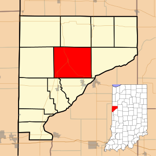
Liberty Township is one of twelve townships in Warren County, Indiana, United States. According to the 2020 census, its population was 861 and it contained 370 housing units.

Belknap Springs is an unincorporated community and private hot springs resort in Lane County, Oregon, United States, near the McKenzie River.

Norton is an unincorporated community located within Union Township, in Hunterdon County, New Jersey. Norton is located on County Route 635, approximately 1.5 mi (2.4 km) northwest of Interstate 78. The village is included in the Van Syckel Corner District, which was added to the National Register of Historic Places in 1979.

Cleveland Township is a township in Davis County, Iowa, United States. As of the 2000 census, its population was 675.
London Springs is an unincorporated community in Lane County, Oregon, United States. It lies 11.33 miles (18.23 km) south-southwest of Cottage Grove at an elevation of 896 feet (273 m). London Springs is near the Coast Fork Willamette River, south of Cottage Grove Lake.
Ward is an unincorporated community in Sussex County, Delaware, United States. in the Little Creek Hundred.
Kirkville is a census-designated place and unincorporated community in Itawamba County, Mississippi, United States.
Mason Springs is an unincorporated community in Charles County, Maryland, United States. Mason Springs is located at the junction of Maryland routes 224 and 225, 1.8 miles (2.9 km) southeast of Potomac Heights. The community had a post office from 1890 to 1924.
Perche Township is one of ten townships in Boone County, Missouri, USA. As of the 2012, its population was 4,037. The village of Harrisburg is the only incorporated settlement inside the township.
Eutaw is a ghost town in Bolivar County, Mississippi, United States. The settlement had a port on the Mississippi River called "Eutaw Landing."
Eulogy is an unincorporated community located in Holmes County, Mississippi, United States.
Goshen Springs is an unincorporated community in Rankin County, Mississippi, United States.
Paha is an unincorporated community in Adams County, Washington, United States. It is located along BNSF Railway's Lakeside Subdivision. Paha is assigned the ZIP code 99169.
Leggo is a ghost town in Yalobusha County, Mississippi, United States.
Swagg is an unincorporated community in Randolph County, Alabama, United States.

Binnsville is a ghost town in Kemper County, Mississippi, United States.
Refuge is an unincorporated community located in Washington County, Mississippi, United States.
Monterey is an unincorporated community in Rankin County, Mississippi, United States.
Spilman is an unincorporated community on the Ohio River in Mason County, West Virginia, United States. The village is located along Spilman Lane, Mason County Route 62/24, parallel to West Virginia Route 62 in Waggener District, about three quarters of a mile southeast of West Columbia.

Dango is a ghost town located in southwestern Jackson County, Kentucky, United States. The town was located at the confluence of Racoon Creek and Horse Lick Creek, which flows into the Rockcastle River. It is located southwest of McKee by 8 miles, and 2.7 miles southeast of another ghost town, Loam. Near the confluence of the two creeks is the historical Carpenter School, which may be named after Carpenter Ridge, of which it is two miles south of. Heavy settlement and farming occurred in the area around Horse Lick Creek, where Dango was, until the early 1900s. The area where Dango was is currently occupied by the Daniel Boone National Forest, known as the Horse Lick Creek Biopreserve, with the majority of ownership being private.


