Billudden

Last updated
Billudden Nature Reserve
Billudden1.JPG
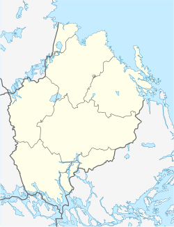
Sweden Uppsala location map.svg
Red pog.svg
Location within Uppsala County
Sweden location map.svg
Red pog.svg
Location within Sweden
Location Sweden
Nearest city Skutskär, Uppsala County
Coordinates 60°40′08.04″N17°31′54.84″E / 60.6689000°N 17.5319000°E / 60.6689000; 17.5319000 Coordinates: 60°40′08.04″N17°31′54.84″E / 60.6689000°N 17.5319000°E / 60.6689000; 17.5319000
Area1,930 ha (4,800 acres; 19.3 km2) [1]
Established1979 [1]

Billudden is a nature reserve in Uppsala County, Sweden.

Billudden is the outermost part of Uppsalaåsen; here the esker forms a promontory into the sea before disappearing from sight underwater. The nature reserve is characterised by the hilly form of the esker, which is still rising with as much as 70 centimetres (28 in) per century due to post-glacial rebound. Areas of windblown sand and sparse Scots pine woods can also be found in the nature reserve. The nature reserve furthermore contains the largest concentration of common sea buckthorn in Europe and several unusual fungi. There are two nature trails with information about the nature of the reserve intended for the educational use of both grown ups and children in the reserve. [2]

There is a former fishing hamlet called Billhamn on the promontory. It lies next to a natural harbour which formed during the last ice age when an ice block of unusually large proportions melted here, creating a circular indent in the shoreline. Today there are no permanent residents and the houses are used as holiday homes. [2]
Related Research Articles

<span class="mw-page-title-main">Esker</span> Long, winding ridge of stratified sand and gravel associated with former glaciers

An esker, eskar, eschar, or os, sometimes called an asar, osar, or serpent kame, is a long, winding ridge of stratified sand and gravel, examples of which occur in glaciated and formerly glaciated regions of Europe and North America. Eskers are frequently several kilometres long and, because of their uniform shape, look like railway embankments.

<span class="mw-page-title-main">Uppsala County</span> County (län) of Sweden

Uppsala County is a county or län on the eastern coast of Sweden, whose capital is the city of Uppsala. It borders the counties of Dalarna, Stockholm, Södermanland, Västmanland, Gävleborg, and the Baltic Sea.

<span class="mw-page-title-main">Kame</span> Mound formed on a retreating glacier and deposited on land

A kame, or knob, is a glacial landform, an irregularly shaped hill or mound composed of sand, gravel and till that accumulates in a depression on a retreating glacier, and is then deposited on the land surface with further melting of the glacier. Kames are often associated with kettles, and this is referred to as kame and kettle or knob and kettle topography. The word kame is a variant of comb, which has the meaning "crest" among others. The geological term was introduced by Thomas Jamieson in 1874.

<span class="mw-page-title-main">Timahoe</span> Village in County Laois, Ireland

Timahoe is a village in County Laois, Ireland, 12 kilometres (7 mi) south of Portlaoise on the R426 regional road.

<span class="mw-page-title-main">Ben Wyvis</span>

Ben Wyvis is a mountain in Easter Ross, in the northern Highlands of Scotland. It lies north-west of Dingwall, in the council area of Highland, and the county of Ross and Cromarty. Ben Wyvis is a large winding and undulating ridge running roughly north–south for about 5 km, the highest point of which is Glas Leathad Mòr at 1,046 metres (3,432 ft). Geologically, the ridge is composed of Moine pelitic gneiss. The mountain is prominent in views of the area, presenting a whale-back shape above the farmland of Strathconon.

<span class="mw-page-title-main">Färnebofjärden National Park</span> Swedish national park

Färnebofjärden National Park is a Swedish national park traversed by the river Dalälven, about 140 km (87 mi) north of Stockholm. It covers 10,100 ha, of which 4,110 ha aquatic, on the frontier between the counties of Dalarna and Gävleborg.

<span class="mw-page-title-main">Lapham Peak Unit, Kettle Moraine State Forest</span>

Lapham Peak is a Wisconsin state park located in the Kettle Moraine State Forest. It is just south of Delafield and seven miles (11 km) west of Waukesha. The park entrance is two miles (3 km) north of the Glacial Drumlin State Trail.

<span class="mw-page-title-main">Gimo, Sweden</span> Place in Uppland, Sweden

Gimo is a small town situated in Östhammar Municipality, Uppsala County, Sweden with 2,765 inhabitants in 2017. The town is located about 20 km west of the Baltic Sea coast and 50 km north of Uppsala. Gimo is best known for the production plant of Sandvik Coromant with 1,500 employees (2019).

<span class="mw-page-title-main">Holmöarna</span>

Holmöarna is an island group in the Kvarken narrows of the Gulf of Bothnia between Sweden and Finland. The islands form part of Umeå Municipality in Västerbotten County. The islands have 75 year-round inhabitants and the largest islands are Holmön, Ängesön, Grossgrunden, Holmögadd and Lilla and Stora Fjäderägg. Large areas of the islands have been set aside as nature reserves.

<span class="mw-page-title-main">Lake Bästeträsk</span> Body of water

Lake Bästeträsk is a freshwater lake located in the northern part of the Swedish island of Gotland. It is the largest lake on the island.

<span class="mw-page-title-main">Põhja-Kõrvemaa Nature Reserve</span> Protected area in Estonia

Põhja-Kõrvemaa Nature Reserve is a protected area in Harju County, Northern Estonia, some 50 km east of Tallinn. With an area of 130.9 km2, it is the third largest nature reserve in Estonia. Dominated by forests and bogs, it aims to protect rare and endangered species, their habitats, and valuable natural landscapes.

<span class="mw-page-title-main">Torsburgen</span> Hillfort in Gotland, Sweden

Torsburgen, Tors borg or þors borg are the remains of an ancient hillfort in Kräklingbo on the Swedish island of Gotland in the Baltic Sea. The fort is approximately 1.2 km2 (0.46 sq mi), was constructed in the 1st-4th century and in use until the 12th century. Situated on a plateau hill it is protected by high cliffs and wall sections, almost 2 km (1.2 mi) long in total. The fort is featured in the Gutasaga. The plateau is also a nature reserve.

<span class="mw-page-title-main">Neuendorfer Wiek and Beuchel Island Nature Reserve</span>

The Neuendorfer Wiek and Beuchel Island Nature Reserve is a nature reserve on the German Baltic Sea island of Rügen in the state of Mecklenburg-Vorpommern. It is 550 hectares in area. The island of Beuchel was designated as a reserve on 25 July 1940. In 1999 and 2004 it was extended to include the bay of Neuendorfer Wiek.

<span class="mw-page-title-main">Broken Head Nature Reserve</span> Protected area in New South Wales, Australia

The Broken Head Nature Reserve is a protected nature reserve located in the Northern Rivers region of New South Wales, Australia, adjacent to the promontory of Broken Head which lies approximately 9 km south of Cape Byron, the easternmost point of Australia. The 98-hectare (240-acre) reserve contains an intact segment of littoral rainforest. Much of the Australian littoral rainforests have been destroyed for agriculture, mining or housing. Species of tree include Tuckeroo, Broad-leaf Lilly Pilly, Native Elm, Pear Fruited Tamarind, Bennett's Ash, Bangalow Palm, Rusty Rose Walnut and Hoop Pine. The extremely rare Scented Acronychia may naturally occur here. Climbers such as Whip Vine and Lawyer Cane are very common. The weed lantana is a serious problem in disturbed areas. The area is noted for its Aboriginal culture, rainforest walks, whale watching, and fishing from pristine beaches.

<span class="mw-page-title-main">Uppsalaåsen</span> Esker in Sweden

Uppsalaåsen is an esker ridge that winds its way across Uppland in Sweden. The ridge disappears and reappears, typically locally named.

<span class="mw-page-title-main">Hällingsåfallet</span>

Hällingsåfallet is a waterfall and a nature reserve in Jämtland County in Sweden. It is part of the European Union-wide Natura 2000 network.

<span class="mw-page-title-main">Rogen Nature Reserve</span>

Rogen Nature Reserve is a nature reserve in Jämtland County in Sweden. It is part of the EU-wide Natura 2000-network.

<span class="mw-page-title-main">Tarvasjõgi</span> River in Estonia

The Tarvasjõgi is a river in Estonia. It is also called the Mõnuvere. It is a tributary of the Jäneda which in turn flows into the Jägala and thence into the Baltic Sea. The Tarvasjõgi begins near the Piibe Highway. The river is 30 kilometres (19 mi) long and has a 64.7-square-kilometre (25.0 sq mi) drainage basin.

<span class="mw-page-title-main">Wiveton Downs</span> Site of Special Scientific Interest in Norfolk, England

Wiveton Downs is a 28.9-hectare (71-acre) biological and geological Site of Special Scientific Interest at Wiveton, west of Sheringham in the English county of Norfolk. Part of it is a Geological Conservation Review site, and an area of 6.5-hectare (16-acre) is a Local Nature Reserve. It is in the Norfolk Coast Area of Outstanding Natural Beauty.

Timahoe Esker is a national nature reserve of approximately 33.4 acres (0.135 km2) located in County Laois, Ireland. It is managed by the Irish National Parks & Wildlife Service.

References

  1. 1 2 "Beslut med föreskrifter" (PDF). Uppsala County Administrative Board. Retrieved 8 February 2017.
  2. 1 2 "Billudden". Uppsala County Administrative Board. Retrieved 8 February 2017.