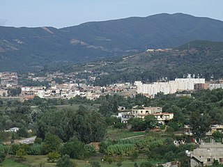
Bir El Arch | |
---|---|
Commune and town | |
Country | |
Province | Sétif Province |
Time zone | CET (UTC+1) |
Bir El Arch is a town and commune in Sétif Province in north-eastern Algeria. [1]
The municipalities of Algeria form the second level of administrative subdivisions of Algeria. As of 2002, there were 1,541 municipalities in the country.
Sétif Province is a province (wilaya) in north-eastern Algeria. Its capital and largest city is Sétif; the next largest city is El Eulma. There is also the World Heritage Site of Djémila there.
Algeria, officially the People's Democratic Republic of Algeria, is a country in the Maghreb region of North Africa. The capital and most populous city is Algiers, located in the far north of the country on the Mediterranean coast. With an area of 2,381,741 square kilometres (919,595 sq mi), Algeria is the tenth-largest country in the world, and the largest in Africa. Algeria is bordered to the northeast by Tunisia, to the east by Libya, to the west by Morocco, to the southwest by the Western Saharan territory, Mauritania, and Mali, to the southeast by Niger, and to the north by the Mediterranean Sea. The country is a semi-presidential republic consisting of 48 provinces and 1,541 communes (counties). It has the highest human development index of all non-island African countries.
Tân Uyên is a district-level town of Bình Dương Province in the Southeast region of Vietnam, about 20 miles northwest of Ho Chi Minh City. The town was formerly the southern part of Tân Uyên District, the northern part is now Bắc Tân Uyên District.
Djemorah is a town and commune in Biskra Province, Algeria. According to the 1998 census it has a population of 11,218.
El Hachimia is a town and commune in Bouïra Province, Algeria. According to the 1998 census it has a population of 13,482.
For the Sufi order of Tamegroute, Morocco see Nasiriyya.
Boukadir is a town and commune in Chlef Province, Algeria. According to the 1998 census it has a population of 41,655.
Ouled Rabah is a town and commune in Jijel Province, Algeria. According to the 1998 census it has a population of 10,142.
Berrouaghia is a town and commune in Médéa Province, Algeria. According to the 1998 census it has a population of 58,780.
Djouab is a town and commune in Médéa Province, Algeria. According to the 1998 census it has a population of 16,751. Djouab is located at 36°08′00″ n., 3°26′00″ e.
Mesra is a town and commune in Mostaganem Province, Algeria. It is the capital of Mesra District. According to the 1998 census it has a population of 20,053.
Djidioua or جيديوة is a town and commune located at 35°5'46 "north, 0°49'50"east in Relizane Province, Algeria and the presumed site of Ancient city and bishopric Catabum Castra, now a Latin Catholic titular see.. by 2008 this had risen to 33,835 and a population density of 254 hab./km².
Ouled Aiche is a town and commune in Relizane Province, Algeria.
Hamadi Krouma is a town and commune in Skikda Province in north-eastern Algeria.
Tamalous is a town and commune in Skikda Province in north-eastern Algeria.
Hanancha, also Hannencha, is a town and commune in Souk Ahras Province in north-eastern Algeria.
Mechroha is a town and commune in Souk Ahras Province in north-eastern Algeria.
Merahna is a town and commune in Souk Ahras Province in north-eastern Algeria.
Guellal is a town and commune in Setif Province in north-eastern Algeria.
Guenzet is a town and commune in Sétif Province in north-eastern Algeria.
Maaouia is a town and commune in Sétif Province in north-eastern Algeria.
Draâ El Mizan is a town and commune in Tizi Ouzou Province in northern Algeria.
Coordinates: 36°08′N5°50′E / 36.133°N 5.833°E
A geographic coordinate system is a coordinate system that enables every location on Earth to be specified by a set of numbers, letters or symbols. The coordinates are often chosen such that one of the numbers represents a vertical position and two or three of the numbers represent a horizontal position; alternatively, a geographic position may be expressed in a combined three-dimensional Cartesian vector. A common choice of coordinates is latitude, longitude and elevation. To specify a location on a plane requires a map projection.
This article about a location in Sétif Province is a stub. You can help Wikipedia by expanding it. |