
The Remutaka Range is the southernmost range of a mountain chain in the lower North Island of New Zealand. The chain continues north into the Tararua, then Ruahine Ranges, running parallel with the east coast between Wellington and East Cape.

Silver Stream Railway is a heritage railway at Silverstream in the Hutt Valley near Wellington, New Zealand. It regularly operates preserved New Zealand Railways Department locomotives along a restored section of the Hutt Valley Line before a deviation was built in 1954.
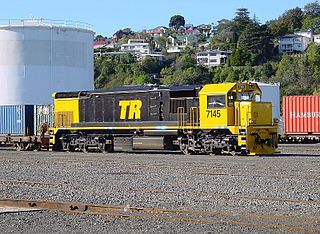
Locomotives of New Zealand is a complete list of all locomotive classes that operate or have operated in New Zealand's railway network. It does not include locomotives used on bush tramways.
The Hedgehope Branch, also known as the Browns Branch, was a branch line railway in Southland, New Zealand that started life in the 1880s as a privately owned bush tramway. It opened as a railway in 1899 and operated until 1968, though the section beyond Browns closed in 1953. It connected with the national rail network in Winton on the Kingston Branch.
The Tuatapere Branch, including the Orawia Branch, was a branch line railway in Southland, New Zealand. Although the Tuatapere and Orawia Branches look like a single line, operationally they were considered separate lines. The first section opened to Riverton in 1879 and reached Tuatapere three decades later. The extension from Tuatapere to Orawia operated from 1925 until 1970. In 1976 the Tuatapere Branch was truncated to Riverton, and was known as the Riverton Branch until 1978, when it closed beyond Thornbury. The remaining portion of the line is now part of the Wairio Branch.
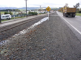
The Ohai Line, formerly known as the Ohai Industrial Line and previously the Wairio Branch and the Ohai Railway Board's line, is a 54.5 km branch line railway in Southland, New Zealand. It opened in 1882 and is one of two remaining branch lines in Southland, and one of only a few in the country. A number of smaller privately owned railways fanned out from Wairio; one of these lines, to Ohai, was originally built by the Ohai Railway Board and was worked by New Zealand Railways from 1990 and incorporated into the national network in 1992.

The NZR WD class was a class of tank locomotive built by Baldwin Locomotive Works to operate on New Zealand's national rail network.
The Bluff Branch, officially the Bluff Line since 2011, is a railway line in Southland, New Zealand that links Invercargill with the port of Bluff. One of the first railways in New Zealand, it opened in 1867 and is still operating. Presently, it essentially functions as an elongated industrial siding.
This is a list of jargon commonly used by railfans and railway employees in New Zealand.
Ngahere is a locality in the Grey District of the West Coast of New Zealand's South Island. The 2013 New Zealand census gave the population of Ngahere and its surrounding area as 363, an increase of 5.2% or 18 people since the 2006 census. Ngahere is located on the south bank of the Grey River, and State Highway 7 and the Stillwater–Westport Line (SWL) railway pass through the village.
Ohai is a town in the Southland region of New Zealand's South Island, 65 kilometres northwest of Invercargill and 25 kilometres west of Winton.
Nightcaps is a town in the Southland region of New Zealand's South Island. It is suggested that Nightcaps got its name either from the snow that is often seen on the Takitimu Mountains, or when early settlers observed fog on the hills known as the Nobbles. State Highway 96 passes through Nightcaps as it runs between Ohai and Winton. The town has a golf course and two primary schools that cater to students from Nightcaps, the surrounding rural area, and since the 2003 closure of its own school, Ohai.
The Hutt Park Railway was a private railway in Petone at the southern end of the Hutt Valley in New Zealand's North Island. It operated from 1885 as a branch from the Hutt Valley section of the Wairarapa Line, from 1915 truncated as an industrial siding.
The Ahuriri Branch, now named the Napier Port Branch, is a 2 km railway branch line off the Palmerston North–Gisborne Line, in Napier, New Zealand. The branch serves the Port of Napier.

Otiria is a rural locality in the Northland Region of New Zealand's North Island. It neighbours Moerewa to the east, with the nearest major town, Kawakawa a few kilometres further eastwards. Other nearby localities include Pokapu to the south, Orauta to the west, and Hupara to the north.

The Cape Foulwind Railway was a branch railway line west of Westport to Cape Foulwind. In 1886 the Westport Harbour Board built the line to their quarry to transport rocks to their breakwaters in the Buller River. In 1888 it was linked to Westport by a road-rail bridge over the Buller River. The iron bridge was planked with kauri forming a 12 ft (3.7 m) wide road. The bridge cost £13,794 and was 1,040 ft (320 m) long. By 1888 it was said to be carrying a considerable passenger traffic, using two coaches. In 1914 a new section of line including a tunnel was built to a new quarry south of the Cape.
The Tāneatua Branch is a 25-kilometre (16 mi) long branch railway line in the Bay of Plenty, New Zealand, running from Hawkens Junction, west of Edgecumbe, to Tāneatua.
The Mount Egmont Branch was a short but steep branch railway line in Taranaki, New Zealand, built to supply rail ballast for the Taranaki and Whanganui districts from a quarry on Mount Taranaki. Although officially known as a branch, the line was more akin to an industrial siding, with only ballast being carried.
The Ohai Railway Board Heritage Trust is a defunct railway preservation society that was formed to preserve Southland's rail history. The trust was formerly based at Wairio on the Wairio Branch in the former Ohai Railway Board workshops, and owned a number of locomotives and items of rolling stock, including the remains of two P class 2-8-0 tender locomotives.
The Ohai Railway Board (ORB) was a short railway in Southland, New Zealand. The railway line itself still exists as the Ohai branch line, but the ORB was dissolved in 1990, and in 1992 the Southland District Council sold the board's assets to New Zealand Rail Limited.
