Bishnupur or Vishnupur may refer to:
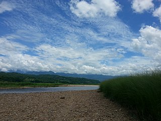
Bara District is one of the seventy–seven districts of Nepal, located in the western part of the Madhesh Province. The district is third richest district in Nepal after Kathmandu and Morang with 3.3% share of total GDP of Nepal and highest per capita income in Madhesh province. Kalaiya serves as the district's headquarter. Bakaiya, Jamuniya, Pasaha, Dudhaura and Bangari are the main rivers of Bara. The main languages spoken in the district are Bhojpuri, Bajjika, Tharu and Nepali.

Saptari, a part of Madhesh Province, is one of the seventy-seven districts of Nepal. Its district headquarter is Rajbiraj. Saptari is an Outer Terai district. This district covers an area of 1,363 km2 (526 sq mi) and has a population (2011) of 639,284 which makes it the 10th most populated district of Nepal. Saptari is renowned for its agricultural output, and is bordered on the east by the massive Sapta Koshi river.
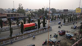
Siraha District, a district in Madhesh Province, is one of the seventy-seven districts of Nepal. It is situated in the Terai belt of Nepal. The district, with Siraha as its district headquarters, covers an area of 1,188 km2 (459 sq mi). It has population of 637,328 according to census of 2011.The District is bordered with Saptari district in the east, Udayapur districting the north, Bihar state of India in the south and Dhanusa district in the west. Majority of the population here is Yadav, Tharus, Sahs(sahukar), Muslims and ethnic minorities with majority population speaking Maithili language and Nepali language.
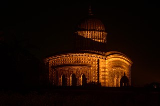
Bishnupur is a city and a municipality of Bishnupur district in the state of West Bengal, India. It is famous for its terracotta temples built by the Malla rulers, historic Radha Krishna temples built during 1600–1800 CE and the Baluchari sarees.
Joyrambati is a Village, in the jurisdiction of Kotulpur police station in the Bishnupur subdivision in Bankura district, West Bengal, India.
Bishnupur is a census town within the jurisdiction of the Bishnupur police station in the Bishnupur I CD block in the Alipore Sadar subdivision of the South 24 Parganas district in the Indian state of West Bengal.
Bishnupur is a village and village development committee in Bara District in the Narayani Zone of south-eastern Nepal. At the time of the 1991 Nepal census it had a population of 2,444 persons living in 344 individual households.

The Eastern Development Region was one of Nepal's five development regions. It is also known as Kirata region. It was located at the eastern end of the country with its headquarters at Dhankuta. The town of Dhankuta was the headquarter of the Eastern Region, as well as the headquarter of the Dhankuta District.
Majhora Bishnupur is a village development committee in Mahottari District in the Janakpur Zone of south-eastern Nepal. In the 1991 Nepal census it had a population of 4286 people in 739 individual households.
Parsa Pateli is a village development committee in Mahottari District in the Janakpur Zone of south-eastern Nepal. At the time of the 1991 Nepal census it had a population of 2958 people living in 515 individual households.
Bishnupur Pra. Ma. is a village development committee in Siraha District in the Sagarmatha Zone of south-eastern Nepal. At the time of the 2011 Nepal census it had a population of 5208.
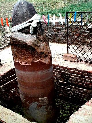
Gotihawa is a village development committee located about 4 kilometres (2.5 mi) southeast of Kapilavastu, in Kapilvastu District, in the Lumbini Zone of southern Nepal. At the time of the 1991 Nepal census it had a population of 3,335 people living in 567 individual households.
Bishnupur is a community development block that forms an administrative division in the Bishnupur subdivision of the Bankura district in the Indian state of West Bengal.
Bishnupur I is a community development block that forms an administrative division in the Alipore Sadar subdivision of the South 24 Parganas district in the Indian state of West Bengal.
Bishnupur II is a community development block that forms an administrative division in the Alipore Sadar subdivision of the South 24 Parganas district in the Indian state of West Bengal.
Bishnupur is a rural municipality in Saptari District in the Sagarmatha Zone of south-eastern Nepal. At the time of the 2017 Nepal census it had a population of 23,035 people living in 6554 individual households.
Bishnupur is a rural municipality in Siraha District in Province No. 2 of south-eastern Nepal. At the time of the 2011 Nepal census it had a population of 18,522 people living.
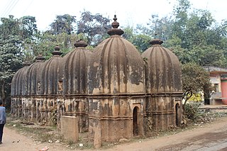
Joykrishnapur is a village in the Bishnupur CD block in the Bishnupur subdivision of the Bankura district in the state of West Bengal, India.
This page is based on this
Wikipedia article Text is available under the
CC BY-SA 4.0 license; additional terms may apply.
Images, videos and audio are available under their respective licenses.


