It is proposed that this article be deleted because of the following concern: Non notable independent (fee paying) primary school. No in depth reliable sources, no claims of importance or significance. Wikipedia is not a listing site for schools or businesses WP:NOTDIR. Article fails WP:GNG and WP:ORG. If you can address this concern by improving, copyediting, sourcing, renaming, or merging the page, please edit this page and do so. You may remove this message if you improve the article or otherwise object to deletion for any reason. Although not required, you are encouraged to explain why you object to the deletion, either in your edit summary or on the talk page. If this template is removed, do not replace it . The article may be deleted if this message remains in place for seven days, i.e., after 13:22, 18 July 2018 (UTC). Nominator: Please consider notifying the author/project: {{subst:proposed deletion notify |Bishopsgate School|concern=Non notable independent (fee paying) primary school. No in depth reliable sources, no claims of importance or significance. Wikipedia is not a listing site for schools or businesses [[WP:NOTDIR]]. Article fails [[WP:GNG]] and [[WP:ORG]].}} ~~~~ |
This article needs additional citations for verification .(June 2011) (Learn how and when to remove this template message) |
Coordinates: 51°26′24″N0°34′52″W / 51.440°N 0.581°W

A geographic coordinate system is a coordinate system that enables every location on Earth to be specified by a set of numbers, letters or symbols. The coordinates are often chosen such that one of the numbers represents a vertical position and two or three of the numbers represent a horizontal position; alternatively, a geographic position may be expressed in a combined three-dimensional Cartesian vector. A common choice of coordinates is latitude, longitude and elevation. To specify a location on a plane requires a map projection.
| Bishopsgate School | |
|---|---|
 | |
| Address | |
| Bishopsgate Road Englefield Green , Surrey , TW20 0YJ United Kingdom | |
| Information | |
| Type | Independent School |
| Motto | Nil Nisi Optimum (Nothing but the best.) |
| Chairman of Governors | Mr Tim Eddis |
| Headmaster | Mr Rob Williams |
| Staff | c 69 |
| Gender | Mixed |
| Age | 3to 13 |
| Enrollment | c 370 |
| Houses | Frobisher, Livingston, Magellan, Shackleton |
| Colour(s) | Black and Red |
| Website | www.bishopsgate-school.co.uk |
Bishopsgate School is a non-denominational co-educational independent school, with pupils aged 3 to 13, in Englefield Green, Surrey.
An independent school is independent in its finances and governance. It is usually not dependent upon national or local government to finance its operations, nor reliant on taxpayer contributions, and is instead funded by a combination of tuition charges, donations, and in some cases the investment yield of a financial endowment. It is typically governed by a board of governors which is elected independently of government, and has a system of governance that ensures its independent operation.
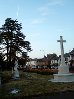
Englefield Green is a large village in northern Surrey, England. It is home to Royal Holloway, University of London, the south eastern corner of Windsor Great Park, borders the town of Egham and more tightly-clustered village of Virginia Water. Its nearest main commercial hubs are Staines-upon-Thames and Windsor. The village grew from a hamlet in Egham in the 19th century, when much of it was sold off from the Great Park in the Crown Estate, and is mostly residential. There are pretty gardens as well as some Cycle paths. The village is not bisected by trunk transport infrastructure, however it is connected to the M25 motorway by the Egham bypass of the A30 road, and is centred 1 mile (1.6 km) from Egham railway station.

Surrey is a subdivision of the English region of South East England in the United Kingdom. A historic and ceremonial county, Surrey is also one of the home counties. The county borders Kent to the east, East and West Sussex to the south, Hampshire to the west, Berkshire to the northwest, and Greater London to the northeast.
The school is set in 20 acres (81,000 m2) of land adjacent to Windsor Great Park. It is classed as an IAPS Preparatory School.

Windsor Great Park is a Royal Park of 2,020 hectares, including a deer park, to the south of the town of Windsor on the border of Berkshire and Surrey in England. The park was, for many centuries, the private hunting ground of Windsor Castle and dates primarily from the mid-13th century. Historically the park covered an area many times the current size known as Windsor Forest, Windsor Royal Park or its current name. The park is managed and funded by the Crown Estate. Most parts of the park are open to the public, free of charge, from dawn to dusk, although there is a charge to enter Savill Garden.
The school stands on the site of Scaitcliffe, a former preparatory boys school. Bishopsgate School was formed by the merging of Scaitcliffe and Virginia Water preparatory school in 1996. There are 350 pupils.
Scaitcliffe was a day/boarding prep school for boys aged 6-13 in Egham, Surrey, UK. After merging with Virginia Water School, the school is now co-educational and known as Bishopsgate School. The school is located in a small village in Egham called Englefield Green near Windsor Great Park.

Virginia Water is a much-wooded commuter town or village in northern Surrey, home to the Wentworth Estate and the Wentworth Club. The place occupies a large minority of the Borough of Runnymede. Its name is shared with the lake on its western boundary: Windsor Great Park. Virginia Water is close to the M25, M4 and M3 motorways. Heathrow Airport is seven miles to the north-east.
The age range is 3 years old to 13 years old. The headmaster is Mr Rob Williams
The school's gross income for the fiscal year ending August 2012 was £3.52 million, [1] of which 1.71 million pounds was spent on the 50 teachers. [2]