
Oglala Lakota County is a county in southwestern South Dakota, United States. The population was 13,672 at the 2020 census. Oglala Lakota County does not have a functioning county seat; Hot Springs in neighboring Fall River County serves as its administrative center. The county was created as a part of the Dakota Territory in 1875, although it remains unorganized. Its largest community is Pine Ridge.

Minnehaha County is a county on the eastern border of the state of South Dakota. As of the 2020 census, the population was 197,214, making it the state's most populous county. It contains over 20% of the state's population. Its county seat is Sioux Falls, South Dakota's largest city. The county was created in 1862 and organized in 1868. Its name was derived from the Sioux word Mnihaha, meaning "rapid water," or "waterfall".

Miner County is a county in the U.S. state of South Dakota. As of the 2020 census, the population was 2,298. Its county seat is Howard. The county was created in 1873 and organized in 1880.

Day County is a county in the U.S. state of South Dakota. As of the 2020 census, the population was 5,449. Its county seat is Webster. The county is named for Merritt H. Day, pioneer and 1879 Dakota Territory legislator.
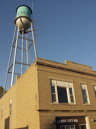
Nelson County is a county in the U.S. state of North Dakota. As of the 2020 census, the population was 3,015. Its county seat is Lakota.

Dakota County is the third-most populous county in the U.S. state of Minnesota, located in the east central portion of the state. As of the 2020 census, the population was 439,882. The population of Dakota County was estimated to be 442,038 in 2021. The county seat is Hastings. Dakota County is named for the Dakota Sioux tribal bands who inhabited the area. The name is recorded as "Dahkotah" in the United States Census records until 1851. Dakota County is included in the Minneapolis–St. Paul–Bloomington, MN–WI Metropolitan Statistical Area, the sixteenth largest metropolitan area in the United States with about 3.64 million residents. The largest city in Dakota County is the city of Lakeville, the eleventh-largest city in Minnesota and sixth-largest Twin Cities suburb. The county is bordered by the Minnesota and Mississippi Rivers on the north, and the state of Wisconsin on the east.

Scouting in South Dakota has a long history, from the 1910s to the present, and serves thousands of youth in programs that suit the environment in which they live.
Watertown is a city in and the county seat of Codington County, South Dakota, United States. Watertown is home to the Redlin Art Center which houses many of the original art works produced by Terry Redlin, one of America's most popular wildlife artists. Watertown is located between Pelican Lake and Lake Kampeska, from which Redlin derived inspiration for his artwork.

Clear Lake is a city in and the county seat of Deuel County, South Dakota, United States. The population was 1,218 at the 2020 census.

Madison is a city in Lake County, South Dakota, United States. The population was 6,191 at the 2020 census. It is the county seat of Lake County and is home to Dakota State University.

Canton is a city in and the county seat of Lincoln County, South Dakota, United States. Canton is located 20 minutes south of Sioux Falls in southeastern South Dakota. Canton is nestled in the rolling hills of the Sioux Valley, providing an abundance of recreational activities with the Big Sioux River bordering the eastern side, Newton Hills State Park to the south, and Lake Alvin to the north. The city was named by Norwegian settler and former legislator James M. Wahl. The population was 3,066 as of the 2020 census.
Bitter Lake may refer to:
The Drift Prairie is a geographic region of North Dakota and South Dakota.

The Lake Traverse Indian Reservation is the homeland of the federally recognized Sisseton Wahpeton Oyate, a branch of the Santee Dakota group of Native Americans. Most of the reservation covers parts of five counties in northeastern South Dakota, while smaller parts are in two counties in southeastern North Dakota, United States. The Reservation was created by treaty on April 22 1867 and called the Flatiron Reservation in reference to its triangular shape. It was created for the "friendly Dakota" from the Minnesota hostilities of 1862-1866. Signatories of the treaty were Gabriel Renville, John Otherday plus twenty-one other Sisseton and Wahpeton leaders. Gabriel Renville was the first Chief of the Reservation.
The Dakota are a Native American tribe and First Nations band government in North America. They compose two of the three main subcultures of the Sioux people, and are typically divided into the Eastern Dakota and the Western Dakota.

Lake Herman State Park is a South Dakota state park in Lake County, South Dakota in the United States. The park is open for year-round recreation including camping, swimming, fishing, hiking and boating on the 1,350-acre Lake Herman. There are 72 campsites which feature electric hook-ups and 4 cabins.
Roy Lake State Park is a South Dakota state park in Marshall County, South Dakota in the United States. The park is divided in two sections on Roy Lake, and is open for year-round recreation including camping, beaches, swimming, fishing, hiking and boating. The Roy Lake Resort & Lodge is located in the park. Boat ramps are available and visitors can rent boats from the resort.
Anderson Lake is a lake in South Dakota, in the United States. It is located less than 1 mile (1 km) east of Bitter Lake, with its closest urban population center being located in Waubay, approximately 4 mi (6.5 km) northwest of the lake.
Bitter Lake is a lake in South Dakota, in the United States.
Bitter Creek is a stream in the U.S. state of South Dakota.
