
The Rockaway River is a tributary of the Passaic River, approximately 35 mi (56 km) long, in northern New Jersey in the United States. The upper course of the river flows through a wooded mountainous valley, whereas the lower course flows through the populated New Jersey suburbs and former industrial area west of New York City. It drains an area of approximately 130 sq mi (340 km²).
Black Brook may refer to:
The North Branch Raritan River is a tributary of the Raritan River in central New Jersey in the United States.

The Millstone River is a 38.6-mile-long (62.1 km) tributary of the Raritan River in central New Jersey in the United States.

Stony Brook is a tributary of Green Brook in central New Jersey in the United States.
The Lamington River, known as the Black River upstream of Pottersville, is a tributary of the North Branch Raritan River in central New Jersey in the United States.

The Black River, known as the Lamington River downstream of Pottersville, is a tributary of the North Branch Raritan River in central New Jersey in the United States.
Primrose Brook is a tributary of the Passaic River in the Jockey Hollow section of the Morristown National Historical Park of northern New Jersey in the United States.

The Cow Yard Brook is a small tributary of the Oakeys Brook, in central South Brunswick, New Jersey in the United States.
Heathcote Brook, also known as Heathcote Run, is a tributary of the Millstone River in central New Jersey in the United States.

Devils Brook is a tributary of the Millstone River in central New Jersey in the United States.

Cranbury Brook, also known as Cranberry Brook, is a tributary of the Millstone River in Middlesex and Monmouth Counties, New Jersey in the United States.
Rock Brook is a tributary of Beden Brook in Somerset County, New Jersey in the United States.

Harrys Brook, also known as the H. Greenlands Brook, is a tributary of the Millstone River in Mercer County, New Jersey in the United States.
Bear Brook is a tributary of the Millstone River in central New Jersey in the United States.

Black Brook is a tributary of the Passaic River that flows through the Great Swamp National Wildlife Refuge in Morris County, New Jersey, in the United States. Black Brook rises at the north east base of Long Hill, Chatham Township, Morris County, flows westerly along the hill, by a course of 7 or 8 miles to its recipient in Morris Township, New Jersey. Due to the chemical fertilizer usage in nearby areas, Black Brook has the second worst water quality after Loantaka Brook.

The Patriots' Path is a multi-use trail in New Jersey, United States, with a total length of 90 miles (145 km).

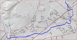
The Whippany River Watershed Action Committee (WRWAC) is a member-based, nonprofit 501(c)(3) organization, which identifies and implements projects to preserve and protect water and the surrounding natural areas. The Whippany River Watershed is an area of 69.3 square miles within Morris County in north central New Jersey. The 16-mile long Whippany River serves the only significant unconsolidated aquifer in northern New Jersey and is a source of drinking water for more than 1 million people.

Morristown & Erie Railway is a short-line railroad based in Morristown, New Jersey, chartered in 1895 as the Whippany River Railroad. It operates freight rail service in Morris County, New Jersey and surrounding areas on the original Whippany Line between Morristown and Roseland, as well as the Morris County-owned Dover & Rockaway Branch, Chester Branch, and High Bridge Branch. The M&E also operated the Maine Eastern Railroad from November 2003 to December 31, 2015.


