
Rancocas Creek is a tributary of the Delaware River in southwestern New Jersey in the United States. The creek's main stem is 8.3 miles (13.4 km) long, with a North Branch of 28.3 miles (45.5 km) and a South Branch flowing 21.7 miles (34.9 km). The creek system drains a rural agricultural and forested area on the western edge of the Pinelands north and northeast of Camden and the New Jersey suburbs of Philadelphia.
Albertson Brook, also called Albertsons Brook, is the name of Nescochague Creek upstream of the confluence with Great Swamp Brook in the southern New Jersey Pine Barrens in the United States.
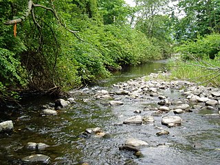
Friendship Creek is a 9.4-mile-long (15.1 km) tributary of the South Branch Rancocas Creek in southern New Jersey in the United States.
Sluice Creek is a 5.3-mile-long (8.5 km) tributary of Dennis Creek in Cape May County, New Jersey in the United States.

Wawayanda Creek is the name of Pochuck Creek above its confluence with the tributary Black Creek.
Clove Brook is a 12.0-mile-long (19.3 km) tributary of Papakating Creek in Sussex County, New Jersey in the United States.
Bisphams Mill Creek is a 5.9-mile-long (9.5 km) tributary of Greenwood Branch in the southern New Jersey Pine Barrens in the United States.
Great Swamp Brook is a 9.1-mile-long (14.6 km) tributary of Nescochague Creek in the southern New Jersey Pine Barrens in the United States.

Green Creek is an unincorporated community located within Middle Township, in Cape May County, New Jersey, United States. It is located on Route 47. It is a very low-lying area with a highest elevation of just above 20 feet (6.1 m). The community is located about 3 miles (4.8 km) west of Rio Grande and about 2 miles (3.2 km) from the Delaware Bay. It is mostly residential with areas of agriculture and commerce along the main road, Delsea Drive. The United States Postal Service ZIP Code is 08219.
Black Meadow Creek is a 9.7-mile-long (15.6 km) tributary of the Otter Kill in Orange County, New York, in the United States. Via the Otter Kill, it is part of the Moodna Creek watershed, flowing onward to the Hudson River, in one of New York State's most biodiverse natural areas. Home to 13 species of salamander as well as to New York's largest population of the Northern Cricket Frog, the state's only listed "Endangered" frog species, the creek area is considered by biologists to be one of the state's herpetological "hot spots". Black Meadow Creek has several confirmed bald eagle nests along its length.

South Dennis is an unincorporated community located within Dennis Township in Cape May County, New Jersey, United States. It is part of the Ocean City Metropolitan Statistical Area. Its postal ZIP Code is 08245.
The Forked River Nuclear Power Plant was a proposed nuclear power plant in Lacey Township in Ocean County, New Jersey. It was proposed as a single 1,070 MW reactor in 1969 to be built by Combustion Engineering and operated by Jersey Central Power and Light. The facility would have been located on a site between JCP&L's existing Oyster Creek Nuclear Generating Station and the Garden State Parkway. Unlike the Oyster Creek Plant, the Forked River Plant would have a cooling tower to prevent the release of hot water into Oyster Creek and Barnegat Bay.
The Sussex County Snow Belt is a microclimate snowbelt region in Sussex County, New Jersey in northwest New Jersey. The belt is part of New Jersey's Northern Climate Zone, which receives about forty to fifty inches of snow per year. The snow belt generally receives more snow than the rest of Northern New Jersey and the Northern Climate Zone because of slight orographic lift of the Kittatinny Ridge, which increases humidity and precipitation.

Baldwins Creek is a tributary of the Stony Brook in Mercer County, New Jersey in the United States.

Timber Run is a tributary of Rocky Brook in Mercer County, New Jersey in the United States.

Jessie Creek Winery is a winery in the Dias Creek section of Middle Township in Cape May County, New Jersey. The vineyard was first planted in 2002, and opened to the public in 2012. Jessie Creek has 5 acres of grapes under cultivation, and produces 1,200 cases of wine per year. The winery's name is an amalgamation of Jessie, the name of the former owner's mother, and Dias Creek.

Neepaulakating Creek is a 2.4-mile long (3.8 km) tributary of Papakating Creek in Wantage Township in Sussex County, New Jersey in the United States. It is one of three streams feeding the Papakating Creek, a major contributor to the Wallkill River. Although the stream was dammed in the 1950s to create Lake Neepaulin as the focal point of a private residential development, the stream did not receive a name until 2002. Residents chose a name that combined elements of the names "Neepaulin" and "Papakating", and submitted a proposal to the United States Board of Geographic Names. The name was approved in 2004.

Swartswood Lake is a freshwater lake located in Stillwater and Hampton townships in Sussex County, New Jersey in the United States. The lake is a 520-acre (210 ha) glacial lake that is the third-largest freshwater lake in New Jersey. The lake stretches 3 miles (north-to-south) and 1 mile wide ; and has an average depth of 22 feet (6.7 m) with a maximum depth of 42 feet (13 m). The lake is the focus of Swartswood State Park a 3,460-acre (14.0 km2) protected area administered by the New Jersey Division of Parks and Forestry.
West Branch Papakating Creek is a tributary of Papakating Creek located in Frankford and Wantage townships in Sussex County, New Jersey, in the United States.


