Spanish Fort is a city in Baldwin County, Alabama, United States, located on the eastern shore of Mobile Bay. The 2010 census lists the population of the city as 6,798. It is a suburb of Mobile and is part of the Daphne-Fairhope-Foley micropolitan area.

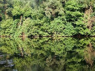
The Tensaw River is a river in Baldwin County, Alabama.

The Battle of Fort Blakeley took place from April 2 to April 9, 1865 in Baldwin County, Alabama, about 6 miles (9.7 km) north of Spanish Fort, AL, as part of the Mobile Campaign of the American Civil War. At the time, Blakeley, Alabama had been the county seat of Baldwin County.
The Battle of Spanish Fort took place from March 27 to April 8, 1865 in Baldwin County, Alabama, as part of the Mobile Campaignof the Western Theater of the American Civil War.
The Alabama, Tennessee and Northern Railroad was a short line railroad which operated in the state of Alabama. The company was founded in 1897 and merged with the St. Louis–San Francisco Railway in 1971. The company was also known as the "Port of Mobile Route."

Metropolitan Mobile has a population of 412,992 within Mobile County Alabama in the southwestern tip of Alabama. The Mobile metropolitan area is the third-largest metropolitan area in the state of Alabama.

Blakeley is a ghost town in Baldwin County, Alabama, United States. During the height of its existence, Blakeley was a thriving town which flourished as a competitor to its western neighbor, Mobile. Blakeley was the county seat for Baldwin County from 1810 until 1868, when the county government was moved south to Daphne. It was the location of a major fort during the Civil War. One of the last battles of the Civil War was fought here in April 1865, as Union soldiers overran Confederates. The town is now in an Alabama historic state park known as Historic Blakeley State Park, north of Spanish Fort.

USS Rodolph (1863) was a steamer commissioned by the Union Navy during the American Civil War.

The Jubilee Parkway is a pair of parallel concrete viaduct bridges that carry Interstate 10 across Mobile Bay from the George Wallace Tunnel on Blakeley Island in Mobile, Alabama eastbound to Spanish Fort/Daphne, Alabama. The bridges are similar in design to the pre-Hurricane Katrina I-10 Twin Span Bridge near New Orleans, Louisiana. Each of the two bridges is two lanes wide, for a total of four lanes, and 7.5 miles (12.1 km) long. The parkway was completed in 1978 and crosses the northern portion of Mobile Bay, running roughly parallel to the nearby Battleship Parkway, with which it has an interchange. It was named for the jubilee phenomena that occurs intermittently in Mobile Bay, but is commonly referred to locally and in the media as the "Bayway".
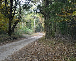
Historic Blakeley State Park is a park located on the site of the former town of Blakeley in Baldwin County, Alabama on the Tensaw River delta. The park encompasses an area once occupied by settlers in what was a thriving community on the river. Later, Confederate soldiers were garrisoned here and fought in the last major battle of the U.S. Civil War against superior Union forces.

The Mobile–Tensaw River Delta is the largest river delta and wetland in Alabama. It encompasses approximately 260,000 acres (110,000 ha) in a 40-by-10-mile area and is the second largest delta in the Contiguous United States.

CSS Huntsville was a Confederate ironclad floating battery built at Selma, Alabama from 1862 to 1863 during the American Civil War.
CSSTuscaloosa was a screw ironclad steamer ram in the Confederate States Navy that was laid down by the Confederate Naval Works at Selma in 1862.

Blakeley Island is an island in the U.S. state of Alabama, within the city limits of Mobile. Located on the northwestern coast of Mobile Bay, it is bounded on the west by the Mobile River, on the south by Pinto Island and Mobile Bay, and on the east and north by the Spanish River. Blakeley serves as a vital road connection point between the Bankhead Tunnel, George Wallace Tunnel, and Cochrane–Africatown USA Bridge on its east side and the Battleship Parkway and Jubilee Parkway on its west side. The northern end is largely undeveloped, while the southern end is dedicated to industrial uses, primarily petrochemical storage and shipbuilding. The largest complex is the shipyards of Austal USA. Approximately 1.25 miles (2.01 km) at its widest and 6 miles (9.7 km) at its longest, it has an average elevation of 7 feet (2.1 m). It, along with downtown, forms District Two of Mobile's city council districts.

Pinto Island is an island in the U.S. state of Alabama, within the city limits of Mobile. Located on the northwestern coast of Mobile Bay, it is bounded on the west by the Mobile River, on the south by Mobile Bay, on the east by the Spanish River, and on the north by Pinto Pass and Blakeley Island. It is dedicated to industrial uses, primarily shipbuilding. The BAE Systems Southeast Shipyards was originally the site of the Alabama Drydock and Shipbuilding Company, and most recently Atlantic Marine, which was acquired by BAE in 2010. The Alabama State Port Authority operates a terminal on the southern end of the island for the ThyssenKrupp steel plant upriver in Calvert.Austal USA is also part of this Island chain taking up most of the central part of this island, & has a stocking shop channel on the west bank, of the island in June 2018 BAE Systems Southeast completed a total shutdown of all facilities on Pinto Island, and selling all there land and Ship Yards to Austal USA, giving Austal USA 51% control of Pinto Island land area from center to South shore.
The Spanish River is a brackish distributary river that forms part of the border between Baldwin and Mobile counties in Alabama. It is approximately 8 miles (13 km) long and is influenced by tides. It begins at the northernmost tip of Blakeley Island, where it diverges from the Mobile River, at 30.772°N 88.0222°W. From there it flows along the eastern edge of Blakeley and Pinto islands, and discharges into Mobile Bay south of Pinto Island, at 30.665°N 88.021°W.
The Middle River is a distributary river in Baldwin County, Alabama, which forms part of the Mobile-Tensaw River Delta. It branches off from the Tensaw River at 31.021°N 87.950°W. From there it flows southward for approximately 9.5 miles (15.3 km) before rejoining the Tensaw at 30.923°N 87.913°W.

Bloody River is a river in Nunavut and the Northwest Territories, Canada. It flows into the Dease Arm of Great Bear Lake in the Northwest Territories at approximately 66°56′01″N120°34′07″W.