Blaker

Last updated
Blaker
Village
Country Norway
Region Østlandet
County Akershus
Time zone CET (UTC+01:00)
  Summer (DST) CEST (UTC+02:00)
Blaker church TRS 070609 005.jpg
Blaker church

Blaker is a village and a former municipality of Akershus county, Norway.

Akershus County (fylke) of Norway

Akershus[²ɑːkəʂˌhʉːs](listen) is a county in Norway, bordering Hedmark, Oppland, Buskerud, Oslo, and Østfold; it also has a short border with Sweden (Värmland). Akershus, with a little over 614,000 inhabitants, is the second most populated county by population after Oslo. The county is named after Akershus Fortress. The county administration is in Oslo, which is not part of the county per se.

Norway constitutional monarchy in Northern Europe

Norway, officially the Kingdom of Norway, is a Nordic country in Northwestern Europe whose territory comprises the western and northernmost portion of the Scandinavian Peninsula; the remote island of Jan Mayen and the archipelago of Svalbard are also part of the Kingdom of Norway. The Antarctic Peter I Island and the sub-Antarctic Bouvet Island are dependent territories and thus not considered part of the kingdom. Norway also lays claim to a section of Antarctica known as Queen Maud Land.

Contents

History

The municipality was established on 1 July 1919, when Aurskog was split in two. At the time of establishment, Blaker had a population of 2,533. On 1 January 1962, Blaker with its then 2,345 inhabitants was merged with Sørum to form the new Sørum municipality.

Aurskog human settlement

Aurskog is a former municipality in Akershus county, Norway. The administrative centre was Aursmoen.

Sørum Municipality in Akershus, Norway

Sørum is a municipality in Akershus county, Norway. It is part of the traditional region of Romerike. The administrative centre of the municipality is the village of Sørumsand. Sørum was established as a municipality on 1 January 1838. The municipality of Blaker was merged with Sørum on 1 January 1962.

The village is situated on the east bank of Glomma, with a railway station on Kongsvingerbanen and Blaker Fortress. The fortress was in use from 1683, expanded to a bastioned star fort in the middle of the 18th century, and decommissioned in 1820. Blaker Church (Blaker Kirke) was built in 1881. The church was huilt of wood and has 450 seats. [1]

Glomma river in Norway

The Glomma, or Glåma, is Norway's longest and most voluminous river. With a total length of 621 kilometres, it has a drainage basin that covers fully 13% of Norway's surface area, all in the southern part of the country.

Blaker Fortress

Blaker Fortress is a former defense facility located at the village of Blaker in Akershus, Norway.

Notable residents

Olav Djupvik was a Norwegian politician with the Christian Democratic Party.

Christian Birch-Reichenwald Norwegian politician

Christian Birch-Reichenwald was a Norwegian jurist and politician who served as mayor of Oslo, Norway.

The name

Blaker is an old district name (Norse Blakar). The meaning is unknown.

Old Norse North Germanic language

Old Norse was a North Germanic language that was spoken by inhabitants of Scandinavia and their overseas settlements from about the 9th to the 13th century.

Related Research Articles

Bærum Municipality in Akershus, Norway

Bærum is a municipality in Akershus County, Norway. The administrative centre of the municipality is the town of Sandvika. Bærum was established as a municipality on 1 January 1838. A suburb of Oslo, Bærum is located on the west coast of the city.

Nesodden Municipality in Akershus, Norway

Nesodden is a municipality in Akershus county, Norway. It is part of the traditional region of Follo. The administrative centre of the municipality is Nesoddtangen. The parish of Næsodden was established as a municipality on 1 January 1838. The new municipality of Oppegård was separated from Nesodden on 1 July 1915.

Elverum Municipality in Hedmark, Norway

Elverum  is a city and municipality in Hedmark county, Norway. It is part of the traditional region of Østerdalen. The administrative centre of the municipality is the town of Elverum. The municipality of Elverum was established on 1 January 1838 . Elverum lies at an important crossroads, with Hamar to the west, Kongsvinger to the south, and Trysil on the Swedish border to the northeast. It is bordered on the north by Åmot municipality, in the northeast by Trysil municipality, in the southeast by Våler, and in the west by Løten.

Sauherad Municipality in Telemark, Norway

Sauherad is a municipality in Telemark county, Norway. It is part of the traditional region of Midt-Telemark. The administrative centre of the municipality is the village of Akkerhaugen. The municipality borders Kongsberg, Skien, Nome, Bø, and Notodden.

Marker, Norway Municipality in Østfold, Norway

Marker is a municipality in Østfold county, Norway. The administrative centre of the municipality is the village of Ørje. Marker was created as a new municipality on 1 January 1964 following the merger of the two former municipalities of Rødenes and Øymark.

Fredriksvern

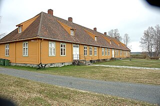
Fredriksvern was an important Norwegian naval base, just south of Larvik in Vestfold. The town of Stavern has in many ways come to be because of this naval base.

Furnes, Norway village in the Ringsaker municipality of Hedmark County, Norway

Furnes is a village in the Ringsaker municipality of Hedmark County, Norway.

Aulifeltet Village in Østlandet, Norway

Aulifeltet is a village in the municipality of Nes, Akershus, Norway. Its population is 2,683, of which 512 people live within the border of the neighboring municipality Sørum.

Frogner, Akershus Village in Østlandet, Norway

Frogner is a village in Sørum municipality, Norway. Its population is 1,174.

Dokka

Dokka is the administrative centre of Nordre Land municipality, in Oppland county, Norway.

Fluberg

Fluberg is a village, a parish and a former municipality, now part of the municipality of Søndre Land in Oppland, Norway.

Nes, Hedmark peninsula and former municipality in Hedmark county, Norway

Nes is a former municipality in Hedmark county, Norway.

Eggedal

Eggedal is a valley and parish in Buskerud county, Norway. It consisting of the northwestern half of the municipality of Sigdal.

Hallingby railway station in Ringerike, Norway

Hallingby is a village in Ringerike municipality in the county of Buskerud, Norway.

Tyristrand railway station in Ringerike, Norway

Tyristrand is a village in Ringerike municipality in Buskerud county, Norway.

Kolbu urban area in Norway

Kolbu is a village in Østre Toten municipality, Oppland county, Norway. It is located in the traditional region of Toten. Kolbu is situated about six kilometers southwest of the municipal center of Lena.

Lindeberg is a village in Sørum municipality, Norway. Its population is 926.

Adam Abraham von Gaffron und Oberstradam was a member of the Silesian ancient noble family, Gaffron.

References

Coordinates: 60°00′14″N11°18′06″E / 60.00389°N 11.30167°E / 60.00389; 11.30167

Geographic coordinate system Coordinate system

A geographic coordinate system is a coordinate system that enables every location on Earth to be specified by a set of numbers, letters or symbols. The coordinates are often chosen such that one of the numbers represents a vertical position and two or three of the numbers represent a horizontal position; alternatively, a geographic position may be expressed in a combined three-dimensional Cartesian vector. A common choice of coordinates is latitude, longitude and elevation. To specify a location on a plane requires a map projection.