Blendville, Joplin

Last updated

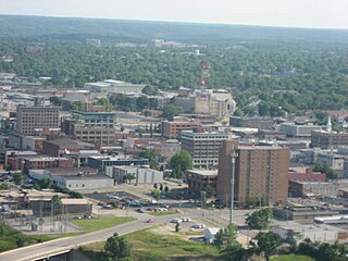
Blendville is a neighborhood of Joplin, Missouri. [1]

Joplin, Missouri City in Missouri, United States

Joplin is a city in southern Jasper County and northern Newton County in the southwestern corner of the U.S. state of Missouri. Joplin is the largest city in Jasper County, though it is not the county seat. As of the 2010 census, the city's population was 50,150. Joplin is the main hub of the three-county Joplin-Miami, Missouri-Oklahoma Metro area.

History

Blendville was originally called Blend City, and under the latter name was founded in the 1870s, and named for ore blending near the original town site. [2] A post office called Blendsville was established in 1890, and remained in operation until 1900. [3] The community was annexed to Joplin in 1892. [1]

A post office is a public department that provides a customer service to the public and handles their mail needs. Post offices offer mail-related services such as acceptance of letters and parcels; provision of post office boxes; and sale of postage stamps, packaging, and stationery. In addition, many post offices offer additional services: providing and accepting government forms, processing government services and fees, and banking services. The chief administrator of a post office is called a postmaster.

Related Research Articles

Plew, Missouri human settlement in United States of America

Plew is a small unincorporated community in western Lawrence County, Missouri, United States. Plew is located on former U.S. Route 66, now Route 96.

Scotland is an unincorporated community in Jasper County, Missouri, United States. It is located slightly northwest of the junction of Missouri Route 66 and Interstate 44/US 71.

Georgia City, Missouri Town (now defunct) in Missouri, United States

Georgia City is the name of a former town in Jasper County, Missouri, United States, approximately 15 miles north of Joplin.

Olympia is an unincorporated community in Cedar County, in the U.S. state of Missouri.

Piper is an unincorporated community in Henry County, in the U.S. state of Missouri.

Belleville is an unincorporated community in Jasper County, Missouri, United States.

Galesburg is an unincorporated community in northwest Jasper County in southwest Missouri, United States. The community is located on the south bank of the Spring River, approximately twelve miles north of Joplin.

Joplin Creek is a stream in Jasper County in the U.S. state of Missouri.

Knights is an unincorporated community in Jasper County, in the U.S. state of Missouri.

Maple Grove is an unincorporated community in Jasper County, in the U.S. state of Missouri.

Medoc is an unincorporated community in Jasper County, in the U.S. state of Missouri.

Parshley is an unincorporated community in southern Jasper County, in the U.S. state of Missouri.

Preston is an unincorporated community in Jasper County, in the U.S. state of Missouri.

Prosperity is an unincorporated community in Jasper County, in the U.S. state of Missouri.

Smithfield is an unincorporated community in Jasper County, in the U.S. state of Missouri.

Tuckahoe is an unincorporated community in Jasper County, in the U.S. state of Missouri.

Joplin Township is an inactive township in Jasper County, in the U.S. state of Missouri.

Bowers Mill is an unincorporated community in Jasper and Lawrence counties, in the U.S. state of Missouri. The community and mill are located on the Spring River midway between Mount Vernon to the east and Carthage to the west. La Russell lies just to the south.

Clarkson is an unincorporated community in Lawrence County, in the U.S. state of Missouri.

Red Oak is an unincorporated community in Lawrence County, in the U.S. state of Missouri.
References

  1. 1 2 U.S. Geological Survey Geographic Names Information System: Blendville (historical)
  2. "Jasper County Place Names, 1928–1945 (archived)". The State Historical Society of Missouri. Archived from the original on 24 June 2016. Retrieved 17 October 2016.
  3. "Post Offices". Jim Forte Postal History. Retrieved 17 October 2016.

Coordinates: 37°04′02″N94°31′36″W / 37.0672833°N 94.526614°W / 37.0672833; -94.526614

Geographic coordinate system Coordinate system

A geographic coordinate system is a coordinate system that enables every location on Earth to be specified by a set of numbers, letters or symbols. The coordinates are often chosen such that one of the numbers represents a vertical position and two or three of the numbers represent a horizontal position; alternatively, a geographic position may be expressed in a combined three-dimensional Cartesian vector. A common choice of coordinates is latitude, longitude and elevation. To specify a location on a plane requires a map projection.