Bloxworth Heath

Last updated
Bloxworth Heath looking east Bloxworth Heath - geograph.org.uk - 1551930.jpg
Bloxworth Heath looking east

Bloxworth Heath is a four-square-mile area of heathland north of the town of Wareham in the county of Dorset, England. It is part of Wareham Forest. [1]

Wareham, Dorset town in Dorset

Wareham is a historic market town and, under the name Wareham Town, a civil parish, in the English county of Dorset. The town is situated on the River Frome eight miles (13 km) southwest of Poole.

Dorset County of England

Dorset is a county in South West England on the English Channel coast. The ceremonial county comprises the unitary authority areas of Bournemouth, Christchurch and Poole and Dorset. Covering an area of 2,653 square kilometres (1,024 sq mi), Dorset borders Devon to the west, Somerset to the north-west, Wiltshire to the north-east, and Hampshire to the east. The county town is Dorchester which is in the south. After the reorganisation of local government in 1974 the county's border was extended eastward to incorporate the Hampshire towns of Bournemouth and Christchurch. Around half of the population lives in the South East Dorset conurbation, while the rest of the county is largely rural with a low population density.

England Country in north-west Europe, part of the United Kingdom

England is a country that is part of the United Kingdom. It shares land borders with Wales to the west and Scotland to the north. The Irish Sea lies west of England and the Celtic Sea to the southwest. England is separated from continental Europe by the North Sea to the east and the English Channel to the south. The country covers five-eighths of the island of Great Britain, which lies in the North Atlantic, and includes over 100 smaller islands, such as the Isles of Scilly and the Isle of Wight.

Contents

Location

Bloxworth Heath lies about 6 kilometres southeast of the town of Bere Regis in Dorset and around 7 kilometres northwest of Wareham. It forms a low forested plateau between the rivers Sherford to the northeast and Piddle to the southwest. It is situated on either side of the minor road from Bere Regis to Wareham and south of the A35. To the west are Bere Heath and Philliols Heath, to the southwest is the Piddle valley, to the south is the Lower Hyde Heath, to the east is Morden Heath, to the northeast is Black Heath and to the north, on the far side of the A35, is Bere Wood and the village of Bloxworth. [2]

Bere Regis village and civil parish in the Purbeck district of Dorset, England

Bere Regis is a village and civil parish in the Purbeck district of Dorset, England, situated 6 miles (9.7 km) north-west of Wareham. In the 2011 census the civil parish had a population of 1,745.

River Sherford river in the United Kingdom

The River Sherford, also frequently called the Sherford River, is one of the four main rivers flowing into Poole Harbour in the county of Dorset, England. It is about 12 kilometres long and drains over the tertiary beds near the harbour.

River Piddle river in the United Kingdom

The River Piddle or Trent or North River is a small rural Dorset river which rises next to Alton Pancras church. Alton Pancras was originally named Awultune, a Saxon name meaning the village at the source of a river. The river's name has Germanic origins and has had various spellings over the years. In AD 966 it was called the 'Pidelen', and on the church tower at Piddletrenthide—the first village to which it gives its name—it is spelled 'Pydel'. Several villages which the river passes through are named after it: as well as Piddletrenthide there are Piddlehinton, Puddletown, Tolpuddle, Affpuddle, Briantspuddle and Turnerspuddle. Local legend tells that the Victorians changed the spelling to 'Puddle', due to 'piddle' being an alternative word for 'piss',, but see for instance the John Speed map of the county from 1610 which has the name 'Puddletown'.

Hillfort

In the middle of Bloxworth Heath on a small knoll is the hillfort of Woolsbarrow. This is the highest point of the heath (67 m) and offers good views over the area. There is a trig point at the top. [2]

Hillfort Type of earthworks used as a fortified refuge or defended settlement

A hillfort is a type of earthworks used as a fortified refuge or defended settlement, located to exploit a rise in elevation for defensive advantage. They are typically European and of the Bronze and Iron Ages. Some were used in the post-Roman period. The fortification usually follows the contours of a hill, consisting of one or more lines of earthworks, with stockades or defensive walls, and external ditches. Hillforts developed in the Late Bronze and Early Iron Age, roughly the start of the first millennium BC, and were used in many Celtic areas of central and western Europe until the Roman conquest.

Flora and fauna

Bloxworth Heath is home to two very rare species of fauna: the ground crab spider, Xysticus luctator , [3] and the short-tailed blue butterfly (Cupido argiades), which was originally called the Bloxworth blue as this is where it was first recorded in 1885. [4]

Short-tailed blue species of insect

The short-tailed blue or tailed Cupid is a butterfly that forms part of the family Lycaenidae. It is found from Europe to Japan and in India.

Walking

Bloxworth Heath is a popular walking area and there are car parks at Sugar Hill in the centre of the area and at Stroud Bridge in the south, both on the minor road from Bere Regis to Wareham. There are numerous trails including the Hardy Way and Wareham Forest Way. [2]

Hardy Way

The Hardy Way is a waymarked long-distance footpath in southern England in the United Kingdom.

Related Research Articles

River Frome, Dorset river in Dorset in the south of England, UK

The River Frome is a river in Dorset in the south of England. At 30 miles (48 km) long it is the major chalkstream in southwest England. It is navigable upstream from Poole Harbour as far as the town of Wareham.

Purbeck District Non-metropolitan district in England

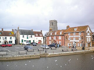
Purbeck was a local government district in Dorset, England. The district was named after the Isle of Purbeck, a peninsula that forms a large proportion of the district's area. However it extended significantly further north and west than the traditional boundary of the Isle of Purbeck along the River Frome. The district council was based in the town of Wareham, which is itself north of the River Frome.

A31 road major trunk road in southern England

The A31 is a major trunk road in southern England that runs from Guildford in Surrey to Bere Regis in Dorset.

A35 road road in England

The A35 is a road in southern England, connecting Honiton in Devon and Southampton in Hampshire. It is a trunk road for some of its length. Most of its route passes through Dorset and the New Forest. It originally connected Exeter and Southampton, the original A35 ran along what is now the A3052 joining the present road at Charmouth.

Puddletown village in the United Kingdom

Puddletown is a village and civil parish in Dorset, England. It is situated by the River Piddle, from which it derives its name, about 4.5 miles (7 km) northeast of the county town Dorchester. Its earlier name Piddletown fell out of favour, probably because of connotations of the word "piddle". The name Puddletown was officially sanctioned in the late 1950s. Puddletown's civil parish covers 2,908 hectares and extends to the River Frome to the south. In 2013 the estimated population of the civil parish was 1,450.

Bloxworth village in the United Kingdom

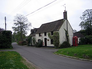
Bloxworth is a village and civil parish in the Purbeck district of Dorset, England, situated in Wareham Forest on the A35 road 5 miles (8 km) west of Poole. In the 2011 census the civil parish had 80 households and a population of 200. Bloxworth Heath is part of Wareham Forest and is home to Woolsbarrow Hillfort.

Wareham Forest heath in the United Kingdom

Wareham Forest is an area in Dorset, England, consisting of open heathland, including Decoy Heath and Gore Heath, and plantations of conifers such as Morden Heath and Bloxworth Heath. The site is overseen by the Forestry Commission for conservation and recreation. Situated next to the A35 road between Dorchester and Poole; the forest provides a home for sika deer, the Dartford warbler and a population of sand lizards.

Mid Dorset and North Poole (UK Parliament constituency) Parliamentary constituency in the United Kingdom, 1997 onwards

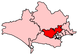
Mid Dorset and North Poole is a constituency represented in the House of Commons of the UK Parliament since 2015 by Michael Tomlinson, a Conservative.

South East Dorset conurbation human settlement in United Kingdom

The South East Dorset conurbation is a multi-centred conurbation on the south coast of Dorset in England. The area is rapidly becoming an amalgamation with the area of South West Hampshire immediately on the fringe of the newly formed New Forest National Park. The main population centres are Bournemouth, Poole and Christchurch; however, the urbanised area spreads as far east as Barton on Sea in Hampshire. There are a number of satellite towns peripheral to these main urban centres. In clockwise rotation these include: Wareham, Upton, Wimborne, Ferndown, Verwood and Ringwood (Hampshire). The urban area is generally surrounded by a green belt.

Shitterton human settlement in United Kingdom

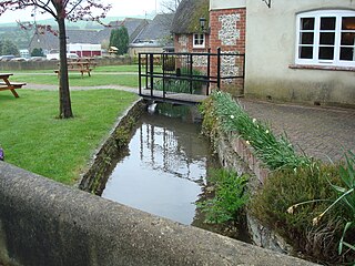
Shitterton is a hamlet in Dorset, England. It has attracted worldwide attention for its name, which dates back at least a thousand years and means "farmstead on the stream used as an open sewer". Shitterton has frequently been noted on lists of unusual place names. The hamlet includes a collection of historic thatched buildings dating back to the 18th century and earlier.

Upton Heath

Upton Heath is one of the largest remaining fragments of a heath that once stretched across central southern England from Dorchester to Christchurch and beyond. Today it is confined to an area immediately west of Poole, much of which is protected. From the Heath there are views across Poole Harbour, Corfe Castle and the Isle of Purbeck.

Geography of Dorset

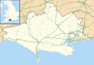
Dorset is a county located in the middle of the south coast of England. It lies between the latitudes 50.512°N and 51.081°N and the longitudes 1.682°W and 2.958°W, and occupies an area of 2,653 km². It spans 90 kilometres (56 mi) from east to west and 63 kilometres (39 mi) from north to south.

Dorset Heaths

The Dorset Heaths form an important area of heathland within the Poole Basin in southern England. Much of the area is protected.

Stonehill Down Nature Reserve

The Stonehill Down Nature Reserve is a downland nature reserve on the Purbeck Hills in the county of Dorset, England. It is managed by the Dorset Wildlife Trust.

Woolsbarrow Hillfort

Woolsbarrow Hillfort is a hillfort on Bloxworth Heath in the district of Purbeck in the county of Dorset, England. It dates to the period from the Late Bronze Age to the Early Iron Age and is classed as an ancient monument. Despite the hillfort only being at an altitude of 220 feet (67 m) it is said to "dominate the surrounding heathland."

Decoy Heath

Decoy Heath is an area of open heathland and bog forming part of Wareham Forest west of the Poole-Bournemouth conurbation in south Dorset, England. It is part of the Dorset Heaths.

References

  1. Bloxworth Heath, Dorset Archived 2016-11-06 at the Wayback Machine at www.wildlifetrusts.org. Retrieved 5 Nov 2016.
  2. 1 2 3 OS Topographic Map, 1:25,000 series, No. OL15.
  3. Ratcliffe, Derek. A Nature Conservation Review: Volume 1: The Selection of Biological Sites of..., Cambridge: CUP, 1977, p. 156. ISBN   978-0-521-21159-8.
  4. Short-tailed Blue at ukbutterflies.co.uk. Retrieved 6 Nov 2016.