Bodmin is a town and civil parish in Cornwall, England, United Kingdom. It is situated south-west of Bodmin Moor.

Cornwall is a ceremonial county in South West England. It is recognised by Cornish and Celtic political groups as one of the Celtic nations, and is the homeland of the Cornish people. The county is bordered by the Atlantic Ocean to the north and west, Devon to the east, and the English Channel to the south. The largest settlement is Falmouth, and the county town is the city of Truro.

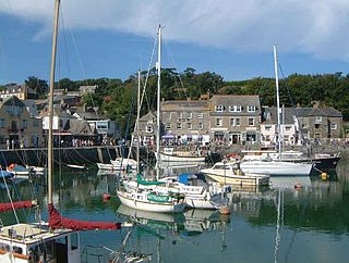
Padstow is a town, civil parish and fishing port on the north coast of Cornwall, United Kingdom. The town is situated on the west bank of the River Camel estuary, approximately 5 miles (8.0 km) northwest of Wadebridge, 10 miles (16 km) northwest of Bodmin and 10 miles (16 km) northeast of Newquay. The population of Padstow civil parish was 3,162 in the 2001 census, reducing to 2,993 at the 2011 census. In addition an electoral ward with the same name exists but extends as far as Trevose Head. The population for this ward is 4,434.

Petroc or Petrock was a British prince and Christian saint.

The Prayer Book Rebellion or Western Rising was a popular revolt in Cornwall and Devon in 1549. In that year, the first Book of Common Prayer, presenting the theology of the English Reformation, was introduced. The change was widely unpopular, particularly in areas where firm Catholic religious loyalty still existed, such as Lancashire. Along with poor economic conditions, the enforcement of the English language led to an explosion of anger in Cornwall and Devon, initiating an uprising. In response, Edward Seymour, 1st Duke of Somerset sent John Russell to suppress the revolt, with the rebels being defeated and its leaders executed two months after the beginning of hostilities.

The hundred of Trigg was one of ten ancient administrative shires of Cornwall—see "Hundreds of Cornwall".

Wadebridge is a town and civil parish in north Cornwall, England, United Kingdom. The town straddles the River Camel five miles upstream from Padstow. The permanent population was 6,222 in the census of 2001, increasing to 7,900 in the 2011 census. There are two electoral wards in the town. Their total population is 8,272.

Hurling is an outdoor team game played only in Cornwall, England, played with a small silver ball. While the sport shares its name with the Irish game of hurling, the two sports are completely different.

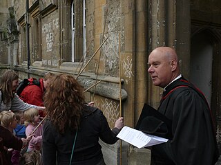
Beating the bounds or perambulating the bounds is an ancient custom still observed in parts of England, Wales, and the New England region of the United States, which traditionally involved swatting local landmarks with branches to maintain a shared mental map of parish boundaries, usually every seven years.

Cubert is a village in Cornwall, England, United Kingdom. It is three miles (5 km) south-southwest of Newquay and is in the civil parish of Cubert.
St Kew is a village in Cornwall, England, United Kingdom. It is also the name of the civil parish, which includes the church town, St Kew, and nearby St Kew Highway.

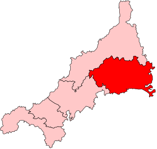
Bodmin was the name of a parliamentary constituency in Cornwall from 1295 until 1983. Initially, it was a parliamentary borough, which returned two Members of Parliament to the House of Commons of England and later the House of Commons of the Parliament of the United Kingdom until the 1868 general election, when its representation was reduced to one member.

Saint Piran's Day, or the Feast of Saint Piran, is the national day of Cornwall, held on 5 March every year. The day is named after one of the patron saints of Cornwall, Saint Piran, who is also the patron saint of tin miners.

Cardinham is a civil parish and a village in mid Cornwall, England. The village is approximately three-and-a-half miles (6 km) east-northeast of Bodmin. The hamlets of Fletchersbridge, Millpool, Milltown, Mount, Old Cardinham Castle and Welltown are in the parish.

The Bodmin manumissions are records included in a manuscript Gospel book, the Bodmin Gospels or St Petroc Gospels, British Library, Add MS 9381. The manuscript is mostly in Latin, but with elements in Old English and the earliest written examples of the Cornish language, which is thus of particular interest to language scholars and early Cornish historians. The manuscript was discovered by Thomas Rodd (1796–1849), a London bookseller, and sold by him to the British Museum in May 1833 being now part of the British Library's collection. It is thought to have been made in Brittany - now part of France - and dates from the last quarter of the 9th century to 1st quarter of the 11th century.

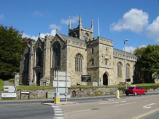
St Petroc's Church, Bodmin, also known as Bodmin Parish Church is an Anglican parish church in the town of Bodmin, Cornwall, England, United Kingdom.
William Hals (1655–1737) was a British historian who compiled a History of Cornwall, the first work of any magnitude that was printed in Cornwall. He was born at Tresawsan, in the parish of Merther in Cornwall. Much of his work was never published but was used by other Cornish historians, including Davies Gilbert, Thomas Tonkin, and John Whitaker. Some of his original work is now held by the British Library.
Sir John Maclean KB, FSA was a British civil servant, genealogist and author.

Brown Willy is a hill in Cornwall, England, United Kingdom. The summit, at 1,378 feet above sea level, is the highest point of Bodmin Moor and of Cornwall as a whole. It is about 2+1⁄2 miles northwest of Bolventor and 4 miles southeast of Camelford. The hill has a variable appearance that depends on the vantage point from which it is seen. It bears the conical appearance of a sugarloaf from the north but widens into a long multi-peaked crest from closer range.


