Related Research Articles

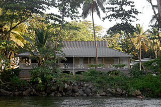
Portsmouth is the second largest town in Dominica, with 2,977 inhabitants. It lies on the Indian River on Dominica's northwest coast, in Saint John Parish. Cabrits National Park is located on a peninsula to the north of town. Portsmouth has its own sea port in Prince Rupert Bay.
La Plaine is a village located on the eastern side of the island of Dominica. It has a population of 1,288, and is the second-largest settlement in Saint Patrick Parish.

Wesley is a village in north-eastern Dominica, situated between the old estates of Eden and Londonderry. Like many other villages along the east coast Wesley developed after Emancipation on hilly land along the boundary between the two estates as labourers sought to establish independent holdings for themselves away from the plantations where they had formerly lived and worked. In the mid 19th century, Charles Leatham, owner of Eden, sold several small lots in this area. His estates had been centres for early evangelization by Wesleyan missionaries and by as early as 1837 religious and night school gatherings were being held in a large estate building on Londonderry estate. Methodist influence grew further when free labourers were introduced into the estates of the north-east from Antigua, Montserrat, and other Leeward Islands to replant the sugar estates in cocoa and limes. By the 1860s the settlement was referred to as Wesleyville and was dominated by a woman shopkeeper called Ma Wesley. Eventually the place was simply called Wesley, while the district continued to be called by its old French parish name, La Soie. At the end of the 19th century the Roman Catholic Church began to make a move to evangelize the area, but so strong was the Protestant influence that it had to buy land for the first church by using one of its faithful to purchase the land in his name and then to declare it for the church after the sale was completed. Tensions between the two faiths were high for a time. In the 1940s and 1950s large-scale land settlement schemes in the interior organized by the British government enabled villagers to buy Crown Lands and free themselves of dependency on the estates. This coincided with the beginning of the banana boom and Wesley benefited materially from this development. Economic growth enabled villagers to improve their housing and send children to secondary schools in Roseau. In 1979 the opening of St.Andrew's High School provided such education closer to home. National political changes also had an effect on the general changes in thecommunity.

Pointe Michel is a small town on the southwest coast of Dominica. It is located to the south of the capital, Roseau, and is known for being the birthplace of Dominica's first female Prime Minister, Dame Eugenia Charles.
Rosalie is a village in Dominica. It is located in Saint David Parish at the northern end of Rosalie Bay, on the central east coast of the island, close to the mouth of the Rosalie River.

Massacre is a town in Saint Paul Parish, Dominica, with about 1,200 inhabitants. It is located on the central west coast of the island, to the north of the capital, Roseau, on the Massacre River.
The Boeri River is a river in Dominica. It rises on the western slopes of Morne Trois Pitons, flowing south and then west to reach the Caribbean Sea on the country's southwestern coast, to the north of the capital, Roseau.
The Rosalie River is a river in Dominica. It rises on the eastern slopes of Morne Trois Pitons, flowing east to reach the Atlantic Ocean on the country's eastern coast, close to the town of Rosalie.
The River Bibiay is a river on the Caribbean island of Dominica.
The Geneva River is a river in Dominica.
The Massacre River is a river on the Caribbean island of Dominica.
The La Ronde River is a river on the Caribbean island of Dominica.
The Micham River is a river on the Caribbean island of Dominica.
The Savane River is a river on the Caribbean island of Dominica.
The Trois Pitons River is a river on the Caribbean island of Dominica.
The Woodford Hill River is a river located in the village of Woodford Hill on the Caribbean island of Dominica.
The River Sarisari is a river on the Caribbean island of Dominica.
The River Ouayaneri is a river on the Caribbean island of Dominica.
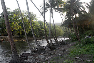
Coulibistrie is a village on the west coast of Dominica, in the northwest corner of Saint Joseph Parish. It is between the villages of Colihaut to the north and Morne Rachette to the south. It extends inland from the coast within a deep valley, along both banks of the Coulibistrie River. The village is primarily residential with few businesses. Many of the houses are built directly atop or adjoining the numerous large boulders that litter the valley along its base.

Morne Plat Pays is a volcano on the island of Dominica. Located on the southern region of the island, the volcano last erupted around the year 1270 AD. Since the mid-18th century, a number of earthquake swarms have occurred near the mountain, but these are not related to Morne Plat Pays' eruptive activity.