In earth science, erosion is the action of surface processes that removes soil, rock, or dissolved material from one location on the Earth's crust, and then transports it to another location. This natural process is caused by the dynamic activity of erosive agents, that is, water, ice (glaciers), snow, air (wind), plants, animals, and humans. In accordance with these agents, erosion is sometimes divided into water erosion, glacial erosion, snow erosion, wind (aeolic) erosion, zoogenic erosion, and anthropogenic erosion. The particulate breakdown of rock or soil into clastic sediment is referred to as physical or mechanical erosion; this contrasts with chemical erosion, where soil or rock material is removed from an area by its dissolving into a solvent, followed by the flow away of that solution. Eroded sediment or solutes may be transported just a few millimetres, or for thousands of kilometres.
Soil erosion is the displacement of the upper layer of soil, one form of soil degradation. This natural process is caused by the dynamic activity of erosive agents, that is, water, ice (glaciers), snow, air (wind), plants, animals, and humans. In accordance with these agents, erosion is sometimes divided into water erosion, glacial erosion, snow erosion, wind (aeolean) erosion, zoogenic erosion, and anthropogenic erosion. Soil erosion may be a slow process that continues relatively unnoticed, or it may occur at an alarming rate causing a serious loss of topsoil. The loss of soil from farmland may be reflected in reduced crop production potential, lower surface water quality and damaged drainage networks.

A wetland is a distinct ecosystem that is inundated by water, either permanently or seasonally, where oxygen-free processes prevail. The primary factor that distinguishes wetlands from other land forms or water bodies is the characteristic vegetation of aquatic plants, adapted to the unique hydric soil. Wetlands play a number of functions, including water purification, water storage, processing of carbon and other nutrients, stabilization of shorelines, and support of plants and animals. Wetlands are also considered the most biologically diverse of all ecosystems, serving as home to a wide range of plant and animal life. Whether any individual wetland performs these functions, and the degree to which it performs them, depends on characteristics of that wetland and the lands and waters near it. Methods for rapidly assessing these functions, wetland ecological health, and general wetland condition have been developed in many regions and have contributed to wetland conservation partly by raising public awareness of the functions and the ecosystem services some wetlands provide.

Subsidence is the sudden sinking or gradual downward settling of the ground's surface with little or no horizontal motion. The definition of subsidence is not restricted by the rate, magnitude, or area involved in the downward movement. It may be caused by natural processes or by human activities. The former include various karst phenomena, thawing of permafrost, consolidation, oxidation of organic soils, slow crustal warping, normal faulting, caldera subsidence, or withdrawal of fluid lava from beneath a solid crust. The human activities include sub-surface mining or extraction of underground fluids, e. g. petroleum, natural gas, or groundwater. Ground subsidence is of global concern to geologists, geotechnical engineers, surveyors, engineers, urban planners, landowners, and the public in general.
A hummock is a small knoll or mound above ground. They are typically less than 15 meters in height and tend to appear in groups or fields. It is difficult to make generalizations about hummocks because of the diversity in their morphology and sedimentology. An extremely irregular surface may be called hummocky.

Pottageville is an unincorporated community located in northeastern King Township, in Ontario, Canada. It is near Schomberg. It is named for one of its early settlers, Edward Pottage.

A hydrosere is a plant succession which occurs in an area of fresh water such as in oxbow lakes and kettle lakes. In time, an area of open freshwater will naturally dry out, ultimately becoming woodland. During this change, a range of different landtypes such as swamp and marsh will succeed each other.

A string bog or strong mire is a bog consisting of slightly elevated ridges and islands, with woody plants, alternating with flat, wet sedge mat areas. String bogs occur on slightly sloping surfaces, with the ridges at right angles to the direction of water flow. They are an example of patterned vegetation.

A palsa is a low, often oval, frost heave occurring in polar and subpolar climates, which contain permanently frozen ice lenses. Like pingos, palsas consist of an ice core with overlying soil, but they are generally smaller than pingos, often occur in groups and may develop from ground water without additional hydrostatic pressure. Palsas are characteristically found in areas with discontinuous permafrost, and in such areas they may be the only reliable surface evidence of permafrost. Surface water, found in bogs, enhances palsa formation in areas called palsa bogs.
Assemblages of plants and invertebrate animals of tumulus springs of the Swan Coastal Plain are ecological communities in Western Australia. They have been managed under a number of other, similar names, including Mound springs of the Swan Coastal Plain and Communities of Tumulus Springs . The tumulus mounds were common to a narrow range of groundwater discharge at the boundary of 'bassendean sand' and 'guildford clay', along the edge of the Gnangara Mound aquifer. The communities are critically endangered.

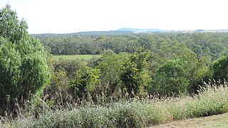
The Paroo-Darling National Park is a protected national park that is located in the Far West region of New South Wales, in eastern Australia. The 178,053-hectare (439,980-acre) national park spans two distinct regions in the outback area. This region covers the arid catchments of the Paroo River and the Paroo-Darling confluence to the south.
This glossary of geography terms is a list of definitions of terms and concepts used in geography and related fields, which describe and identify natural phenomena, geographical locations, spatial dimension and natural resources. Geographical terms are classified according to their functions, such as description, explanation, analysing, evaluating and integrating.
Missen are small, shallow, forest bogs in pine -dominated woods that form on crests, saddles, hollows or plateaus in the hills or mountains. They only have a thin layer of peat of between 30 and 100 centimetres thick. The term misse is local to the Northern Black Forest and also surfaces as Miß, Müsse or Müß. These names probably derive from the German Moos ("moss") because peat mosses (Sphagnum) play a key role in their development. Due to the poor tree growth associated with them, however, it could also stand for mies ("bad").
Adclarkia dawsonensis, also known as boggomoss snail or Dawson Valley snail, is a species of air-breathing land snail, terrestrial pulmonate gastropod mollusk in the family Camaenidae. Adclarkia dawsonensis was the first species described within the genus Adclarkia and is found in the Taroom district in Queensland, Australia.
A mire is a wetland type, dominated by living, peat-forming plants. Mires arise because of incomplete decomposition of organic matter, due to waterlogging and subsequent anoxia. Like coral reefs, mires are unusual landforms in that they derive mostly from biological rather than physical processes, and can take on characteristic shapes and surface patterning.

Elizabeth Springs is a heritage-listed artesian springs in Diamantina Lakes, Shire of Diamantina, Queensland, Australia. It is one of the springs of the Great Artesian Basin (GAB). It was added to the Australian National Heritage List on 4 August 2009.