
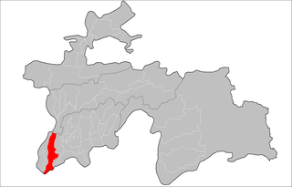
Shahritus, also spelled as Shaartuz, is a city in southwestern Tajikistan region. Situated on the River Kafirnigan, the city was founded in 1938.

Hisor District or Nohiyai Hisor is a district in the Region of Republican Subordination, in Tajikistan, located west of the capital Dushanbe, between Varzob District in the east and Shahrinaw District in the west. Its capital Hisor (Gissar) is a town of 50,000 people about 10 km west of Dushanbe, at the center of the fertile Gissar Valley.
Qabodiyon District or Nohiya-i Qabodiyon is a district in Khatlon province, Tajikistan. Its capital is Qabodiyon.

Jilikul District or Nohiya-i Jilikul is a district in Khatlon province, Tajikistan. Its capital is Jilikul.

' Khuroson District', formerly Ghozimalik District, is a district in Khatlon province of Tajikistan extending south from national capital Dushanbe toward the provincial capital Kurgan-Tyube (Qurghonteppa). The district population is 73,100. Ghozimalik District was renamed Khuroson District around 2003, and its capital was renamed at about that time from Pravda to Obikiik.

Hamadoni District is a district in the south-east of Khatlon Province of Tajikistan, located south of Kulob and stretching along a section of the Panj on the border with Afghanistan. Population 123,800. Between 1950 and 2004 called Moskovskiy District, then renamed in honor of Mir Sayyid Ali Hamadani, a 14th-century Persia Great Islamic preacher,Traveller, poet, and scholar who preached Islam in different parts of world, and is buried in Khatlon.
Chilgazi is a town and jamoat in northern Tajikistan. It is located in Isfara District in Sughd province. The jamoat has a total population of 12,150.
Nijoni is a town and jamoat in north-western Tajikistan. It is located in Istarawshan District in Sughd province. The jamoat has a total population of 7,747.
Kommunizm is a town and jamoat in north-western Tajikistan. It is located in Istarawshan District in Sughd province. The jamoat has a total population of 22,190.
Avzikent is a town and jamoat in north-western Tajikistan. It is located in Mastchoh District in Sughd province. The jamoat has a total population of 10,373.
Rudaki is a town and jamoat in western Tajikistan. The jamoat has a total population of 15,039.
Mehnatobod is a town and jamoat in north-western Tajikistan. It is located in Zafarobod District in Sughd province. The jamoat has a total population of 7,636.
Shahriston is a town and jamoat in north-west Tajikistan. It is located in Shahriston District in Sughd province. It is the administrative center of Shahriston District, in the central part of Sughd province. The jamoat has a total population of 16,295.
Seshanbe is a town and jamoat in Tajikistan. It is located in Tursunzoda District in Districts of Republican Subordination province. The jamoat has a total population of 10510.
Luchob is a town and jamoat in Tajikistan. It is located in Varzob District in Districts of Republican Subordination province.The jamoat has a total population of 5141.
Navdi is a town and jamoat in Tajikistan. It is located in Rasht District in Districts of Republican Subordination province.The jamoat has a total population of 10474.
Kiblai is a town and jamoat in Tajikistan. It is located in Rudaki District in Districts of Republican Subordination province.The jamoat has a total population of 8682.
Hakimi is a town and jamoat in Tajikistan. It is located in Nurobod District, Tajikistan in Districts of Republican Subordination province. The jamoat has a total population of 10163.
Bustonqala is a town and jamoat in Tajikistan. It is located in Bokhtar District in Khatlon Province. The jamoat has a population of 2,518.
Qahramon is a town and jamoat in Tajikistan. It is located in Hamadoni District in Khatlon Province. The jamoat has a total population of 14364.


